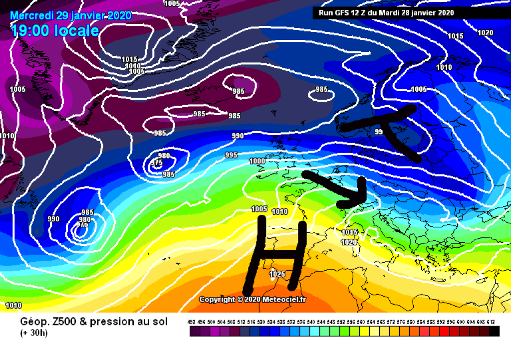
Skip to content

Cookies 🍪

This site uses cookies that need consent.

Learn more

Zur Powderguide-Startseite Zur Powderguide-Startseite

Language selection

Search PowderGuide

WeatherBlogs

WeatherBlog 11 2019/20 | Winter greetings

Snow and cold, at least in the short term

by Lea Hartl 01/29/2020
The PowderAlert has already announced it and anyone looking out of the window in the Northern Alps will notice it: it's been a long time since rain or even snow instead of sun and high fog! A nice change that we have a cold front from the northwest to thank for.

Current situation

A powerful low-pressure complex west of the British Isles is sending its fronts towards us and they are making it far enough south to cause accumulating precipitation in the Alps. The steering low draws in polar air masses, which warm up over the Atlantic before they reach us, but are still significantly colder than the warm air mass of the permanent high of the last few weeks. If it feels warmer in the valleys since the precipitation started: the wind and precipitation from the cold front have cleared out the cold air lakes of the inversion. The cold front has brought cooler temperatures at altitude, but it may well be that it has become significantly warmer near the ground depending on the location - this is referred to as a "masked" cold front.

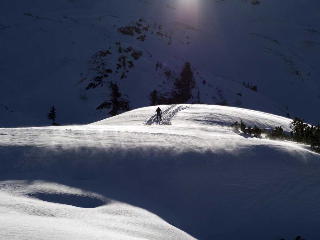
In addition to snow, the current front also brings a lot of wind and a significant stabilization of the atmospheric stratification, which can result in sleet showers here and there. Lots of fresh snow, lots of wind and a frequently built-up old snow cover together result in a very critical avalanche situation. Avalanche warning level 4 has been issued today in western Tyrol and parts of Switzerland and France.

WeatherBlogs
presented by

Outlook

Snowfall will continue in the congested areas throughout the course of today. It will ease from the west towards the evening. Thursday will start cloudy in the east, but will then become friendlier and it should be sunny in the west in the morning. Milder air will move in and temperatures will rise again. In the western Alps, the next disturbance, this time a warm front, will approach in the evening or on Friday night. You can expect rain up to around 2000m. It's the same in the Eastern Alps, but the precipitation will start a little later. On Friday it will be mostly sunny again in the west, in the east it will take a little longer and it will only clear up during the day. It will be even warmer with the zero degree limit expected to be well above 2000m. In the south, it will remain dry the whole time, except for a few snowflakes today near the main ridge.

The weekend and the start of the coming week look similarly changeable from today's perspective: Warm, clouds moving through every now and then, a little precipitation from the northwest from time to time.

Glass sphere

The glimmer of hope for the middle of next week already mentioned by the oracle still exists and looks as follows: With an outbreak of cold air over the eastern half of the American continent, warm air advection will occur downstream in the Atlantic and the Azores High will bulge significantly to the north. To the east of this, cold polar air could then flow south towards the Alps. This would mark the end of the predominantly zonal weather situation and a potentially more sustainable switch to wintry conditions. Winter fans should keep their fingers crossed!

Photo gallery

This article has been automatically translated by DeepL with subsequent editing. If you notice any spelling or grammatical errors or if the translation has lost its meaning, please write an e-mail to the editors.

Show original (German)

Related articles

Comments

WeatherBlogs
presented by