Skip to content

Cookies 🍪

This site uses cookies that need consent.

Learn more

Zur Powderguide-Startseite Zur Powderguide-Startseite

Language selection

Search PowderGuide

SNOWGRID at PowderGuide

Snow depths and snow depth changes for Austria

by PowderGuide 01/01/2017
As of today, SNOWGRID maps from ZAMG for Austria and some neighboring parts of the Eastern Alps are available on PowderGuide. SNOWGRID is a high-resolution snowpack model that shows the spatial distribution of the snowpack in the terrain very well. We now have the current snow depth and the change in snow depth over the last 24 hours as a separate sub-category in the Weather/Snow section and are pleased to be able to offer this service together with ZAMG.

What is SnowGrid?

SNOWGRID is a snowpack model, i.e. a program that uses measured data on snow and weather and the laws of physics to calculate how the snowpack changes. There are complex models that precisely reproduce the layer structure of the snowpack - including density, snow temperature, microstructure of the layers, etc. - for a specific point. However, this is very computationally complex and requires many different input parameters that are not measured at all weather stations and are therefore only available for certain locations.

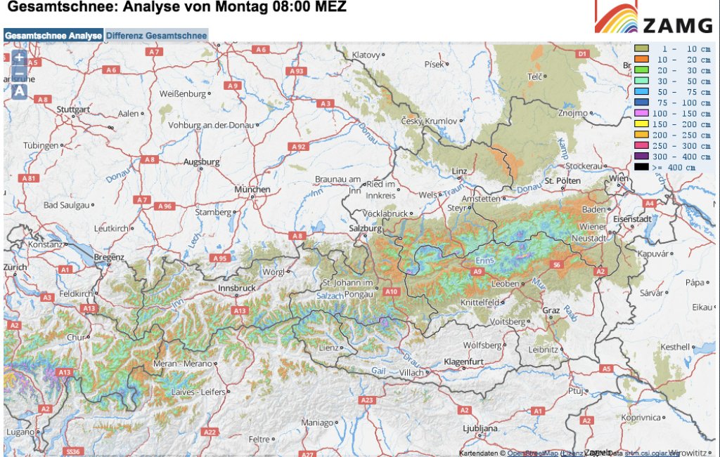
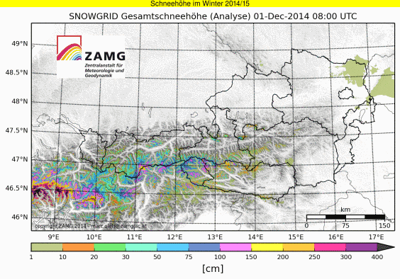
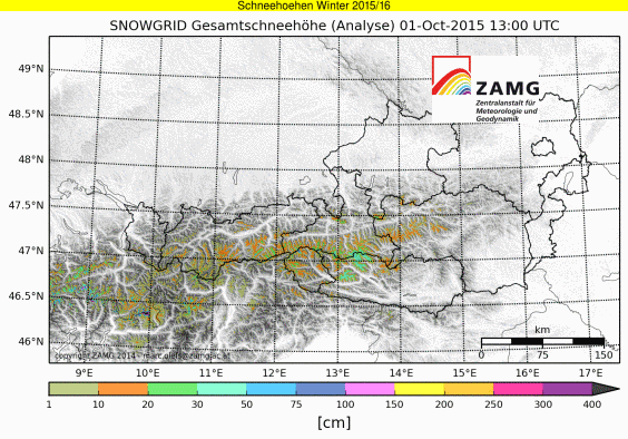
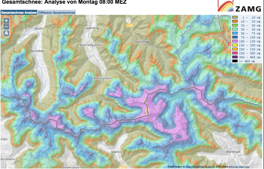
SNOWGRID is a comparatively simple model that only knows two layers: the uppermost, newest layer and the old snow cover below it. In return, the computational effort is significantly lower and you don't have to measure so many different parameters. SNOWGRID can therefore be used over a large area, or for so many different points that a map is created.

The SNOWGRID domain (the spatial section covered) comprises a rectangle roughly the size of Zurich-Bratislava and Nuremberg-Trieste, or around 28 million data points. The spatial resolution is therefore 100m.

Here you can find the PowderGuide.com SNOWGRID maps: http://www.powderguide.com/wetter/snowgrid.html

What can SnowGrid do and where are the limits?

SNOWGRID calculates the total snow depth as well as the water value of the snow cover, the average snow temperature and the amount of new snow. To do this, the model needs the amount of precipitation, the snow line and the density of fresh snow. A combination of ground measurements and radar data is used for precipitation. When calculating the snow line, a drop due to precipitation cooling in the valleys is also taken into account - as a result, the result is often much closer to reality. The density of new snow is approximated as a function of temperature. The decrease in snow cover due to settling or melting is of course also simulated.

How well the model works is verified by measurement data (= go out and look, automatic weather stations,...) and satellite images. Individual precipitation events are recorded very well. There are always a few outliers in the snow depth and water value, but this also works quite well in general. SNOWGRID provides valuable information for assessing the regional, areal distribution of the snow cover, but of course does not replace measurements in the field. SNOWGRID also does not currently take into account whether and how the wind can redistribute the snow.

This is what winter 2014/15 looked like at SNOWGRID:
Click on the image if the GIF does not move.

How can I make good use of SNOWGRID?

The SNOWGRID maps provide a quick overview of the general snow situation: the map of the total snow depth allows conclusions to be drawn about the existing base, while the 24-hour snow depth difference shows where it has snowed and how much. Of course, the model does not show every shark peeking out and every snowflake that has fallen, but it is still very helpful as a planning tool. For example, the map of the total snow depth currently shows the result of the most recent, widespread snowfall far to the east and that the Tauern mountains are slightly better covered than the Tyrolean Oberland, for example. In combination with other aids such as webcams, weather stations etc., SNOWGRID is a valuable tool for tour planning.

The forecast for the coming week is very exciting and we are looking forward to following the development of the total snow depth as well as the 24-hour differences on SNOWGRID and then, of course, verifying them conscientiously on skis!

Photo gallery

This article has been automatically translated by DeepL with subsequent editing. If you notice any spelling or grammatical errors or if the translation has lost its meaning, please write an e-mail to the editors.

Show original (German)

Related articles

Comments