Skip to content

Cookies 🍪

This site uses cookies that need consent.

Learn more

Zur Powderguide-Startseite Zur Powderguide-Startseite

Language selection

Search PowderGuide

WeatherBlogs

WeatherBlog 21 2022/23 | Spring powder & end of season

All's well that ends well?

by Lea Hartl 04/12/2023
It's getting wintry again! What we missed in the height of winter will be delivered in April: With a bit of luck, we'll get a lot more fresh snow over the next few days, especially on the eastern main ridge. And with pretty low temperatures!

Current situation and outlook

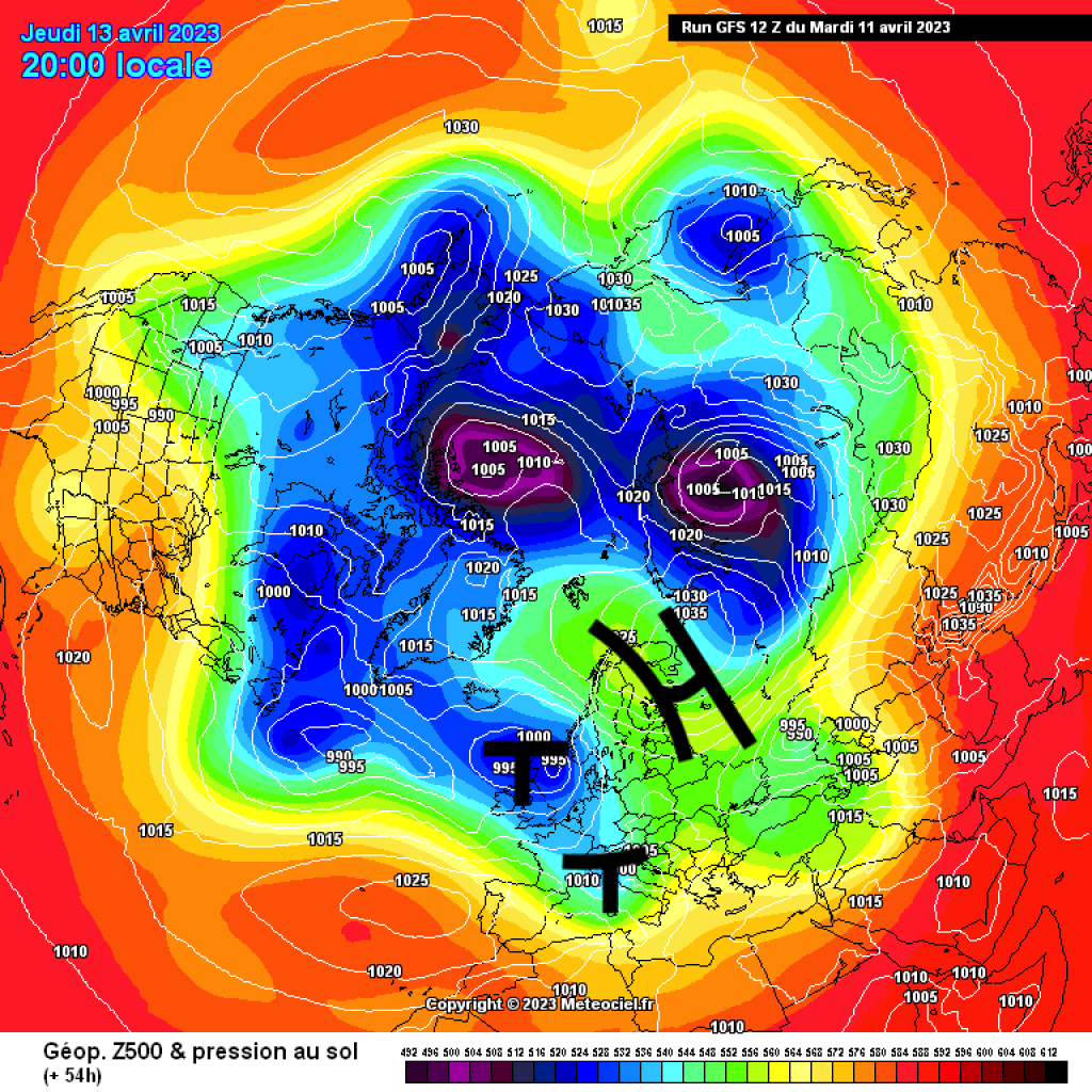
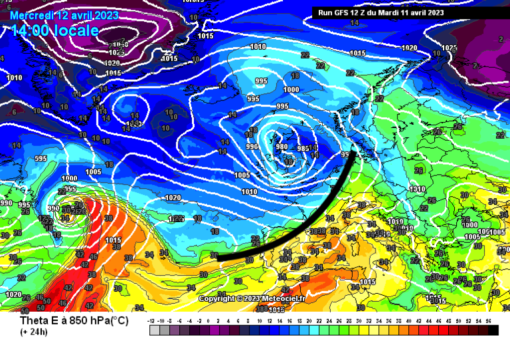
It's rather complicated this time. In principle, the Alps are in a westerly current that is carrying a series of fronts towards us. An area of low pressure over the British Isles sits in the background as the controlling center. A large-scale area of high pressure stretching from Eastern Europe to Scandinavia is in the way of the westerly flow. The disturbances will therefore be transported by the British-Atlantic low pressure system as far as the Alps, but will then not really get any further. Specifically, a warm front will reach us today (Wednesday), bringing warmer and partly foehn-like weather. This will be followed by a cold front that will arrive in the west tomorrow afternoon and then work its way east and south. The cold front in the afternoon/evening will probably also bring some intense, thundery precipitation, but this will not last long. The snow line will drop significantly and is likely to be in the higher valleys, at least in the eastern Alps. It will remain higher in the west.

WeatherBlogs
presented by

Due to the blockade in the east, the whole thing is moving rather slowly and a genoa low is expected to develop over the course of Thursday as the disturbance spills over to the south. The exact path of this low and the position of the larger low pressure complex in the northwest will be decisive for the following days. The future genoa low currently appears to be planning a trip back north, with a stopover in the IT-SLO-AT border triangle. This would bring some more fresh snow to the Eastern Alps - first in the south-east and then on the main ridge. However, the genoa low's travel plans are rather uncertain and the focus of the precipitation will shift in one direction or the other from run to run.

From today's perspective, it will also be comparatively wintry at the weekend. The rough northerly flow due to the migration of the marginal low and the low in the north seems fairly certain. It is difficult to say where precipitation will fall, as small changes in the position of the marginal low will make a big difference. Tendency: Not ideal for spring tours in the sunshine, but another chance of powder! We suspect that the oracle will also give an assessment of the situation, but that also depends on developments today and tomorrow.

WeatherBlog goes on summer break

Although it is currently less summery than during most of the winter of 2022/23, the WeatherBlog is taking a "summer break". If the April winter continues for much longer, we'll be back. This time, the very hazy crystal ball sees mixed weather for next week at the beginning, then high pressure and significantly rising temperatures. The PG weather service (fresh snow maps, SNOWGRID, ...) will also be discontinued at the end of this week. If necessary, WB and the PowderOrakel will of course still provide information via the usual channels.

Have fun with the spring snow and then, when the time is right, have a great summer!

This article has been automatically translated by DeepL with subsequent editing. If you notice any spelling or grammatical errors or if the translation has lost its meaning, please write an e-mail to the editors.

Show original (German)

Related articles

Comments

WeatherBlogs
presented by