Skip to content

Cookies 🍪

This site uses cookies that need consent.

Learn more

Zur Powderguide-Startseite Zur Powderguide-Startseite

Language selection

Search PowderGuide

WeatherBlogs

WeatherBlog 14 2022/23 | Is winter coming back?

All good things come from above

by Sebastian Müller 02/22/2023
In any case, the high pressure is over for now and we're in for a cold snap in the next few days, hopefully with more than just cosmetic snowfall. And yes, the Alps urgently need snow! The upcoming FWT finals in Fieberbrunn and Verbier could use it, as could all of us, and finally northern Italy, which is already fearing the next summer drought. We can find reason for hope further above us, in the stratosphere.

The WEATHER SITUATION AND ITS OUTLOOK

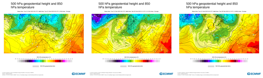
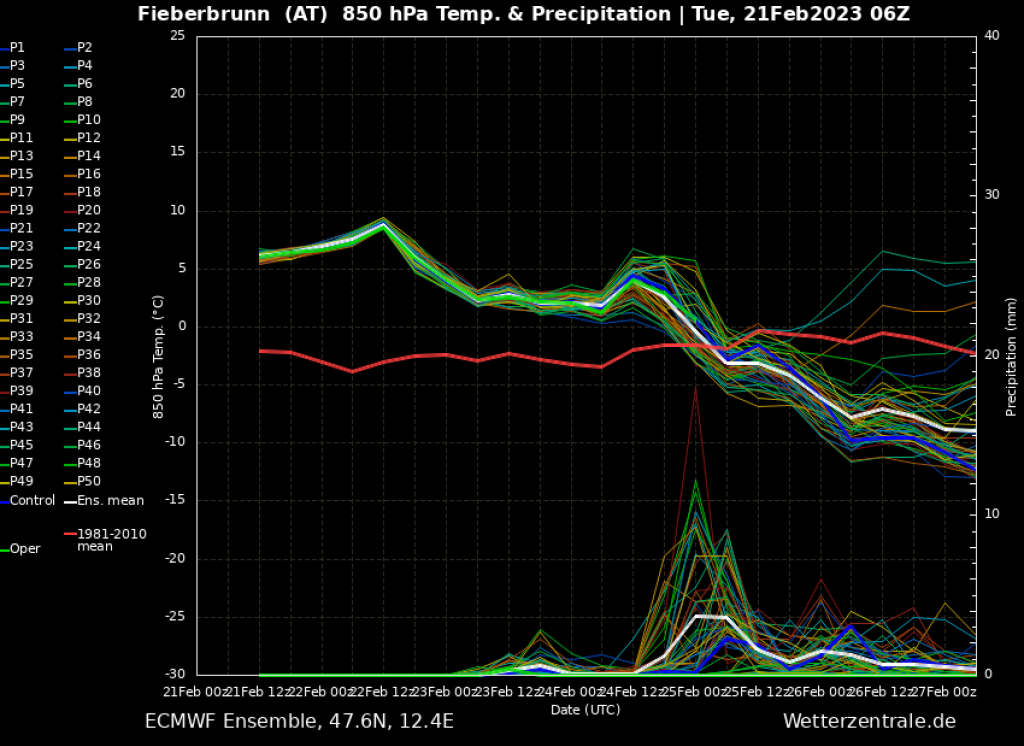
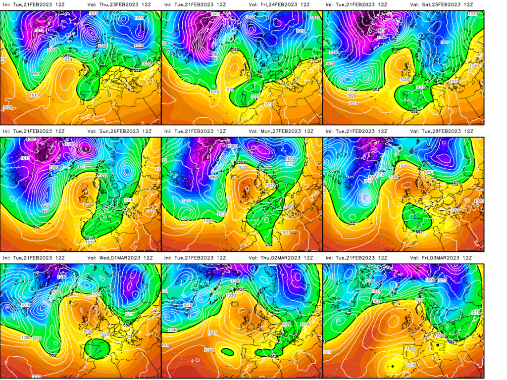
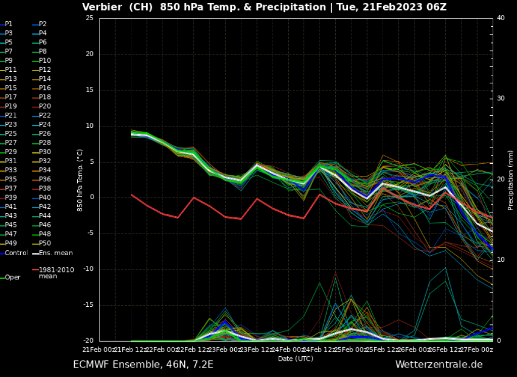
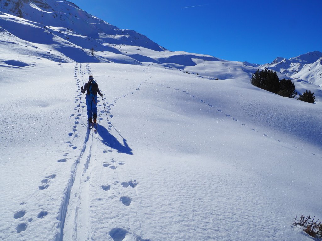
We start with the old story of this winter: snow conditions are well below average almost throughout the Alps, there has just been a long phase of stable high pressure and the rare PowderAlerts have often been blown away by the wind. But at least the high pressure is over for now. A low pressure system over Scandinavia will send a deep trough to the northern slopes of the Alps towards Saturday. There will be a lot of fresh snow and a considerable drop in temperatures. The low moves further east but the trough remains for a few days and continues to bring cold air from the north-east to the Alps. A high-pressure trough detaches from it and becomes weather-determining for the Mediterranean. What is very surprising is that this low-pressure system continues to move westwards into the Atlantic. This could bring some more snow to the south side of the Alps and the Pyrenees.

WeatherBlogs
presented by

Influence from the stratosphere

Far above our weather patterns, in the stratosphere, a Polar Vortex Breakdown and subsequent Sudden Stratospheric Warming has been taking place in recent weeks. This means that the prevailing cyclonic circulation is destabilizing and weakening due to vertically propagating and breaking waves, which is accompanied by warming. Within a few weeks, the circulation moves further and further towards the troposphere and then exerts an increasing influence on the jet stream, undulating it and allowing cold air intrusions to occur more frequently. On a statistical average over many events, there is even a signal of increased precipitation in the Alpine region. The ECMWF seasonal forecast also gives hope for snow in March and a conciliatory end to the winter. The current general weather situation could certainly be seen as a small sign of a return of winter.

Snow conditions and water supply

You could even hear the fears of the Trentino authorities on the news. The low snow levels will also have a considerable impact on the water supply in summer. After the record drought last summer, people are certainly sensitized and water savings could be the result. We can only hope for a March with plenty of precipitation so that sufficient water is available for agriculture in the summer. Finally, the FWT would also be pleased to see a little more snow on the slopes of Wildseeloder and Bec des Rosses. The Polar Vortex Breakdown described above doesn't promise anything concrete for the time being, but at least it allows for surprises.

Photo gallery

This article has been automatically translated by DeepL with subsequent editing. If you notice any spelling or grammatical errors or if the translation has lost its meaning, please write an e-mail to the editors.

Show original (German)

Related articles

Comments

WeatherBlogs
presented by