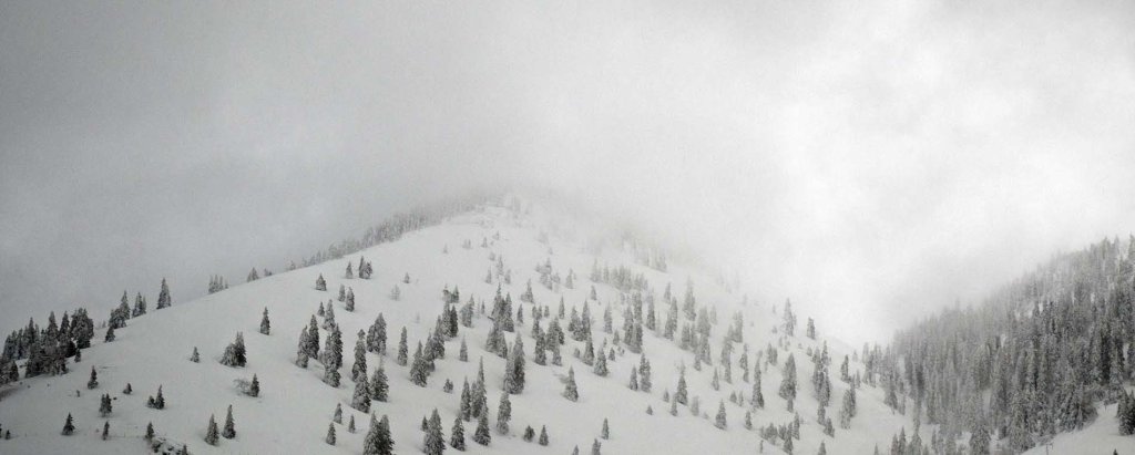
Skip to content

Cookies 🍪

This site uses cookies that need consent.

Learn more

Zur Powderguide-Startseite Zur Powderguide-Startseite

Language selection

Search PowderGuide

WeatherBlogs

WeatherBlog 9 2018/19 | North jam, north jam, north jam

North jam.

by Lea Hartl 01/09/2019
...and the occasional bit of north-westerly congestion. That more or less sums up the current outlook. As you can read in the never-ending PowderAlert series, it's still snowing in the northern Alps for the time being.

Outlook

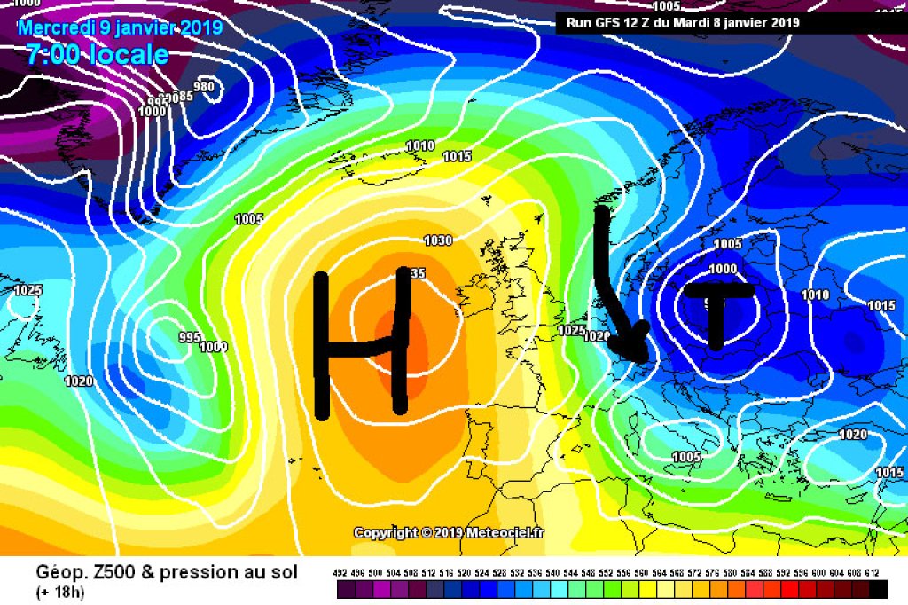
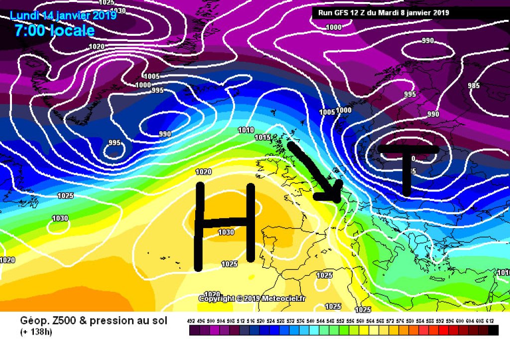
The general weather situation is proving to be stubborn - meteorologists like to call it persistent - and will only change at a detailed level for the time being. There is still an area of high pressure over the western Atlantic, on the eastern flank of which one front after another is sliding towards the Alps from the north. Over the past week, this has mainly affected the Austrian northern Alps and Bavaria. Now the high is gradually being eaten away by the frontal zone (= change at detailed level) and Switzerland is also being affected by the current alarm.
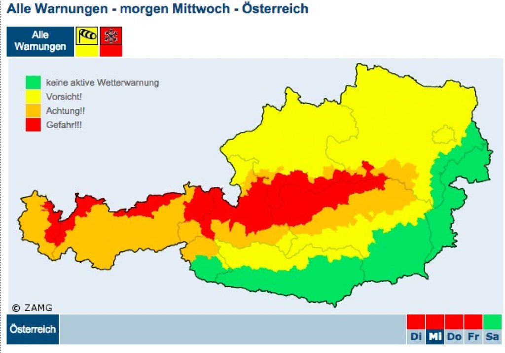
Warning

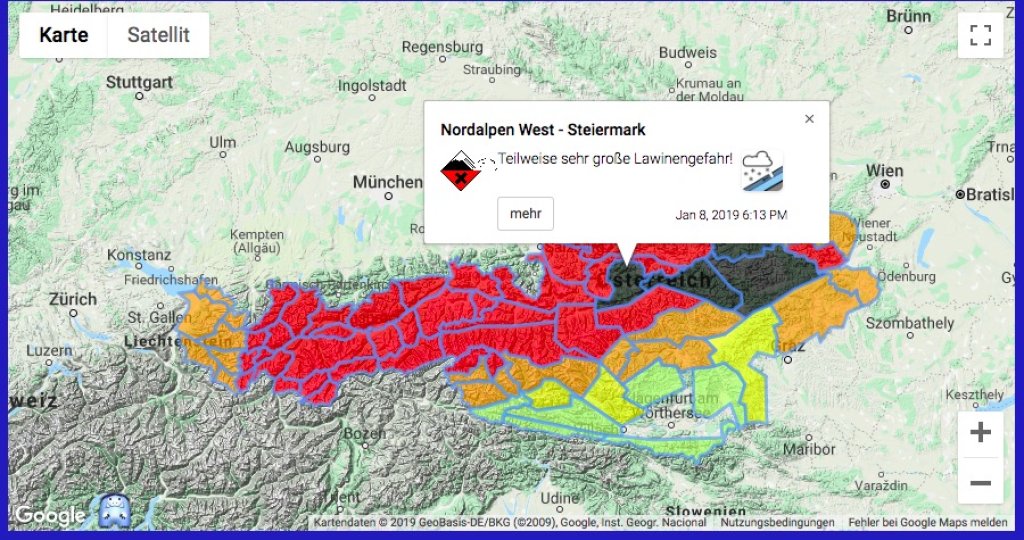
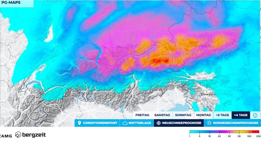
This Wednesday, somewhat colder air masses are arriving again compared to the last few days and the snow line is dropping into many valleys. By Thursday morning, there will be another fairly critical load of fresh snow, especially in the already known alert areas. The ZAMG has once again issued a red snow warning for the northern Alps. Avalanche warning level 4 has also been issued across the northern Alps from eastern Switzerland to the Rax, at least above the tree line. Level 5 was issued today in the north of Styria and in neighboring Lower Austria.

WeatherBlogs
presented by

Some villages in Upper Styria have been cut off from the outside world since Friday. The most affected areas are the Sölktal, where, according to ÖAMTC, not even emergency vehicles can currently reach, and villages in the Gesäuse. The Planneralm and Hochkar ski resorts were evacuated in convoys of cars, Hochkar for the first time in the history of the ski resort. Obertauern, Saalbach-Hinterglemm and some other Salzburg communities were temporarily accessible again after closures, but closures are to be expected again with the renewed snowfall on Wednesday.

In addition to the avalanche situation, the risk of snow breakage is a major issue in many areas. In a rather harmless version of this problem, the Ski resort Winkelmoos Alm Steinplatte, for example, was only accessible from the Austrian side (Waidring) yesterday (Tuesday). The gondola in Reit im Winkel was out of service due to the risk of trees falling into the cable car. Although some helicopter flights were possible in occasional weather windows on Tuesday, including at the Winkelmoos Alm, to clear snow from the trees by downwashing the rotors, today's worsening weather has probably put an end to this for the time being. Various road and train connections remain closed due to the risk of snow breakage, as do many hiking trails, cross-country ski trails, etc.

According to ZAMG, the current snow depths in the north are not yet at record levels for the time of year. Especially at lower altitudes, the snow cover has settled considerably due to the warmer temperatures and the rainfall over the last two days. In terms of new snow totals, however, there has already been more snow in many places in the congested areas than in an average January.

Short snow break yesterday in Chiemgau.

Short snow break yesterday in Chiemgau

.

LH

Contrasting program in the south

While the north is groaning rather than panting under the snow, it remains dry and sunny south of the main Alpine ridge with north föhn. While there is 200cm of snow on the Galzig, there is only 20cm at a similar altitude on the Villacher Alpe south of the main ridge. There is a similar contrast between the valley towns of Hochfilzen in Tyrol with 140cm of snow and Mallnitz in Carinthia with 14cm, which are only 70km apart as the crow flies. No additional snow is expected here for the time being, although the neighbors in the north would probably be happy to give some away.

There is a lot of snow a little further south: In the Apennines, mountain villages are sinking in snow thanks to the Mediterranean Sea effect and heavy snowfall is also causing massive traffic problems in southern and central Greece.

The WeatherBlog wishes the north and the south continued good nerves, also in view of the currently quite exhausting social media bipolarity of "Best Day Ever so deep it has never been #powstria" and "completely irresponsible to go outside in this weather, if something happens to you it's your own fault !!!1!!"

Photo gallery

This article has been automatically translated by DeepL with subsequent editing. If you notice any spelling or grammatical errors or if the translation has lost its meaning, please write an e-mail to the editors.

Show original (German)

Related articles

Comments

WeatherBlogs
presented by