Skip to content

Cookies 🍪

This site uses cookies that need consent.

Learn more

Zur Powderguide-Startseite Zur Powderguide-Startseite

Language selection

Search PowderGuide

WeatherBlogs

WeatherBlog 8 2018/19 | Happy New Year!

More about the North Congestion Week

by Lea Hartl 01/02/2019
High fog over Lake Achensee on New Year's Day

High fog over Lake Achensee on New Year's Day

LH
The year 2019 is still young, but already has a lot to offer in terms of snow: one alarm follows the next and winter really seems to have arrived, at least in the north-east of the Alps. The west and especially the south will have to make do with artificial snow and the remnants of the early season snowfalls for the time being.

Current situation and outlook

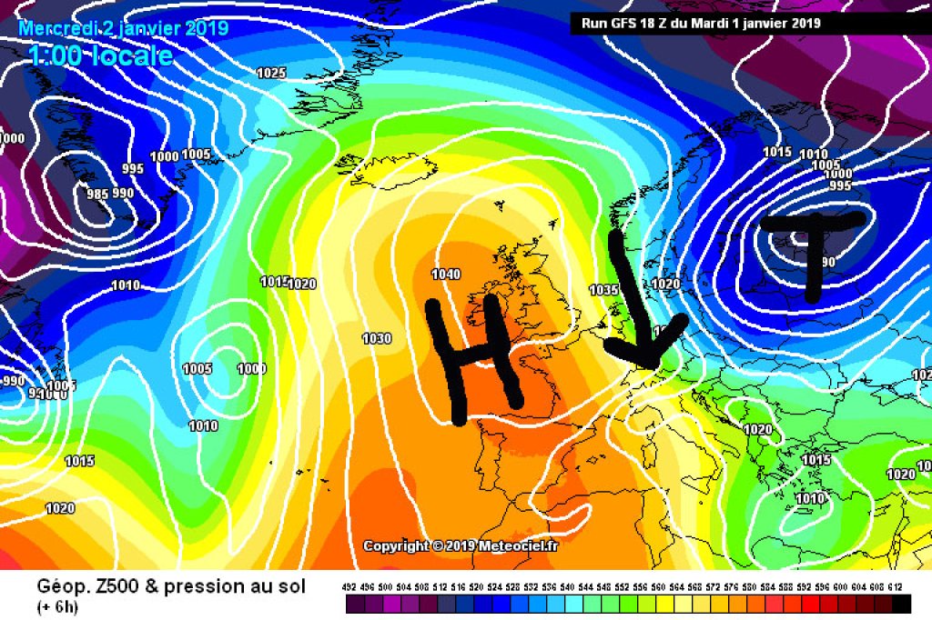
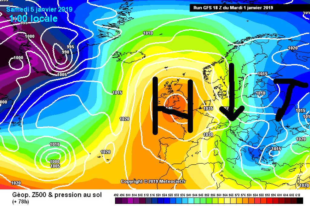
As is well known, the Alps like to be divided into east and west, usually roughly along an imaginary line between Lake Constance and Lake Como. The weather is also taking part in the east-west division this week, although the meteorological dividing line runs a little further east than the geographical one:

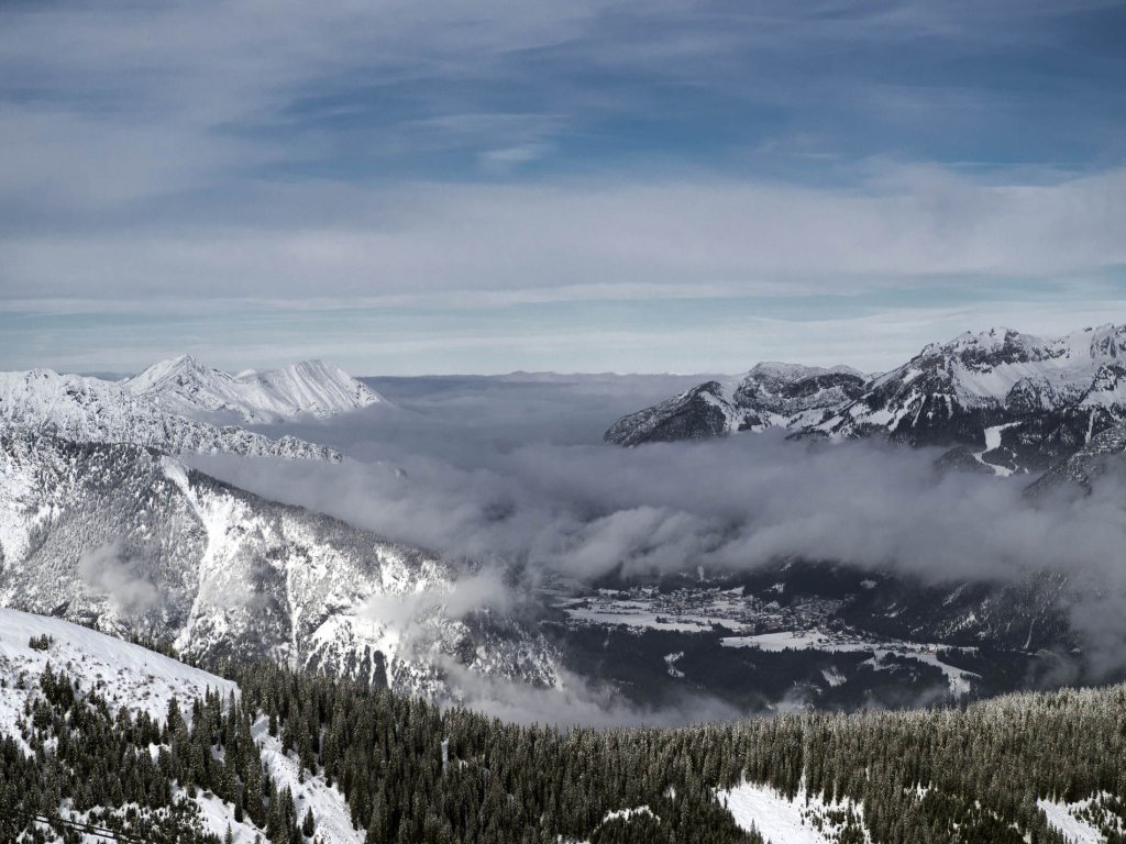
A blocking high over Western Europe and the British Isles is currently cutting the Alps off from the Atlantic westerly drift. Between the high and a low with a core somewhere over the Baltic, cold polar air is flowing south in a tight northerly flow. The eastern Alps are getting the cold and quite humid air, while the western Alps are dominated by the high with bright sunshine.

WeatherBlogs
presented by

It's already snowing in the east today (Wednesday) and temperatures are dropping significantly with a wave of cold high-altitude air heading towards the Alps. Thursday will remain turbulent with the potential for sleet showers and perhaps even the odd winter thunderstorm mixed in with the snow showers. Things will calm down a little on Friday - meaning it will snow a little less - before a warm front brings a slight rise in temperatures and more heavy precipitation on Saturday.

The details can be found in the current PA and then most likely in PA number 6 from Friday. According to the crystal ball, the blocking high will not really budge in the more distant future and the north to north-westerly flow should continue to accompany us next week with everything that goes with it.

The further west and south you go, the sunnier it is and will remain over the next few days.

New Year's Eve fog

A brief digression on the topic of condensation nuclei on the occasion of the turn of the year with accompanying fireworks: Water vapor in the air condenses into small droplets when the moisture content of the air exceeds the saturation level. It condenses much better if the air contains small particles to which water molecules can dock. Such particles are actually always present in the air in more or less large quantities and come from natural sources, for example dust from the desert or salt from the sea, or from human activities such as lighting fires, driving diesel cars or shooting New Year's Eve firecrackers.

High fog over Lake Achensee on New Year's Day

High fog over Lake Achensee on New Year's Day

LH

The concentration of particulate matter on busy roads is around 70 micrograms per square meter. According to ZAMG, values of up to 3,000 micrograms per square meter are reached on New Year's Eve at busy locations. This is not only far beyond the level of fine dust pollution that is usually considered acceptable, bad for asthmatics and generally quite toxic, it also promotes the formation of particularly dense fog. Due to the many soot particles in the air, instead of a few, large fog droplets, many, very small fog droplets are formed. If the soot is then caught in an inversion, visibility sometimes drops to minimal values, "Driving becomes impossible and pedestrians wander around disoriented".

It might be worth considering whether the fireworks should be avoided, as the latter effects can also be achieved by simply drinking alcohol.

This article has been automatically translated by DeepL with subsequent editing. If you notice any spelling or grammatical errors or if the translation has lost its meaning, please write an e-mail to the editors.

Show original (German)

Related articles

Comments

WeatherBlogs
presented by