Skip to content

Cookies 🍪

This site uses cookies that need consent.

Learn more

Zur Powderguide-Startseite Zur Powderguide-Startseite

Language selection

Search PowderGuide

WeatherBlogs

WeatherBlog 6 2018/19 | Changeable and warmer

Christmas thaw from the west

by Lea Hartl 12/19/2018
Western weather will bring repeated disturbances over the next few days with significantly milder temperatures than recently. By Friday, considerable amounts of fresh snow in the west, albeit with a very high snow line.

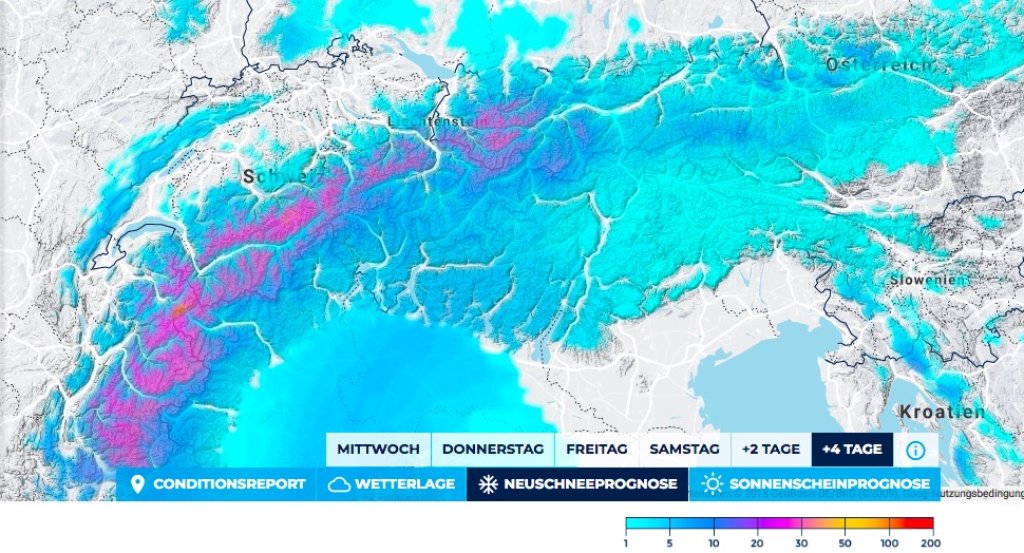
Current situation and outlook

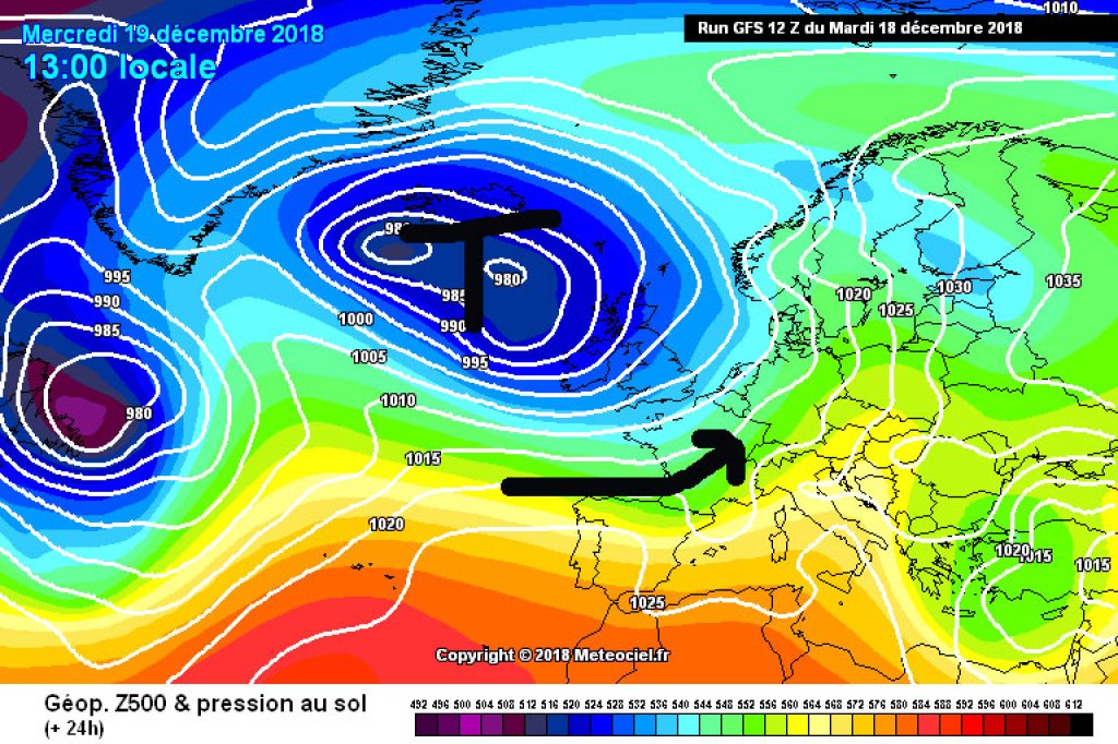
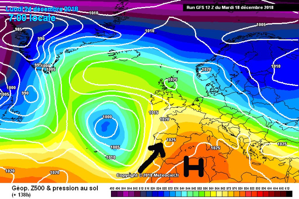
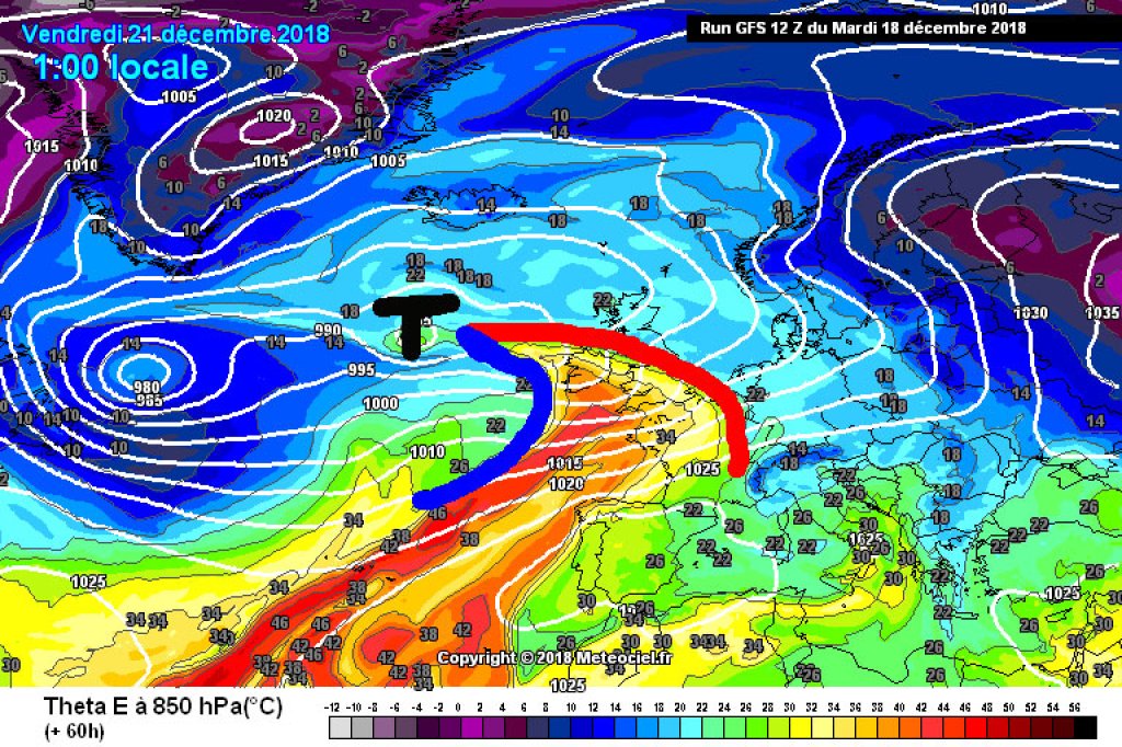
The cold of the last few days has gone and the thin, pre-Christmas snow cover is melting away, at least in the lowlands. The weather is currently dominated by a low over the British Isles. The Alpine region is on the front side of the depression in a westerly to south-westerly current that is steering mild air masses towards Central Europe. There is now enough snow at higher altitudes to ensure a white Christmas in many places despite the warmer temperatures. The comparatively cosmetic amounts of snow currently found in the foothills of the Alps, for example, will almost certainly not survive the coming days.

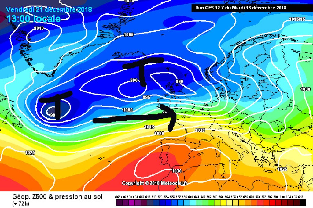
Today, Wednesday, will be cloudy in the west and snowfall will set in in the southern western Alps. In the east, it will first be clearer, then increasingly cloudy, with unproductive snowfall and possible black ice problems in the lowlands on Thursday night. On Thursday, the small disturbance will move eastwards during the course of the day and it will gradually become sunnier from the west.

WeatherBlogs
presented by

A warm front is on the horizon for Friday. With the passage of the front, the snow line is likely to rise to unpleasant heights of over 2000m. Far to the west, the high areas may still get a good load of fresh snow (half a meter according to current forecasts). Exactly how this will work is still uncertain. East of the Dolomites, for example, it will remain more or less dry.

The trend of "relatively mild, changeable westerly weather" will continue at the weekend and probably also at the beginning of next week. It will tend to be sunnier on the southern slopes of the Alps, while in the north there will be precipitation from time to time with a fluctuating snow line.

And otherwise

The Balkans have seen impressive amounts of snow since the weekend. Several small low pressure systems have moved from the Mediterranean to the Black Sea over the last few days, dumping enough snow over a fairly large area to cause massive traffic problems, power cuts and other chaos.

A rugby match between a team from Wales and one from Romania had to be called off because it snowed half a meter shortly before the scheduled match and they were apparently overwhelmed with clearing the Romanian pitch. The Wales team wanted to leave, but this also proved difficult: the team, coach and referee were initially stuck in their plane for hours and were then asked to disembark and help clear the runway at Timisora airport. A truck that was called in to pull out the plane stuck in the snow also got stuck in the snow. Oh well

.

Photo gallery

This article has been automatically translated by DeepL with subsequent editing. If you notice any spelling or grammatical errors or if the translation has lost its meaning, please write an e-mail to the editors.

Show original (German)

Related articles

Comments

WeatherBlogs
presented by