Skip to content

Cookies 🍪

This site uses cookies that need consent.

Learn more

Zur Powderguide-Startseite Zur Powderguide-Startseite

Language selection

Search PowderGuide

WeatherBlogs

WeatherBlog 5 2016/17 | Snow cannons are happy about dry high pressure and cold weather

Currently cold and dry. Outlook: less cold and dry.

by Lea Hartl 11/29/2016
A generally mild fall comes to a sunny but cold end. While the south-western Alps have received a decent base over the last week, the Föhn winds in the north have taken away most of the snow again. At least it is now cold enough again to run up all the available snow cannons and get the slopes in shape for the Christmas rush. In light of the current situation: What is artificial snow?

Review and current situation

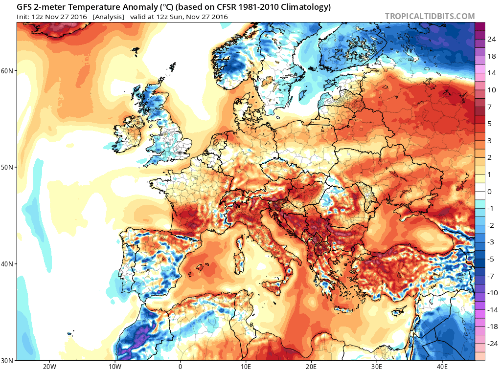
The meteorological fall (September, October, November) is coming to an end. While temperatures in the mountains were close to the long-term average, the lowlands in Austria were significantly too warm, resulting in an above-average warm autumn overall. Although October was rather cool, the mild September and a more or less average November made up for the minus. Autumn review by ZAMG.

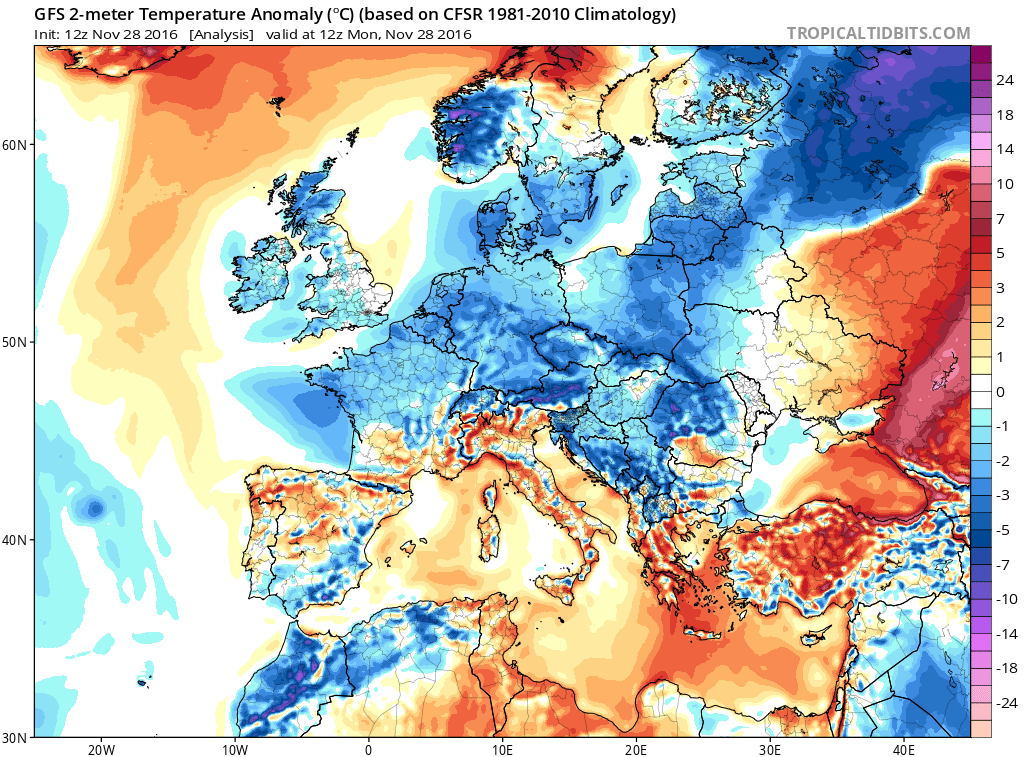
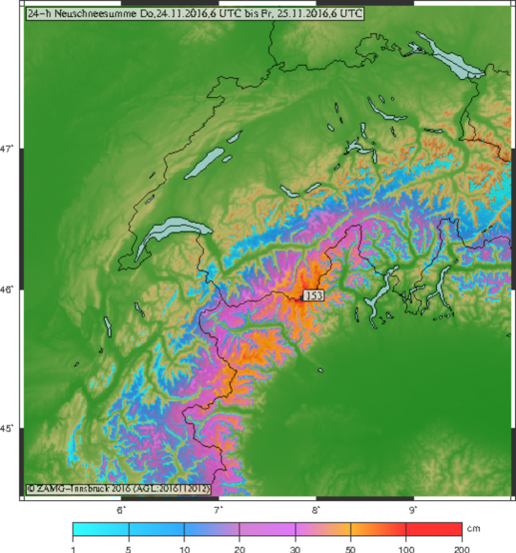
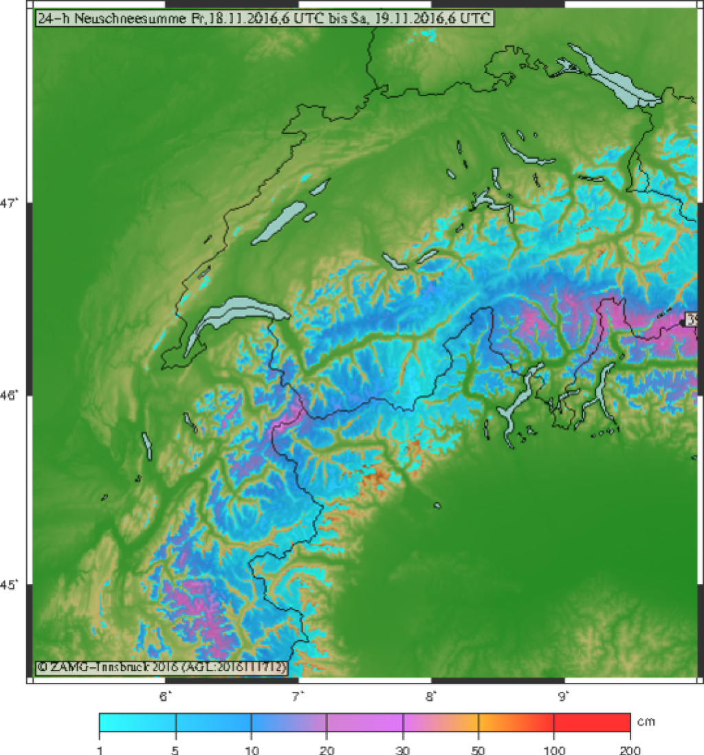
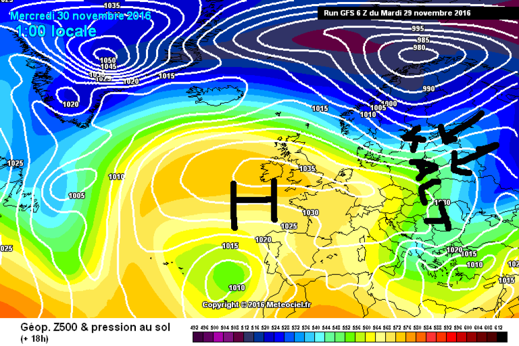
In the last few "autumn days", the Alpine region is under the influence of a high with its center over the British Isles. While a foehn-like southerly flow (with impressive amounts of precipitation in the south-western Alps, both in solid and liquid form) was dominant last week, much colder air is currently reaching us from northerly directions. The jump in temperature between Sunday and Monday was considerable and was due to a surge of cold polar air that made it to us from the north-east. The cold air is very dry and it was not possible to get anything more than a light coating of sugar in parts of the eastern Alps from the aforementioned surge in terms of precipitation.

Outlook

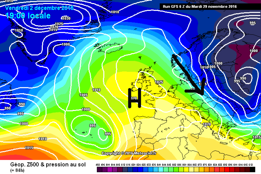
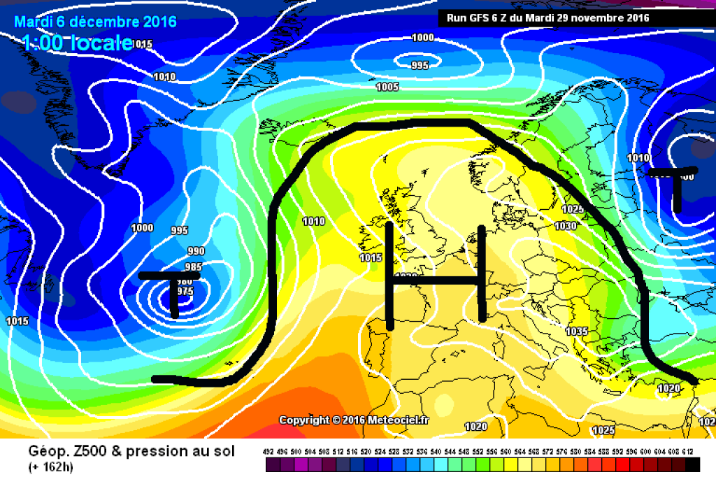
The general weather situation will not change significantly at the meteorological start of winter. The axis of the high wedge will tilt a little and the flow will turn from north (east) to northwest over the course of Wednesday. This will also increase the wind speed and Thursday and Friday are likely to be quite stormy in the northern eastern Alps. In the same region (north-eastern Eastern Alps) it will be cloudy as well as windy, and there may even be a snowflake or two. More than a few rather cosmetic centimetres are not to be expected. It will remain dry and sunny in the rest of the Alps. Towards the weekend, warmer Mediterranean air will gain influence over the cold continental air and it will become milder from the west. The wind will also ease. There is no significant snow in sight for the foreseeable future.

WeatherBlogs
presented by

Best snow cannon weather!

As natural snow is known to behave uncooperatively and capriciously more often than not, most ski resorts are now also known to rely on the far less capricious artificial snow. The current weather is ideal for artificial snow production: cold and dry. Incidentally, in terms of tourism policy, artificial snow is called "technical snow" because it is made of ice and is not artificial at all - in contrast to the much more artificial polystyrene snow that is sometimes used for film shoots.

Apart from isolated special solutions, artificial snow is produced using snow cannons or lances. The lances are less energy-intensive and cheaper, but have a lower snow output. In both variants, water is sprayed into the air from small nozzles. Normally, there are nozzles that spray only water and those that spray compressed air or compressed air and water. The compressed air/water mixture expands when the ambient pressure drops (i.e. when it leaves the snow gun), cools down and freezes. This creates condensation nuclei that promote the freezing of other droplets. However, droplets can also freeze without such nuclei if it is cold enough.

When temperatures are well below freezing, snowmaking is not a problem anyway. It becomes critical in the borderline temperature range, where it is just about possible or just not possible at all. In such cases, in addition to the air temperature, humidity is particularly important, as are radiation, wind, droplet size and trajectory. The faster and smaller the droplets come out of the nozzles, the better. High speed promotes turbulent energy loss to the air. Small droplets have more surface area overall and therefore a higher energy loss. The longer the droplet flies, the more time it has to lose energy.

The drier the air, the more water evaporates during the droplets' flight phase. The phase transition causes the droplet to cool down and freeze faster. With the same water temperature, snow can be produced just as well at -2°C air temperature and 20% humidity as at -6°C and 90% humidity. It works just as poorly at temperatures around zero and high humidity. Logically, the whole thing works better if the water is as cold as possible, which is why snow cannon water is cooled in some areas before it is sprayed.

The droplets do not freeze into snow crystals, of course, but into small ice balls. The balls freeze from the outside in, sometimes leaving a liquid core. Technical snow is generally finer-grained than natural snow and much denser. There are more contact points between the grains, so they bond more quickly and the snow becomes harder overall. This is why artificial snow is much easier to groom and you need less of it to make a slope skiable.

The WeatherBlog would still prefer it to snow un-technically soon and hopes that the crystal ball will soon have something more interesting to offer.

Photo gallery

This article has been automatically translated by DeepL with subsequent editing. If you notice any spelling or grammatical errors or if the translation has lost its meaning, please write an e-mail to the editors.

Show original (German)

Related articles

Comments

WeatherBlogs
presented by