Skip to content

Cookies 🍪

This site uses cookies that need consent.

Learn more

Zur Powderguide-Startseite Zur Powderguide-Startseite

Language selection

Search PowderGuide

WeatherBlogs

WeatherBlog 26 2015/16 | What is the cold snap doing and what actually happened to El Niño?

Also: Farewell to the summer break

by Lea Hartl 04/26/2016
Since last Sunday, a cold snap has had not only the Alps but also large parts of Central Europe firmly in its grip. To the east of a massive, blocking high in the Atlantic, cold air from the polar regions is being directed towards us. Snow showers are causing confusion in the northern German lowlands, in many places there is concern about frost damage to the fruit blossom and in the mountains, everyone who didn't give up on winter in February is going in search of a few more powder turns.

Current situation and outlook

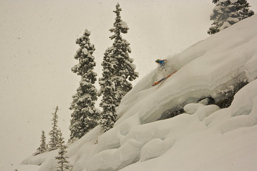
Late cold spells in April are nothing unusual. Often, the late winter spookiness has already disappeared before you even really notice it, just like the proverbial April weather. The current situation is relatively persistent and the snow at very low altitudes in particular is quite remarkable (a brief blanket of snow in Schleswig-Holstein, for example). Anyone thinking: "It's never been this cold at the end of April!" should be reminded that it is not just since last winter that we have often been dealing with temperatures that are significantly above the long-term average. This can distort our perception when it suddenly gets a bit colder.

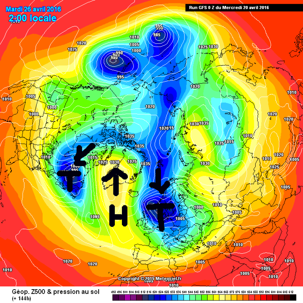
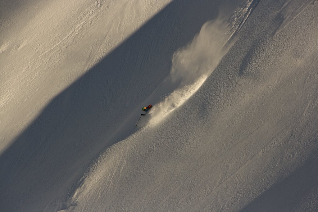
Last night, a cold front in the Alps brought considerable amounts of fresh snow, with the focus of the precipitation shifting from northwest to southeast during the course of the day (a small Adriatic low is still involved here, so it will be exciting again today in the Julian Alps and neighboring areas) and it will clear up increasingly from the west. The weather-determining low pressure system with its core in the area of Denmark will slowly shift towards Sweden and its influence on the Alps will decrease accordingly over the next few days. After a probably partly clear and therefore very cold (possibly bring in balcony plants!) night on Thursday, it will become milder, but will remain rather unsettled and prone to showers, at least on the northern slopes of the Alps. On Friday, the flow will turn SW and it will be reasonably sunny with little wind. Saturday looks similar, while the next cold front is forecast for Sunday, albeit with slightly higher temperatures. So the changeable weather will continue for the time being, but temperatures will slowly rise again.

WeatherBlogs
presented by
Ad

Where is Godzilla?

Who remembers the excitement at the beginning of winter, when speculation about the effects of the announced monster El Niño was everywhere, especially among snow lovers of all kinds? The usual guesswork about the course of winter based on ants, honeybees and the like was extended to include an impressive Hollywood monster. While the impact on Europe is small and very difficult to identify anyway, there has now also been some disillusionment in North America, especially in drought-stricken California, which was hoping for huge amounts of rainfall from Godzilla. After all, this was the case with the last major El Niño events (1997/98 and 1982/83)! In fact, the winter in the Californian Sierra was rather "average" in terms of precipitation, with a rather wet start to the season followed by a fairly dry February. This is a clear improvement on the previous, extremely dry years, but doesn't really knock your socks off.

Other, less skier-relevant effects of the El Niño phase coming to an end were, for example: extreme precipitation events in the Atacama Desert and Death Valley, contribution to the development of Hurricane Patricia due to very high sea surface temperatures off Mexico, drought and heat in Indonesia and Australia, drought in parts of Africa and Asia, especially in Ethiopia, heavy rainfall with local flooding and landslides in Peru, Ecuador and northern Chile.

The El Niño event of 2015/16 was definitely one of the strongest in recent decades. The measure of this are indices such as the ONI (Oceanic Niño Index - calculated from deviations in water surface temperatures in certain regions) and the SOI (Southern Oscillation Index - measure of the pressure difference between the high pressure area over the south-eastern Pacific and the Asian-Australian low pressure system). These indices are valuable, but an El Niño cannot be fully described by ONI or SOI alone. Things like the exact distribution of ocean temperature anomalies also play a role in the impact on different regions (where exactly is it warmest? What does this do to the circulation? How does this in turn affect precipitation patterns?) Here is a nice set of graphs comparing the major El Niño events of the last 60 years.

No two El Niños are the same, even if the ONI or SOI index are similar. Accordingly, the expectation "because it was like this in 97/98, it will be like this in 2015/16" is sometimes quite a flop. In this very interesting blog entry by climate change/climate impact researcher Ricky Rood, it is about how the Godzilla El Niño of 2015/16 was treated in the media and how this has changed compared to the 1997/98 event. The "democratization" of the media landscape through bloggers, point of view journalism and the internet in general, leads to:

"The communication of El Niño is, as they say, more democratic. This democracy carries on with little filtering imposed on accuracy of information or, even, appropriateness of the message."

Rood also rightly criticizes the chronic inability of many scientists to communicate their work in a meaningful, generally understandable way. Recommended reading.

Hasta la vista

As the current cold spell is coming to an end in the foreseeable future and the WeatherBlog also needs a break, I'm saying goodbye to summer. If it should snow three meters in July at minus 20 ° or so, there will of course be an unscheduled message.

Otherwise: The next winter is sure to come!

This article has been automatically translated by DeepL with subsequent editing. If you notice any spelling or grammatical errors or if the translation has lost its meaning, please write an e-mail to the editors.

Show original (German)

Related articles

Comments

WeatherBlogs
presented by