Skip to content

Cookies 🍪

This site uses cookies that need consent.

Learn more

Zur Powderguide-Startseite Zur Powderguide-Startseite

Language selection

Search PowderGuide

WeatherBlogs

WeatherBlog 20 | Cold air drops and stratospheric warming

Outlook: Snow in the southwest, then lots of sun everywhere

by Lea Hartl 03/15/2016
This morning in Tyrol: residual clouds are clearing quickly, the Hohe Munde still has a canopy here.

Today morning in Tyrol: residual clouds are clearing quickly, the Hohe Munde still has a cap here.

LH
In contrast to the rest of the winter so far, the Alps have been in a north-easterly flow for a while now (apart from a few foehns), which brings relatively cool weather. Most recently, a drop of cold air paid us a visit. What's it all about and why are we not feeling the otherwise frequent Atlantic influence at the moment?

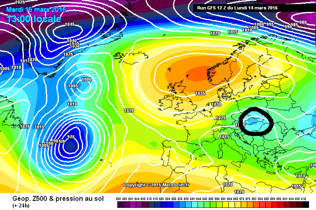
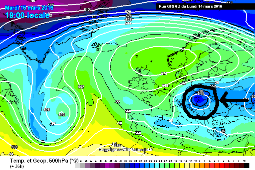
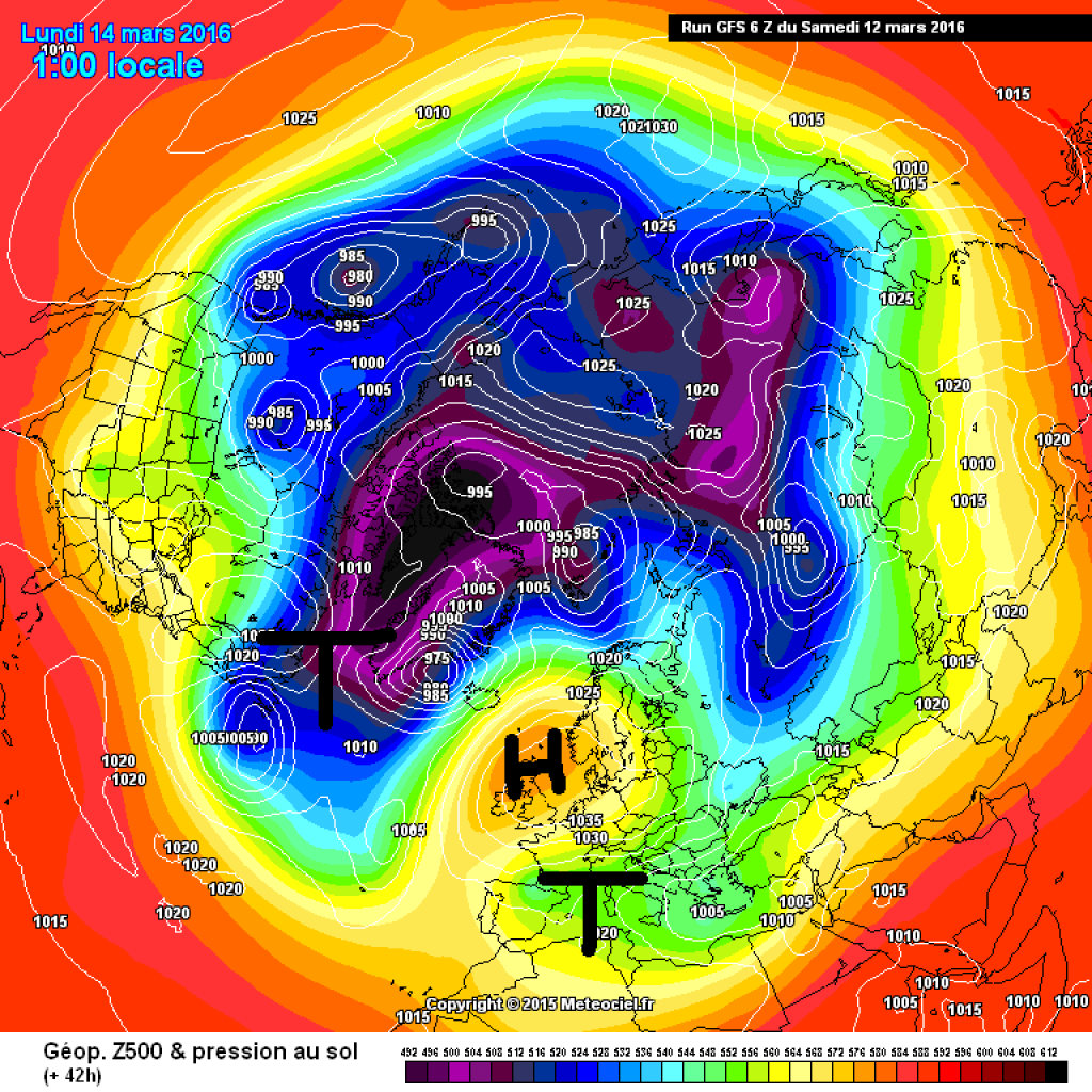
Since the end of last week, we have been in a high-over-low situation, which has now become a kind of omega. High-over-low traditionally means that the Azores high and Iceland low swap places. In the current case, the high is more likely to be found in the area of the British Isles and the low in the Mediterranean region. The blocking effect is nevertheless present: The powerful high reaching far to the north stands in the way of the westward drift and prevents Atlantic lows from reaching us on their usual track. The culprit is located between north-eastern Canada and Greenland: a center of the displaced and still disturbed polar vortex shovels warm air (important for the high) far to the north.
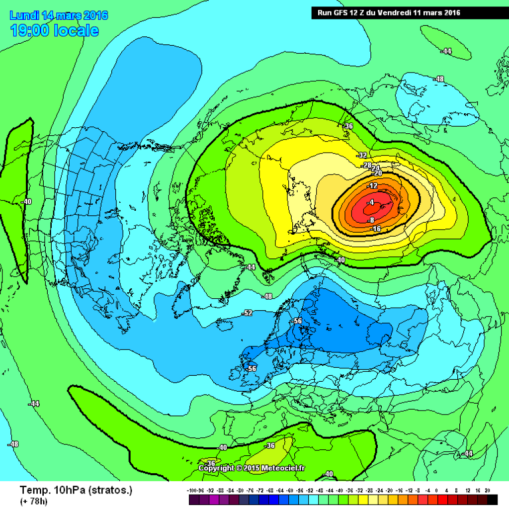
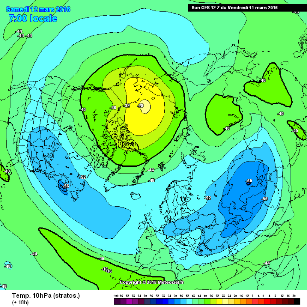
The stratosphere

The stratosphere also plays a role in the background and makes the weather dolls dance in the troposphere. However, it's quite a complicated play and it's difficult to say exactly why a particular puppet is twitching right now. In any case, there was a sudden warming of the stratosphere over the weekend (see DWD Topic of the Day from Sunday). This affects the polar vortex and can result in very persistent blocking layers. The current warming occurred quite late in the winter season and large parts of Eastern Europe have been snow-free for some time anyway, so the continental air flowing into Central Europe from the east is not too cold.

WeatherBlogs
presented by

In case anyone has the impression that March has been pretty cold so far, the first half of March in Austria was a little too warm compared to the 1981-2010 average, or more or less average. This may seem cold because February was very, very warm and you usually expect it to get warmer as spring progresses. As is so often the case, the "cold or warm" problem is therefore primarily a question of reference value.

The cold air drop

It has actually been quite cool over the last 2 days. We have a cold air drop to thank for this, which also brought us a few snowflakes yesterday. Cold air drops are small high-altitude lows that extend from a few hundred to around 1000 km and are between 5 and 10 km high. The air in the drop is significantly colder than in the surrounding area. Such altitude lows cannot usually be detected on the ground using a barometer and can only be seen on altitude maps. The exact path of cold air drops is sometimes difficult to predict (this time the models did a pretty good job) and is controlled by the usually weak current near the ground. Sometimes the drops remain stationary somewhere for a longer period of time, together with any precipitation they may bring with them. Further explanations.

Stratospheric map: Temperature in 10hPa on Monday, 14.3.16.

Stratosphere map: Temperature in 10hPa on Monday, 14.3.16.

meteociel.fr

What's next?

The blocking high is increasingly shifting back towards the Atlantic (=retrograde), causing the current to switch to the N or NW. In the Alps, the gradient will remain comparatively weak and a few very sunny days are on the cards. Today and tomorrow it will still be cloudy and wet in the southwest (combination of cold air drops and warm, humid Mediterranean air), although it will start to clear up there tomorrow. The main focus of precipitation will once again be in Piedmont, where a good half meter should accumulate by the end of the snowfall on Thursday. The Monte Rosa region will also be interesting, otherwise there will be much less. It has been sunny in the east since this morning and this is unlikely to change significantly until the weekend.

Photo gallery

This article has been automatically translated by DeepL with subsequent editing. If you notice any spelling or grammatical errors or if the translation has lost its meaning, please write an e-mail to the editors.

Show original (German)

Related articles

Comments

WeatherBlogs
presented by