Skip to content

Cookies 🍪

This site uses cookies that need consent.

Learn more

Zur Powderguide-Startseite Zur Powderguide-Startseite

Language selection

Search PowderGuide

WeatherBlogs

WeatherBlog 18 2017/18 | Still wintry and snow in the south

The next südstau is just around the corner

by Lea Hartl 03/14/2018
Today, Wednesday, is still characterized by a short-lived intermediate high, but there is already a strong new low off the Iberian Peninsula. Bit by bit, it is closing in on the high and should make its presence felt as early as tomorrow night with a strong south-westerly flow.

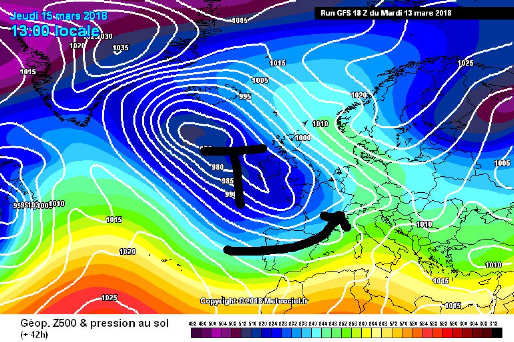
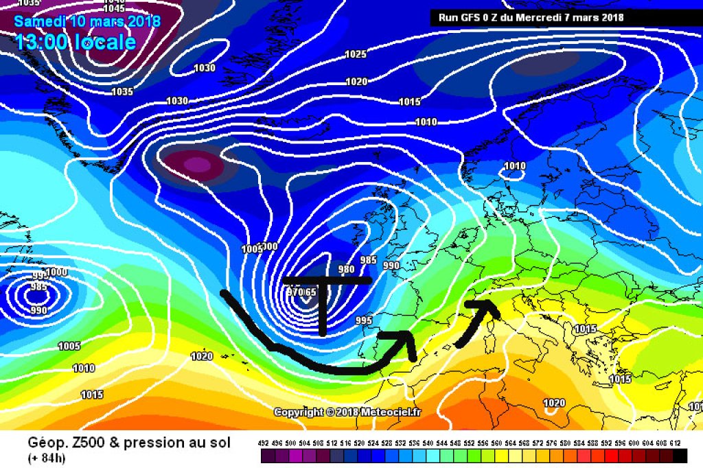
A southwesterly flow means, as demonstrated just two days ago, southstau and south föhn, depending on which side of the flow obstacle you are on. Both the Föhn and the focus of the precipitation will shift from west to east from this evening/night until tomorrow evening.

Even tonight, precipitation will start to fall in the western southern conurbations, with the snow line likely to vary considerably locally. Tomorrow evening, the Dolomites, Julian Alps and Co. will get theirs. At the same time, the Föhn will probably stop again in the north sometime around Thursday evening. It will be interesting to see whether the oracle will make another statement at short notice. Friday will be generally calmer and quite friendly in the west. It will remain cloudy for longer in the east, but it will also clear up here from the west.

WeatherBlogs
presented by

Winter at the weekend

Last Sunday, Germany exceeded the 20 degree mark for the first time this year and it was almost like early summer in the northern Alps with foehn winds. To compensate for this, it will be quite cold again next weekend - double-digit minus temperatures are not unlikely, even in the valleys. Northern Germany could also get very cold and the conditions for a "Baltic Sea Lake Effect" seem quite favorable again if anyone wants to go jibbing on the beach.

A high over Scandinavia is responsible for this. Already present to some extent, it will develop into a larger structure blocking the Atlantic over the next few days. Our current southern depression is still slipping "underneath" (south) of it and will tap into cold air from the east at the weekend, which will be brought into the vicinity by the position of the high.

This constellation will result in precipitation in the Alps, especially in the south-east. Whether, when, where and how much depends primarily on whether a Mediterranean low can take advantage of the cold air. It will be interesting to see.

Shortly before the spring equinox, winter will once again do the honors. It looks suitably spring-like again at the moment, but until then there is still a lot of water flowing down the river. So gaseous water flows along the atmospheric circulation. You know what I mean.

Photo gallery

This article has been automatically translated by DeepL with subsequent editing. If you notice any spelling or grammatical errors or if the translation has lost its meaning, please write an e-mail to the editors.

Show original (German)

Related articles

Comments

WeatherBlogs
presented by