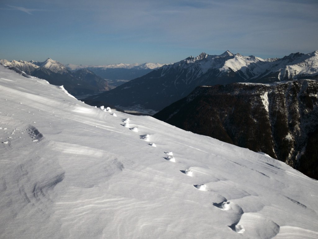
Skip to content

Cookies 🍪

This site uses cookies that need consent.

Learn more

Zur Powderguide-Startseite Zur Powderguide-Startseite

Language selection

Search PowderGuide

WeatherBlogs

WeatherBlog 17 2016/17 | Turbulent carnival weather

A series of lows keeps the Alps busy and brings highly changeable weather.

by Lea Hartl 02/21/2017
Outlook: Warm, cold, snow, rain, sun, thunderstorms - the carnival days have it all. Embedded in a windy westerly current, several small lows are heading towards the Alps in quick succession. After cold and fresh snow down to some valley locations on Friday, warmer weather will quickly follow.

Current situation

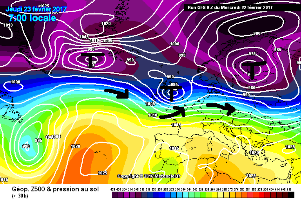
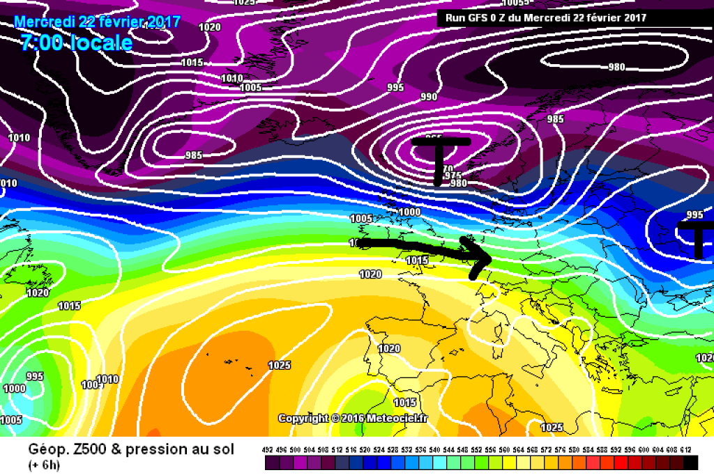
A weekend of great weather (even with a little fresh snow) was followed by a gradual change in the weather at the start of the week. Yesterday, Tuesday, a warm front brought milder temperatures, clouds, wind and rain up to relatively high altitudes. This warm front will continue to affect at least the Eastern Alps today, but will finally move away during the course of the day and it will be quite sunny everywhere. It will continue to be sunny on Thursday. It will get warmer again and remain windy at high altitudes.

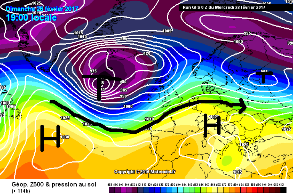
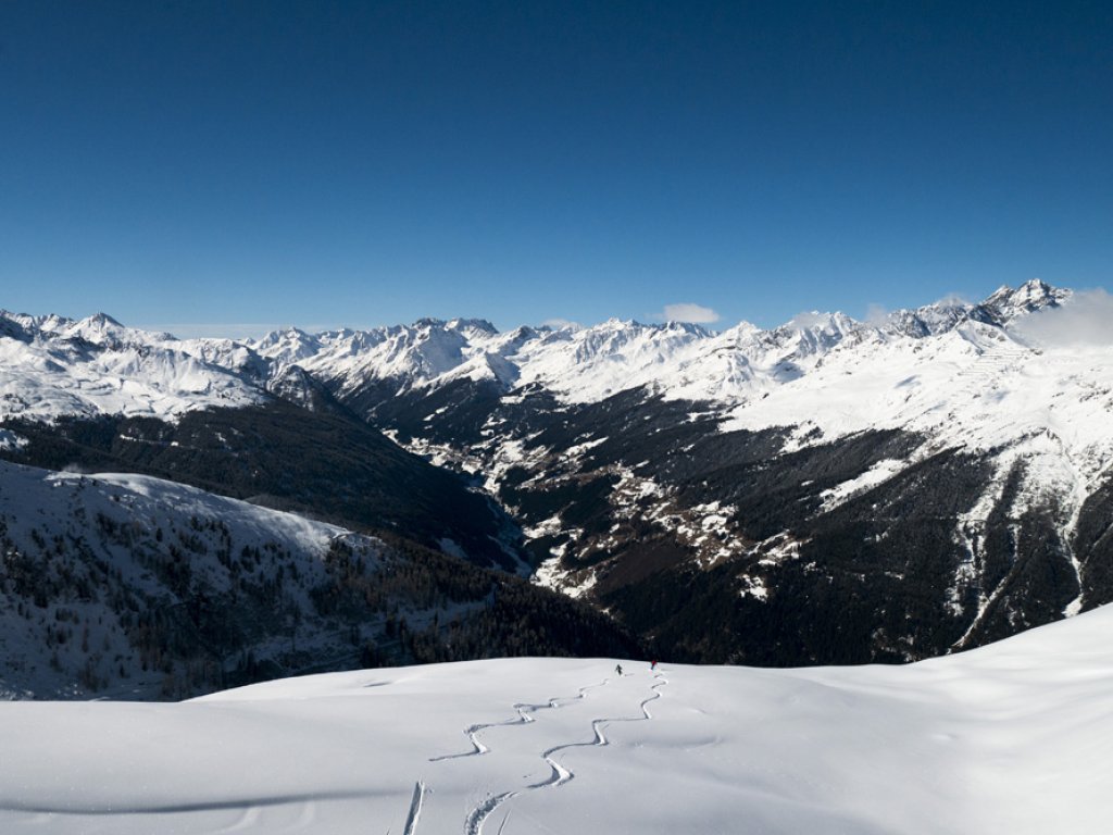
Snow for the weekend, unsettled mid-term

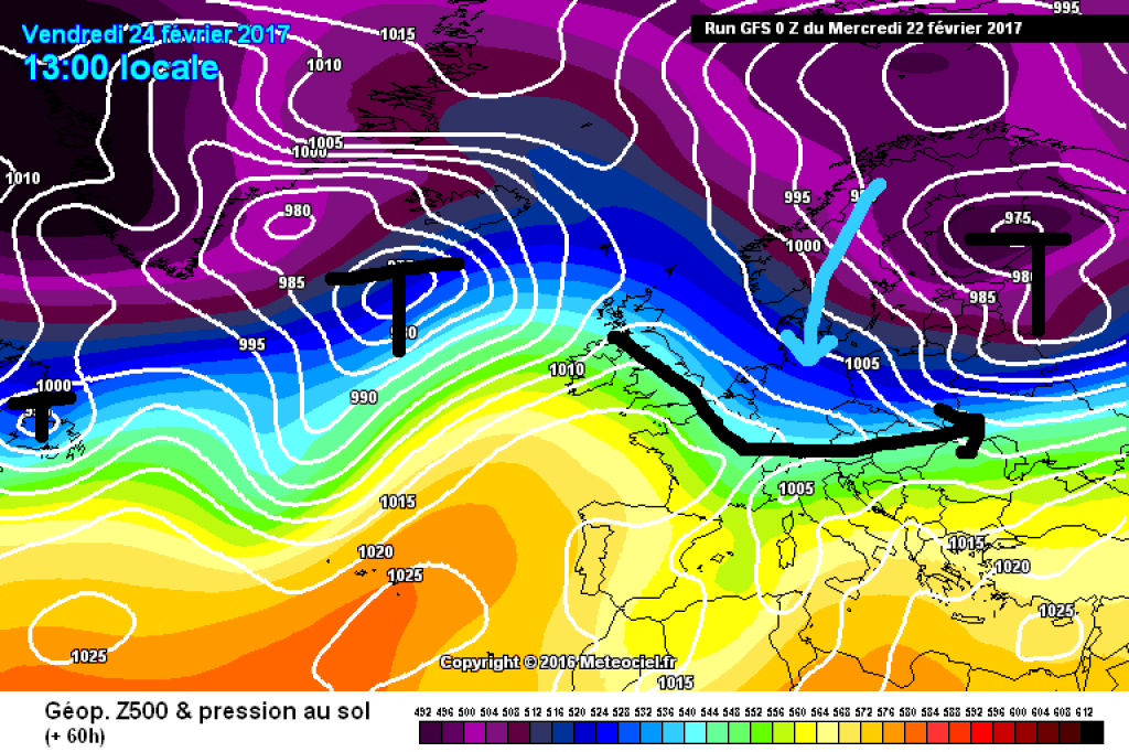
In the night to Friday, a cold front from the NW will bring a significant drop in temperature of up to 15°C in the mountains. The snow line will drop again in many valleys in the northern Alps and there is likely to be a lot of fresh snow, especially in the northern foothills. The cold front will be followed by a push of cold polar air, which could possibly cause one or two winter storms.

It is still unclear where and to what extent the trough in which the cold front is embedded will reach the southern side of the Alps. Two days ago, the models still saw this development as quite widespread and optimistic, but currently it looks more like just a graze far to the south-east. Only the precipitation caused by the cold front on the northern slopes of the Alps seems relatively reliable at the moment, while the situation in the south is more complex and difficult to predict. More details on this will probably come soon from my colleague PowderOrakel. On Saturday it will become sunnier again from the west, the northern slopes in the eastern Alps will have to wait a little longer for clearer weather. Temperatures will rise again relatively quickly after the front passes.

The brief winter interlude with snow down to low elevations will probably be followed by a fairly mild SW situation. The trend towards unsettled, mild and humid weather will continue in the forecast until further notice.

WeatherBlogs
presented by

Winter lettuce crisis

The winter months in this country were extremely dry in many areas. The beginning of a more changeable weather phase should counteract the precipitation deficit somewhat - positive news for domestic agriculture at the start of spring. In the European Mediterranean countries, on the other hand, the last few months have been very rainy in some cases. Cold and heavy rainfall have led to major crop losses here, which is now having an impact on vegetable prices in supermarkets in Central Europe (see this DWD Topic of the Day or this detailed Guardian article). In winter, around 80% of the vegetables in European supermarkets normally come from the greenhouses and fields of southern Spain. Prices for peppers, cucumbers and co. have risen sharply, and some supermarkets in England had to strictly ration iceberg lettuce in January. In the meantime, the crisis is no longer visible at first glance in the form of empty shelves in many places, as the vegetables are now being imported from the USA.

As we all know, the weather only gets better (=winter) when you eat your plate empty. Perhaps things will get back on track if we simply eat more of our local winter vegetables in future. Even if coleslaw with a radish and parsnip garnish might take some getting used to at first - if it makes Mrs. Holle more generous, the WeatherBlog will gladly accept a change in diet.

Photo gallery

This article has been automatically translated by DeepL with subsequent editing. If you notice any spelling or grammatical errors or if the translation has lost its meaning, please write an e-mail to the editors.

Show original (German)

Related articles

Comments

WeatherBlogs
presented by