Skip to content

Cookies 🍪

This site uses cookies that need consent.

Learn more

Zur Powderguide-Startseite Zur Powderguide-Startseite

Language selection

Search PowderGuide

WeatherBlogs

WeatherBlog 16 2018/19 | Return of the westerly weather

The long period of high pressure is coming to an end

by Lea Hartl 02/27/2019
The meteorological winter is coming to an end (the skiing winter is still a long way off, of course!) and with it, the permanent high that has dominated the Alpine weather for what feels like half an eternity is slowly coming to an end.

Current situation and outlook

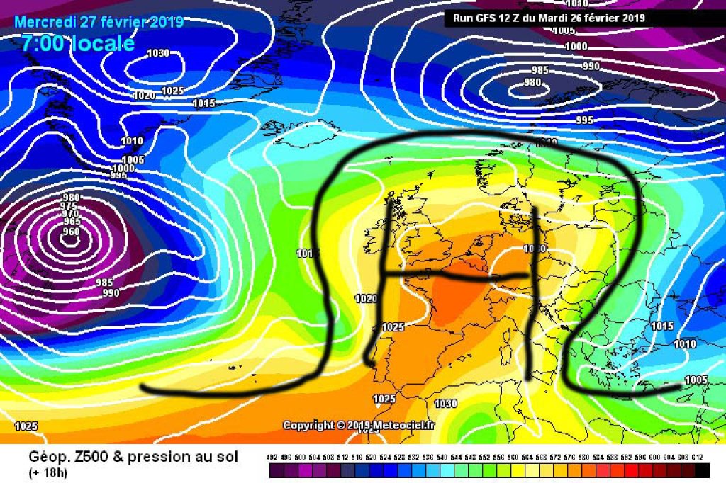
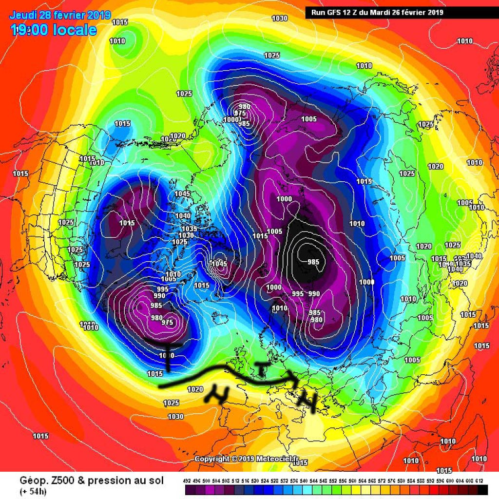
A strong extension of the Azores High is still over the Alps and will provide plenty of sunshine, high temperatures and general spring fever everywhere today, Wednesday. However, a low over the British Isles is nibbling away at our high in the northwest and a first low pressure system will reach the Alps around Thursday evening. Wind and clouds increase from the NW over the course of Thursday and it gets colder. In the evening it will start to snow on the northern slopes of the Alps. Friday will be widely overcast, with snow and rain showers subsiding. The amount of fresh snow is expected to be somewhere between cosmetic and 20 cm, here and there a little more in more westerly, favorable congested areas. In the south, it will remain dry and rather clear with a light north föhn.

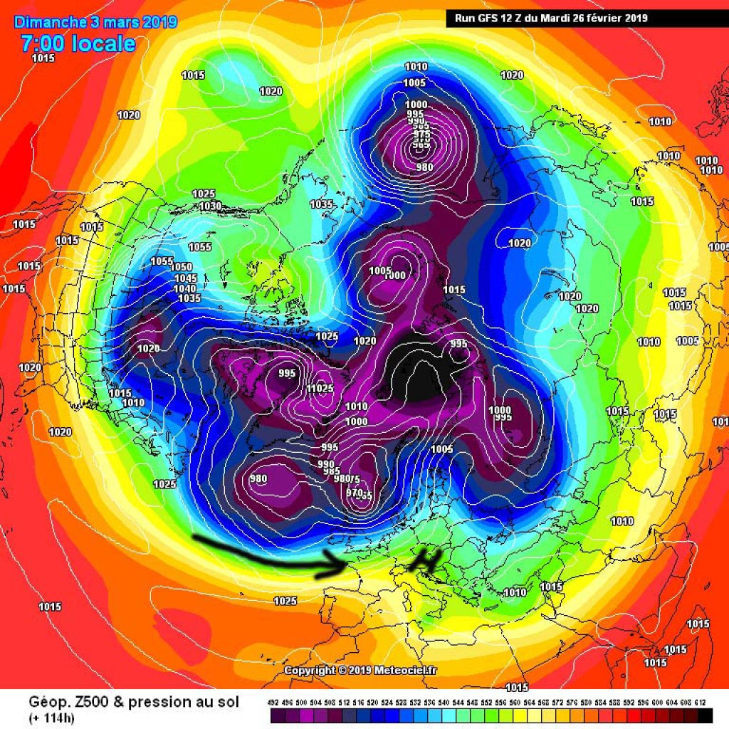
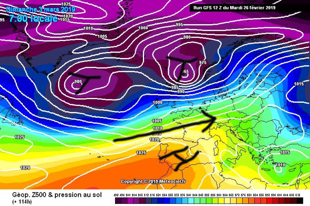
The weekend looks like something between "half sunny" and "mixed". In the eastern Alps, clouds will hang around for longer on Saturday, in the west it will clear up more quickly, but it will be quite windy everywhere and briefly milder in the north with a föhn wind. On Sunday, the next disturbance will approach from the west. The trend for next week is also towards unsettled westerly weather with a rapid succession of shallow troughs and ridges, similar to before the long phase of high pressure, but now with slightly higher temperatures.

WeatherBlogs
presented by

Change in the general weather situation

If you only look at the sun-cloud icons in the weather forecast, you might think that not much will change over the next few days. However, the sun icon for today is fundamentally different from the one for Saturday, for example, in terms of the general weather situation. Today, we are still in a pronounced loop of the polar vortex: the Azores High - part of the subtropical high pressure belt - is pushing the polar front over Central Europe far to the north and the jet stream is forming a kind of large, almost standing wave on which we have been surfing for some time like the Munich city surfers on the Eisbach, to reach deep into the box of dubious metaphors.

However, the atmosphere is not quite as unchanging as concrete steps in the Eisbach, which is why our standing wave is toppling over these days. Instead of one big wave, we'll soon be getting lots of smaller waves that are embedded in a strong, zonal current and pass by much faster. This winter's snow is probably slowly coming to an end at low altitudes, but in the mountains the weather is getting more exciting again.

Photo gallery

This article has been automatically translated by DeepL with subsequent editing. If you notice any spelling or grammatical errors or if the translation has lost its meaning, please write an e-mail to the editors.

Show original (German)

Related articles

Comments

WeatherBlogs
presented by