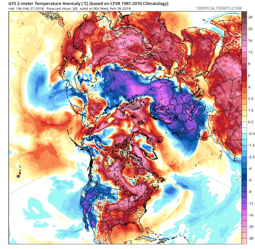
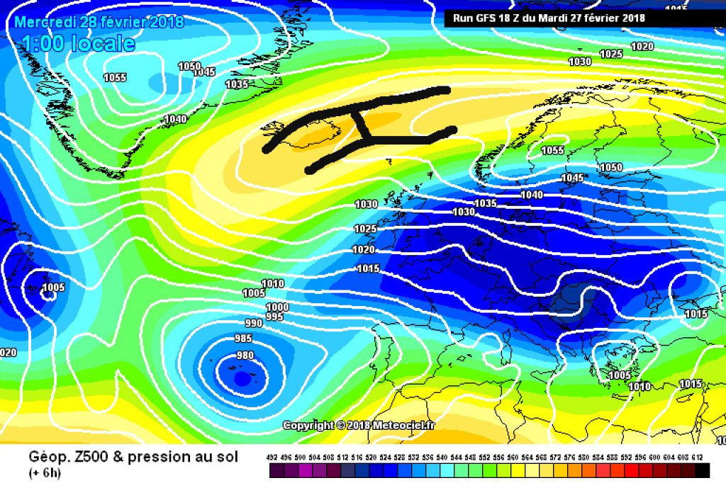
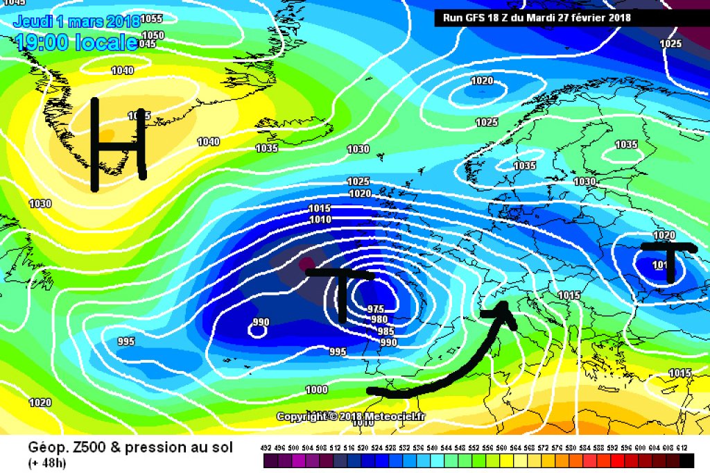
After the presumed cold peak last night, it is now getting warmer again. The high pressure system tips over and "falls" to the side into a high-over-low situation. The Alps are on the southern edge of the associated low or a low-pressure trough running from west to east. This will bring warm, humid air from the southwest to the Apenbogen. Today, Wednesday, will still be very frosty, but by tomorrow temperatures will rise to around 15°, although it will take longer to warm up further east. Tomorrow, light snowfall is likely in the south, while in the north it will remain foehn-like. Friday and Saturday will also remain unsettled with precipitation in the south and west and a tendency towards friendlier, but not really good, weather in the north and east. From today's perspective, Sunday looks relatively sunny before it gets cloudy again in the afternoon, especially in the west.
Winter review
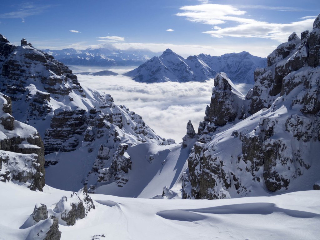
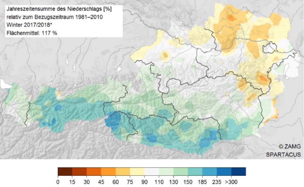
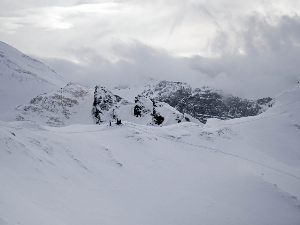
We emphasize once again: The skiing winter is not over yet, only the statistical meteorological winter. The latter was very rainy. In Austria, a total of 25% more precipitation fell than the long-term average, with January in particular being very wet with an increase in precipitation of 70%. The most snow and rain fell in Tyrol and Carinthia. The snow depths in the mountains are consistently above average, but not in the valleys.
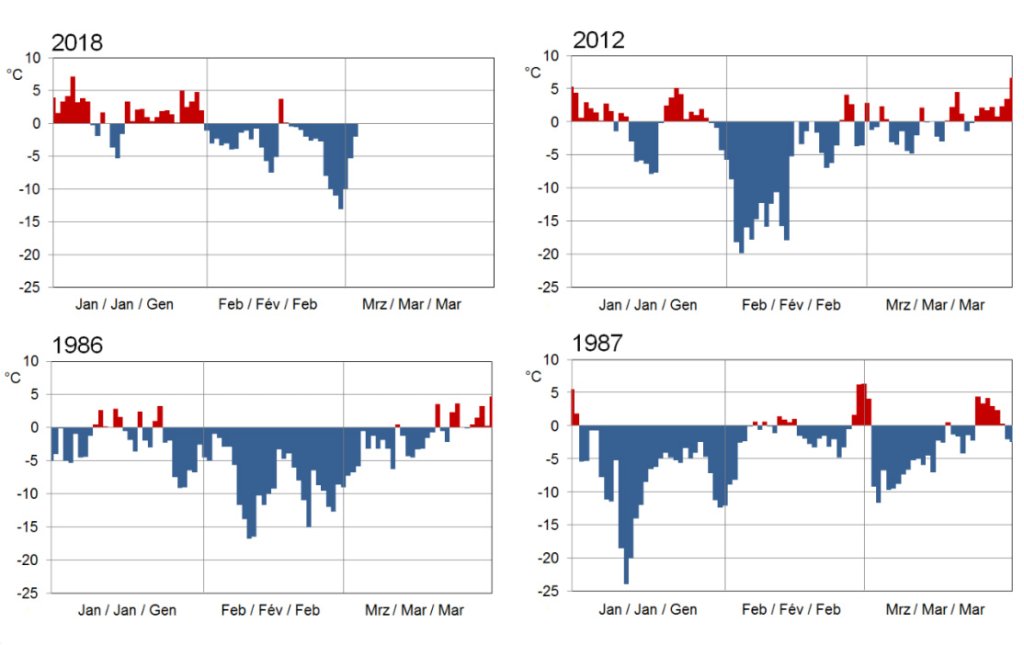
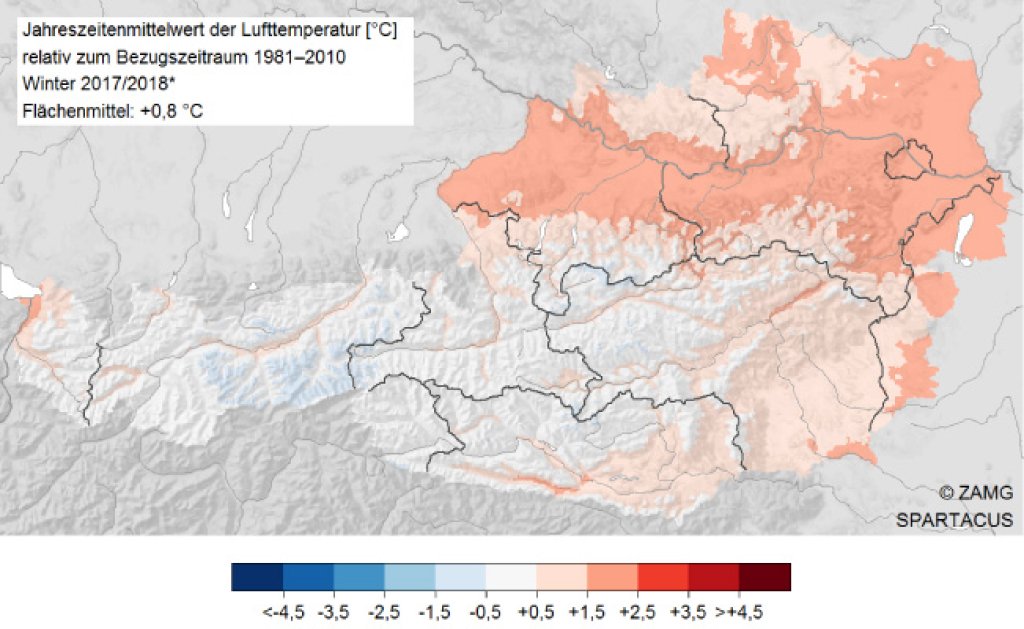
The explanation logically lies in the temperatures. Apart from the last few days, they were above average, especially at low altitudes. In Austria, the cool February (-2.1°C colder than average) could no longer prevent the "mild winter" status in view of the slightly too warm December (+0.8°C) and the very warm January (+3.8°C). However, February 2018 was one of the coldest Februaries in Austria in the last 32 years in the mountain regions.