Skip to content

Cookies 🍪

This site uses cookies that need consent.

Learn more

Zur Powderguide-Startseite Zur Powderguide-Startseite

Language selection

Search PowderGuide

WeatherBlogs

WeatherBlog 12 2018/19 | Polar vortex brings südstau in a roundabout way

Turbulent weather not only in the Alps

by Lea Hartl 01/30/2019
Foehn clouds in the Alaska Range

Foehn clouds in the Alaska Range

LH
FC
This time we start with a look at the big picture, or at least the northern half of the big picture. The polar vortex has not been swirling nicely around the pole for a while now, but is wobbling around irregularly with several low-pressure centers.

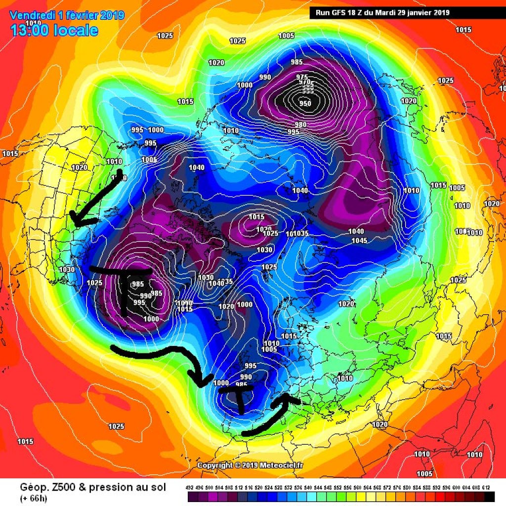
Polar vortex branch brings cold for the eastern USA and dynamic Atlantic weather

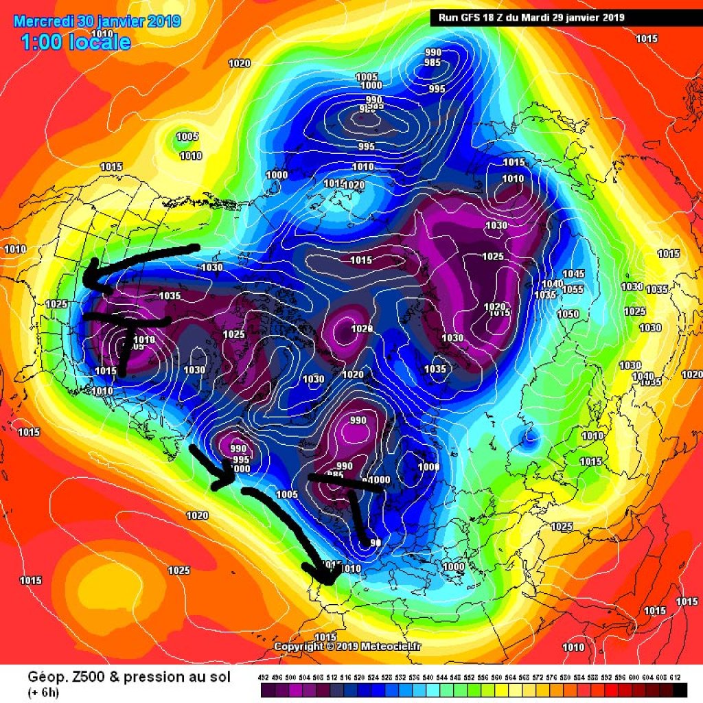
One of the low pressure centers is located over north-eastern Canada and is currently causing extremely cold temperatures in the eastern half of Canada and the USA. The coldest temperatures in 20 years are forecast for some regions in the Midwest. A "wind chill" temperature of -61 degrees Fahrenheit (-52C) was measured at a weather station in North Dakota on Tuesday. The actual air temperature was -25F (-32C). Further west, the other side of the wave is shoveling unusually warm air all the way to the far north, and at the WeatherBlog in Interior Alaska, they're worried about road conditions. The usually cold, dust-dry snowy roads become extremely slippery when it does thaw for once.

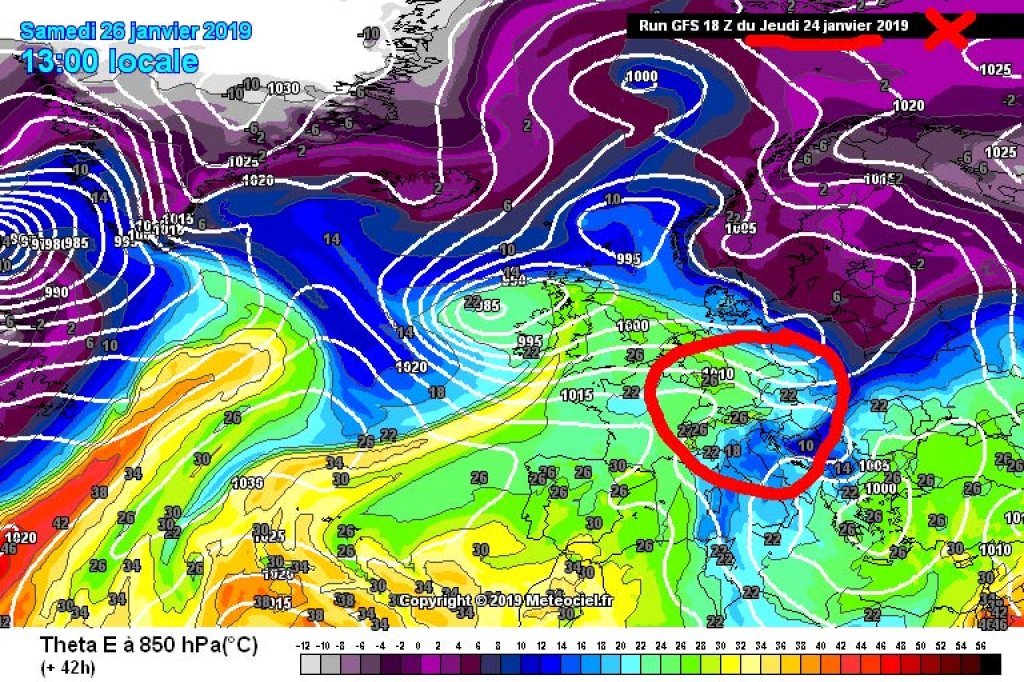
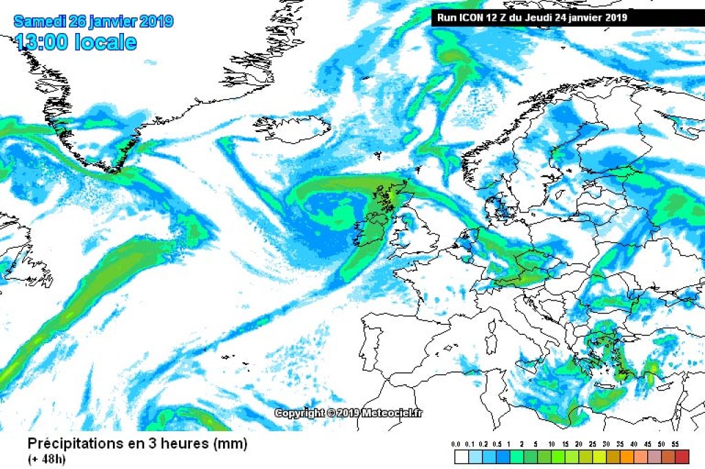
The weather in Europe is also more or less directly linked to the polar vortex in eastern Canada. This ensures that cold air constantly reaches the northwest Atlantic and promotes the development of low pressure there. New Atlantic lows are constantly moving along the westerly drift towards Europe and preventing the Azores High from spreading northwards - hence the changeable, Atlantic-influenced weather character of the last few days.

WeatherBlogs
presented by

High pressure in the east vs. Atlantic lows

What the Azores High is currently failing to do, the continental high in the east is increasingly succeeding in doing. It is increasingly becoming a blockade for the Atlantic disturbances, causing them to slide southwards over western Europe and - as can be seen in the last PowderAlert - bring snow to the western Alps before picking up speed again in the Mediterranean.

Today, Wednesday, a minor disturbance will complete the aforementioned route and bring clouds and moderate snowfall to the Alpine region. In the eastern Alps, it will remain friendly and dry for longer. Significant fresh snow will probably only occur relatively far in the southwest and even there it will probably remain below alarm levels. On Thursday, there will be a brief period of high pressure before the next disturbance moves into the Mediterranean. In the west, it is likely to become cloudy again in the afternoon, while it will remain fairly friendly in the east until the evening. On the southern side of the Alps, snowfall will set in from west to east and is likely to intensify everywhere on Friday. We can look forward to a report from the oracle. As usual, congestion in the south means Föhn in the north, with the precipitation making it relatively far north thanks to the strong flow. At the weekend, the snowfall will decrease from west to east.

User question: Forecast uncertainty

PG - User skimale7892 stated last week: "On Friday, the alpine weather forecast suddenly announced that tomorrow (Sat) a (warm?) front embedded in the generally low-precipitation weather situation will reach us and bring significant fresh snow. There was no mention of this front the day before yesterday (Wednesday) and no model/weatherman had it on the screen."

To get to the bottom of this, the WeatherBlog has collected a series of forecast maps for Saturday, January 26, 13:00 in the image gallery below, namely the 18:00 model run from the previous Wednesday (January 23) and Thursday (January 24). In the 500hPa geopotential maps - which give a good overview of the general weather situation - you have to look pretty closely to see a difference between Wednesday's and Thursday's run. Similarly in the comparison of the Theta E maps, where you can clearly see the fronts.

Foehn clouds in the Alaska Range

Foehn clouds in the Alaska Range

LH
FC

The small, but in this case significant difference lies in the exact position of the marked cold-in-the-south and warm-in-the-north air mass boundary. In Wednesday's run, the cold air associated with the low in the southern Mediterranean was assumed to be slightly further north; in Thursday's run, it is slightly further south. According to the Wednesday run, the high in the west should have extended a little further east towards western Switzerland, while the Thursday run recognized a slightly smaller "bulge" in this direction. This changes the direction of flow only slightly, but enough to change the weather character in the area of the air mass boundary from "cool and dry" to "warmer and humid".

The precipitation resulting from this constellation of high-low-warm-cold was therefore already on the weather forecasters' radar on Wednesday and that of the models anyway, it was just expected a little further north. In the GFS model, "a little further" was roughly estimated from the maps at 300-400km, while in the DWD's ICON it was only 100-200km. Especially in combination with the complex topography of the Alps (precipitation may be intensified by the sliding of warm air onto cold inversions in the valleys and congestion effects), 100 km either way can make a considerable difference to the local and regional weather, as was the case last Saturday. However, depending on the weather situation, 100 km back and forth with rather small-scale air mass boundaries are simply at the limit of what weather models can reliably see 3 days in advance.

Photo gallery

This article has been automatically translated by DeepL with subsequent editing. If you notice any spelling or grammatical errors or if the translation has lost its meaning, please write an e-mail to the editors.

Show original (German)

Related articles

Comments

WeatherBlogs
presented by