Skip to content

Cookies 🍪

This site uses cookies that need consent.

Learn more

Zur Powderguide-Startseite Zur Powderguide-Startseite

Language selection

Search PowderGuide

TouringTips

Short Ötztal ski crossing | Three days of rustic huts, good snow and many kilometres of downhill skiing

Ski crossing from Obergurgl via two huts to Vent

by Benjamin Kraft 04/25/2022
Out and about on the Gurgler Ferner

On the way on the Gurgler Ferner

Benjamin Kraft
Ötztal Alps
What do you do when winter doesn't really want to start, there is little fresh snow and the temperatures are actually too warm? Exactly, you take various Alpine Club maps, two good friends and other literature (e.g. Panico Ski Touring Guide Ötztal Alps) to start planning for spring at the end of December. Seeing something new again and experiencing nature in a different way was the aim of our short Ötztal ski crossing, which we undertook from 10. April to 13. April 2022.

Of course, you could also extend the whole thing to the Ötztal Tour, but due to the uncertain weather forecast and the more beautiful parts in terms of skiing, we focussed on the eastern part of the Ötztal.

After booking huts early (at the end of January) - which is highly recommended due to the crowds - we were looking forward to our little ski crossing at the beginning of April; however, a glance at the weather forecast diminished our motivation somewhat. "Never mind", we said to ourselves when only two hours of sunshine were forecast for the day (10th of April 2022). The next day should at least be nice.

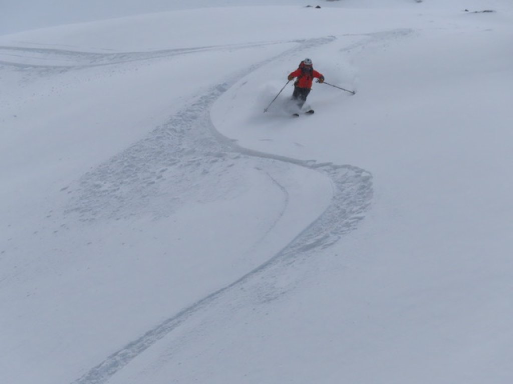
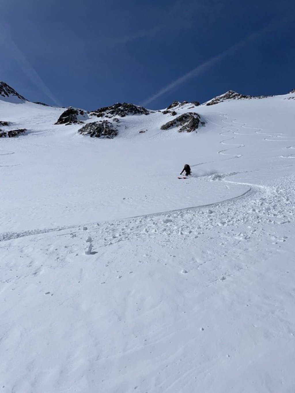
Day 1: Relaxed start with a sick descent

And so we set off from Innsbruck at around 7.30 am and arrive in Obergurgl at around 9.00 am. We park the car at the last public car park near the parish church and pay €8 per day, which is reasonable considering the horrendous prices in the multi-story car park (€16 per day).

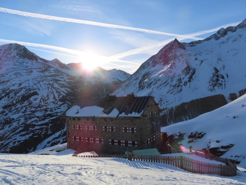
We set off across the empty pistes towards Schönwieshütte and, in view of the stationary gondolas and the lack of ski crowds on the pistes, we wonder whether it really is already the Easter holidays in various German states. The route to the Schönwieshütte is quite entertaining and only takes about an hour (350 metres in altitude, 3 km) despite our heavy luggage. There are now two options for the rest of the route to the Langtalereckhütte, our destination for today. Either directly on the tracked path to the hut (an additional 200 metres and 3 km) or climb one of the peaks that border the Rotmoostal valley to the west and ski down to the hut from above.

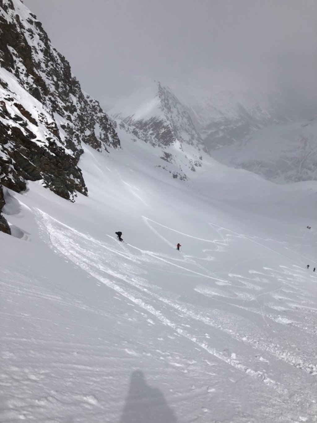
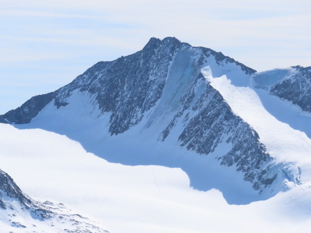
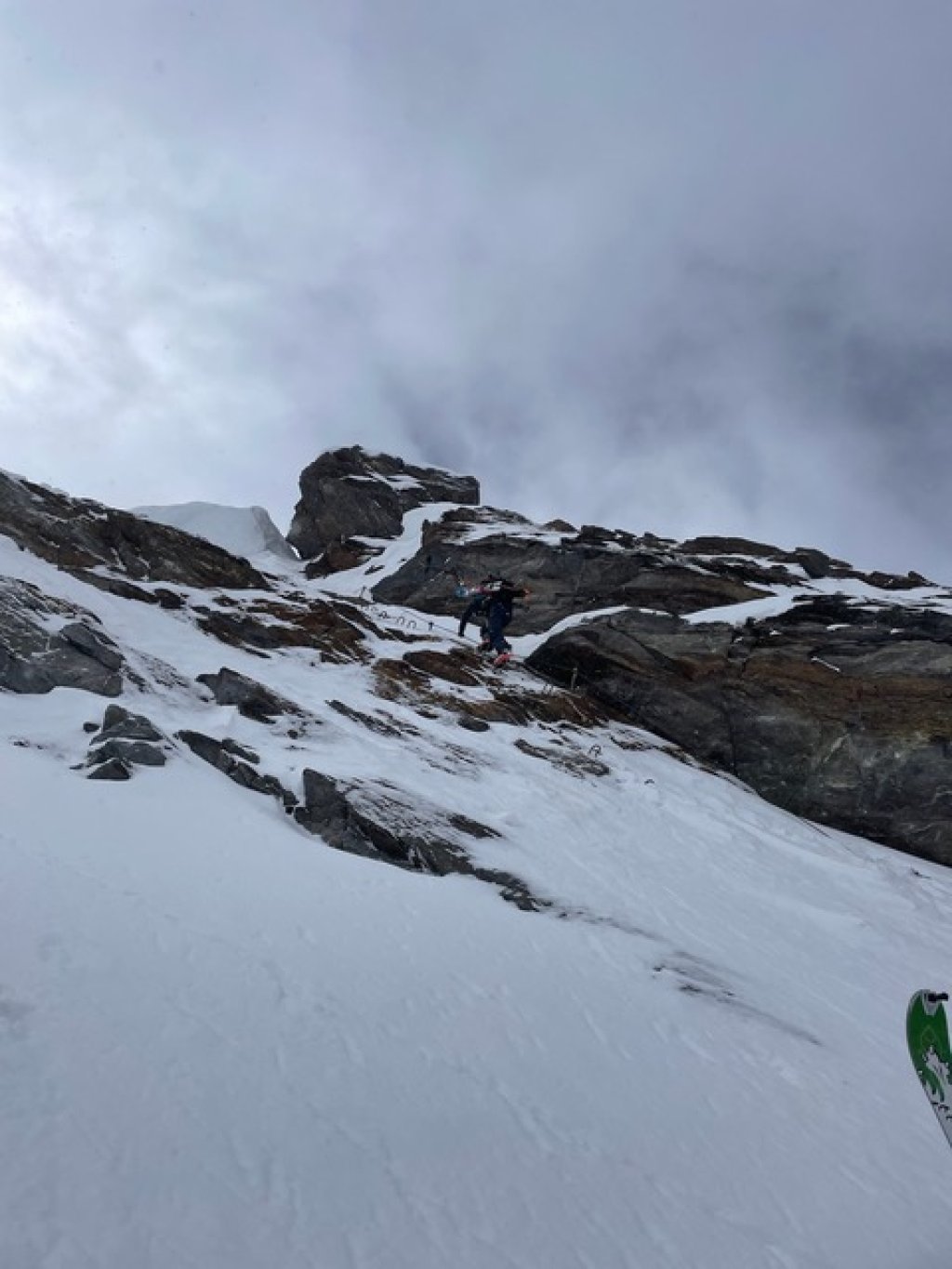
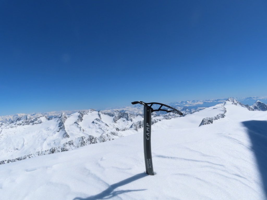
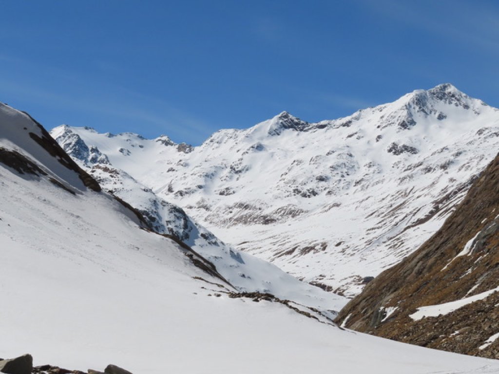
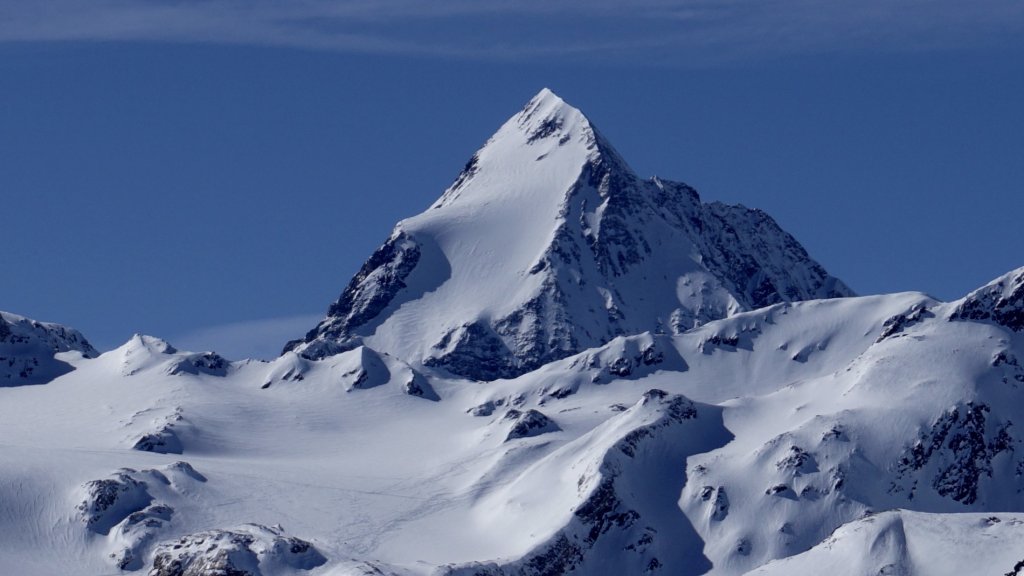
We decide in favour of the second option due to the improving weather situation and because we are not in a hurry. Our interim destination is the 3,228 metre-high Eiskögele, one of the first peaks in the Rotmoostal valley.

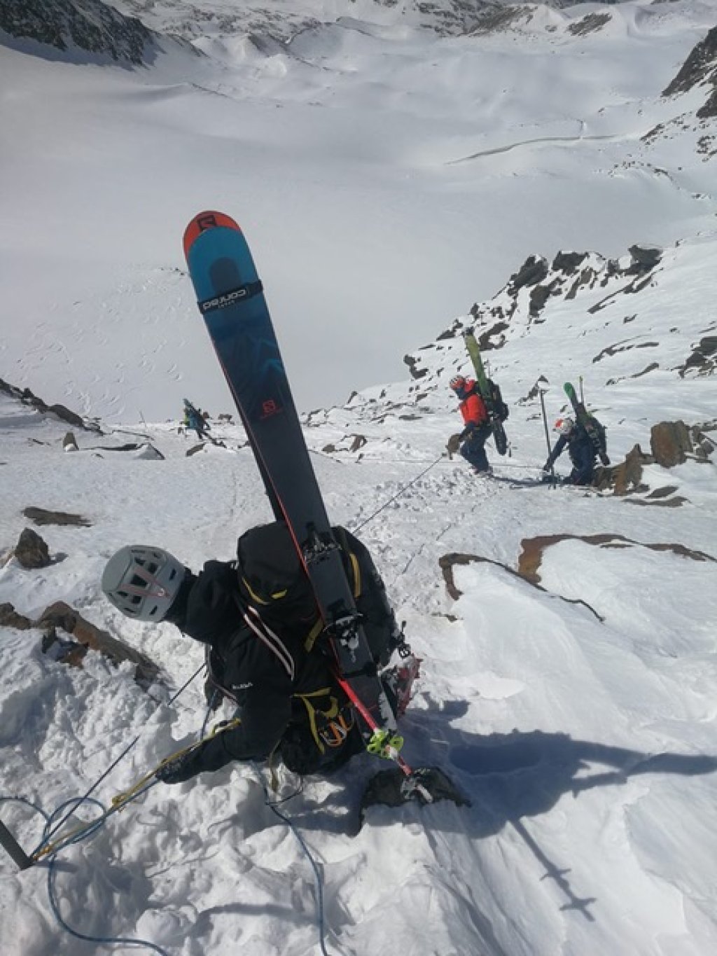
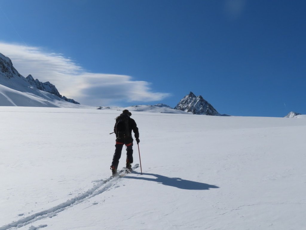
We walk approx. 1 km into the Rotmoostal valley and reach flatter terrain via a short steep ascent (approx. 200 m). We follow the already established trail up to an altitude of approx. 2,800 metres. Here we can decide again whether to continue in the direction of Eiskögele or head south round a rocky outcrop and climb up to the front Seelenkogel. The terrain in the direction of Eiskögele looks easy to walk on and we decide to stick to our original plan. The snow here still looks very powdery and unbound and we wonder whether this will also be the case in the Hochebenkar exposed to the west (our descent route to the Langtalereckhütte).

TouringTips
presented by

Via the last remnants of the Hangererferner glacier on the orographic left-hand side, we reach a saddle below at around 3,100 metres. With little snow, the ascent to the saddle is the key section of the tour, as a short but exposed and steep climbing section has to be mastered with skis on the back. We are lucky and can use the steel cable and the attached steps, but the ascent to the saddle is still not easy. If there is a lot of snow, you may be able to trudge up a little further lookers left through a small narrowing.

Once we reach the saddle, we treat ourselves to a short break in the sun. As we've only been travelling for 3.5 hours from the car, we want to make it to the summit. However, when we see how many other people are struggling on the summit ridge due to the gritty snow and lack of tracks, we decide to take advantage of the snow in the Hochebenkar, which looks good from above, and ski straight down to the Langtalereckhütte.

Good decision, because we come across other tracks, an ascent track and signposts that confirm the route to the Langtalereckhütte. After a 30-minute descent, which has almost every conceivable snow condition with powder, firn and broken snow, the beautifully situated Langtalereckhütte appears out of nowhere behind a flat section.

For the ascent, we stay on the right-hand side of the cirque as seen from the saddle and find some good, wind-free but slightly settled powder snow here. It is also possible to ski down the left-hand side of the cirque, but this part is somewhat flatter. After a good 300 metres of climbing, the terrain recedes and it becomes confusing. We see old tracks, but they keep crossing northwards. A quick look at the map is enough and we unanimously decide to find our own way. The Langtalereckhütte should actually be pretty much in the fall line of the centre of the Hochebenkar, so we cross back in a southerly direction and safely make it to the hut.

An overnight stay here is highly recommended, as the hut offers beautiful terrain, is rustic and also offers excellent food.

Summary day 1:

  • Trail: Obergurgl - Schönwieshütte - Eiskögele - Langtalereckhütte

  • Altitude metres: approx. 1,300 m uphill and 800 m downhill

  • Trail distance on the ascent: 6 km

  • Planned time to the summit: 4.5 hours

Night view from the Langtalereckhütte in the direction of Schalfkogel

Night-time view from the Langtalereckhütte towards the Schalfkogel

Christian Kraft
Ötztal Alps

Day 2: Imposing glacier world

In view of the not-too-warm temperatures on day 2 and the good weather, we decide to set the alarm for 6.30 am. However, we are all awake by 5.30am at the latest, as the Langtalereckhütte can be very noisy. As we asked the hut owner the evening before, the path through the Gurgler Schlucht gorge is currently not very problematic, but there are one or two water holes that need to be negotiated. Over a cosy breakfast, we learn that a group of 10 people with a mountain guide are attempting the same route, so our first goal for the day is to stay ahead of this group.

At 7.30 am we are refreshed and ready for the 200 metre descent from the hut into the gorge. We arrive just in time, because a second large group, initially travelling the same route (this group probably climbed the Hochwilde via the Gurgler Ferner), is carrying out an avalanche transceiver check. The descent on the hard surface goes off without a hitch and after a short skinning up we are ready for the route through the gorge. After just five minutes, we reach the first waterhole, which can be overcome quite easily with a little teamwork. We continue on and realise once again why we want to stay ahead of the large groups: Almost 15 people are queuing at the waterhole while the mountain guide secures his group across the narrow passage. A little stress in the morning is sometimes worth it!

The gorge is impressive and makes the path to Gurgler Ferner an entertaining and quick pleasure. After just under 1.5 hours from the hut, we arrive at the former glacier gate, which unfortunately no longer deserves its name. The first discussion of the day centres on two topics in view of what feels like 15 degrees plus in the shade: Is the SPF 30 sun cream enough? Should we put on the harness now or later?

We decide to apply the 50 sun cream and put on the harness straight away, but continue without being roped in. This will make rescue much easier in an emergency. The Gurgler Ferner is well snow-covered and has been travelled frequently, so we trust the track that has been made. We follow the Gurgler Ferner southwards until we reach a steep step (along the old summer path, which is now closed due to falling rocks) at around 2,800 metres on the western side. We quickly overcome this steep step with many kickturns and short stomping passages and are glad to arrive at the flatter part of the Kleinleitenferner. Slipping in the steep section would be fatal, as you would fall over quite high rocks onto the Gurgler Ferner. In two wide turns (first to the right, then to the left), the route continues relaxed on the Kleinleitenferner towards the Schalfkogeljoch (3,373 m, approx. 4.5 hours from the Langtalereckhütte). Both the Kleinleitenspitze (3,445 m) and the Schalfkogel (3,540 m) can be climbed from the mountain pass, whereby the Schalfkogel can be reached via its south ridge on easy scrambles when there is little snow. The panorama from the summit is overwhelming and offers a perfect view of some well-known mountains (Wildspitze, Hintere Schwärze, Ortler, Königsspitze, Zuckerhütl, Schrankogel and many more).

Continue on the next page -->

However, we don't linger too long at the summit, as we still want to get to the Martin-Busch-Hütte and know that we still have the ascent to the hut ahead of us. From the Schalfkogeljoch we head down the west side of the Schalfferner. The first hundred metres are secured with iron poles and we descend quickly in a combination of lowering, climbing down and abseiling to the terrain that can be skied again. The descent over the Schalfferner is spectacular and firny to powdery in the upper section, but the lower section quickly becomes arduous due to the rotten snow. It is important that you always keep riders left in order to really get to the bottom of the valley, as the south-facing slopes quickly snow out and descending here is unpleasant. We ski down to the Schalfbach (a short 10 metre carry) and follow it to the junction with the Nedertal. Looking back down into the valley, it is unimaginable to us that in 1925 the Schalfferner still flowed as far as the end of the valley and that 20 years earlier there was still a continuous connection with the Marzellferner, so that the Martin-Busch-Hütte could be reached almost without a counter-climb ...

Back in the present, it's now time to put on your skins for the 200 metre ascent to the Martin-Busch-Hütte, probably the most mentally and physically demanding part of this day. The moment when you see the hut for the first time after the kickturns is particularly demotivating, as there is no direct connection to it, so you first have to walk a good distance southwards to the bridge. We arrive at the hut, exhausted but happy and, above all, just in time for the afternoon beer.

Compared to the Langtalereckhütte, the Langtalereckhütte has more modern facilities and a fantastic view of the Mutmalspitze hanging glacier, but in terms of food, we liked the Langtalereckhütte a little better. Nevertheless, you can definitely get seconds at both huts (just ask).

Summary day 2:

  • Trail: Langtalereckhütte - Gurgler gorge - Schalfkogeljoch - Schalfkogel - descent into the Nedertal valley - Martin-Busch-Hütte

  • Altitude metres: approx. 1,500 m uphill and 1,400 m downhill

  • Trail distance on the ascent: 8 km

  • Planned time to the summit: 5 hours

TouringTips
presented by

Day 3: Good snow, cosy hut and dream weather

On the evening of the second day, we sit in the parlour of the Martin-Busch-Hütte and discuss what we should do tomorrow before returning to everyday life. There are various suggestions in the room and on the map, including Mutmalspitze, Hintere Schwärze and Similaun. These are all beautiful mountains, but in the current conditions, only the Mutmalspitze Firnrinne is an option in terms of skiing. However, as we don't fancy the ascent back to the hut, we decide in favour of the Hauslabkogel with its imposing northern slopes. Although the summit is "only" 3,403 metres, lower than the surrounding peaks, it offers a lot in terms of skiing and views. Not only can we take the route we have chosen back to the hut via the Sayferner, but we can also take a descent to the west (a short but easy climb from the summit) to the Hochjochhospiz.

As the tour is short, we start from the hut at around 7.30 a.m. and quickly cover the 2 km into the flat valley along the Niederjochbach stream. Now we head west along the snow-covered trench of the Saybach up to the Sayferner. At the top, there are various possibilities to ski small gullies or to climb up one or other nameless mountain pass. We decide in favour of the summit and after a few kickturns and a total of 2.5 hours from the hut, we reach the summit. The snow looks good on the ascent on the orographic right side of the Sayferner, but slightly wind-pressed, so we want to try a descent via the orographic left and untracked part of the glacier (there are also fewer crevasses here, if the satellite images and AV maps are to be believed). The snow is good, powdery at the top and firny at the bottom, so that we get back to the flat valley floor without coming into contact with rocks and little effort. If you cross high enough now, you can carry enough momentum all the way to the hut so that further skinning is no longer necessary.

After a good descent, we are already sitting on the hut’s terrace at 11.00 a.m. in the most beautiful sunshine and are happy about three successful days with great weather and fantastic experiences. We share a Tyrolian Dumpling Duo with Sauerkraut and a Kaiserschmarrn (both highly recommended) and enjoy the beautiful day with a beer.

But there are still two drops of bitterness. One, the completely bare north face of the Hintere Schwärze, which we actually wanted to climb this spring, and second, the impressive glacier shrinkage and the certainty that we will probably be the last generation to have the privilege of touring the glaciers of the Eastern Alps.

The rest of the descent to Vent leads along the forest path and is quickly mastered (with a few carrying sections). In the morning, however, there is a risk of falling on the hard snow surface and you should be very careful.

We take the bus from Vent back to Obergurgl, where three cold beers are already waiting for us in the car.

All in all, a successful little crossing of the Ötztal Alps with wonderful views, good snow and fine weather that you should have done.

Summary day 3:

  • Trail: Martin-Busch-Hütte - Hauslabkogel - Martin-Busch-Hütte - Vent

  • Altitude metres: approx. 900 m uphill and 1,700 m downhill

  • Trail distance on the ascent: 4.5 km

  • Planned time to the summit: 3 hours

Good snow quality in places

Good snow quality in places

Benjamin Kraft
Ötztal Alps

A few tips and tricks for the tour

  • Bringing glacier equipment, crampons and ice axe is obligatory for the tour and also opens up many other descent and ascent options

  • The Martin-Busch-Hütte offers great terrain in spring, so if you want to stay here longer, you will easily find tours for a whole week. According to the hut landlord, Tuesday and Wednesday are the quietest days at the hut and it is also possible to get a place spontaneously.

  • You should expect to pay around €50 - €60 per day for a place to sleep and half board, plus drinks and other food. We would also like to take this opportunity to thank the Alpine Club Youth for supporting us financially! This is a really worthwhile and cool initiative for people under 30 who plan and organise their own alpine tours. So definitely check it out.

  • The time frames we give are usually very generous, as a rule we were a little quicker

  • The huts should also be booked early, as there is a lot of ski touring traffic on some sections due to the Venter Runde

  • Ohropax ensure a good night's sleep

  • Travelling to Obergurgl by public transport is easy and it is a good idea to leave the car in Zwieselstein, for example. If you get on the bus in Vent on the way back, you can save yourself the 20-minute bus journey from Zwieselstein to Obergurgl

  • Sun cream with SPF 50+ is definitely advisable. A little tip on the side: applying sun cream to your thighs is essential on a skiing tour (probably the worst sunburn I've ever had)

  • The Alpine Club maps AV 30/1 Gurgl and AV 30/2 Weißkugel actually contain a lot of the information you need for planning. We also used Google Earth and Fatmap for planning

  • A Fatmap plan of our tour is available here

Photo gallery

This article has been automatically translated by DeepL with subsequent editing. If you notice any spelling or grammatical errors or if the translation has lost its meaning, please write an e-mail to the editors.

Show original (German)

Related articles

Comments

TouringTips
presented by