Skip to content

Cookies 🍪

This site uses cookies that need consent.

Learn more

Zur Powderguide-Startseite Zur Powderguide-Startseite

Language selection

Search PowderGuide

SnowFlurry

SnowFlurry 18 2019/20 | The types of spring - Part 1

Classic and non-classic spring situation

by Lukas Ruetz 03/28/2020
Avalanche warning products often only refer to the "classic spring situation". But what are the "non-classical" spring situations? There are three of them, which we will discuss in more detail in the next SnowFlurry. But to start with, let's look at the most common of the four different snow cover scenarios in spring.

Classic spring situation: Daily melt-freeze cycles

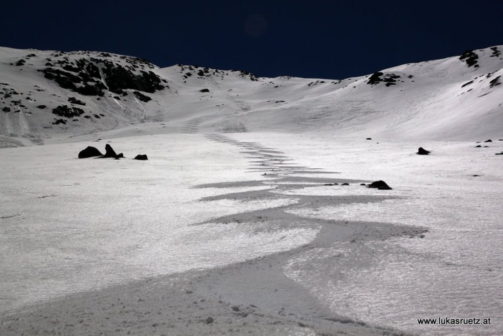
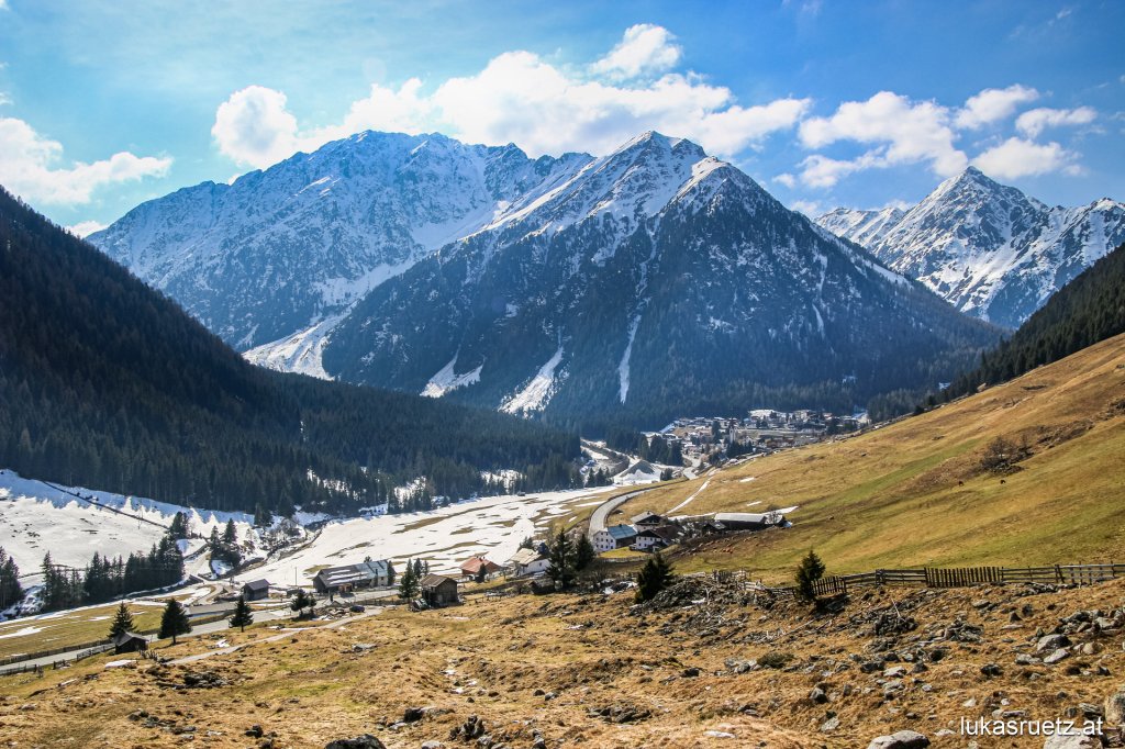
We often read about this, and it is by far the most common snow situation in spring. In terms of snow cover, spring in the Alps begins as early as February in the lower regions in the Randalpine area. In the high Alps, a high winter situation can always prevail until May - provided the weather conditions are right - and the first soaking of the snow cover only takes place then! We only talk about spring in combination with the snow cover when it becomes deeply soaked for the first time.

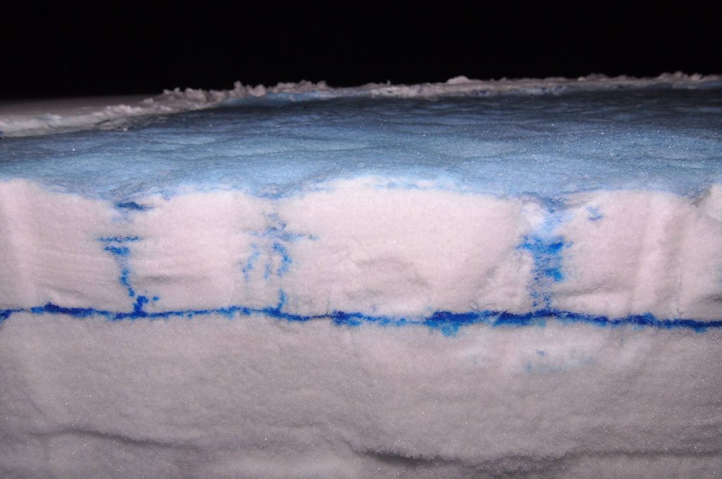
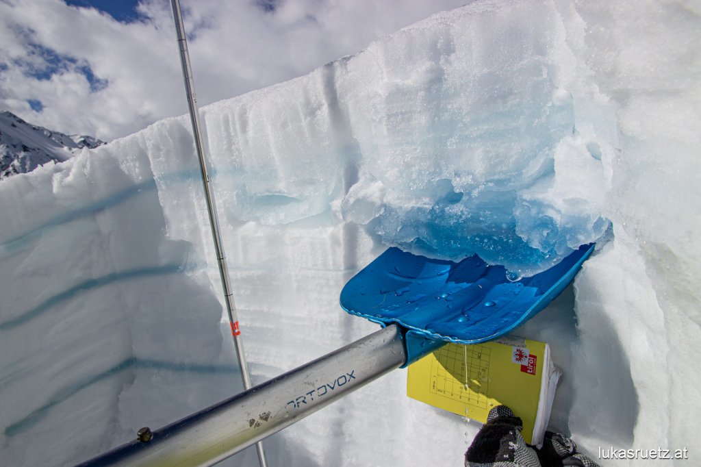
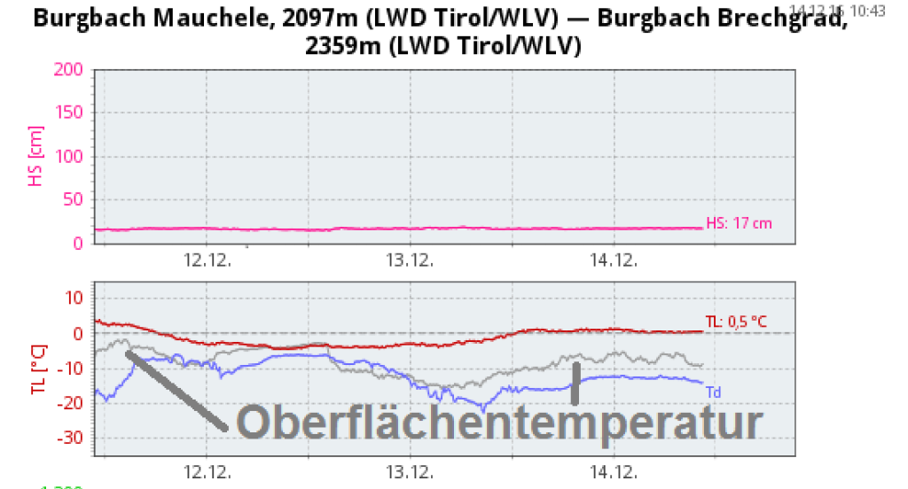
In the classic spring situation, the snow surface softens ("firns up") during the day and freezes back together at night to form a snow cover. This can be thick and stable, but it can also be thin and crumbly - depending on the exact temperature, humidity and cloud cover. However, the thickness of the snow cover also depends on the depth of moisture in the snow cover. If the snow cover is only a few centimetres moist on the surface and still dry underneath, then only the uppermost centimetres can freeze to form a hardpack.

It doesn't matter whether the snow cover is already completely soaked/soaked or whether the uppermost layers have only become moist - both are referred to as the "classic spring situation" as long as there is a daily change between the formation of hardpack on the surface and thawing during the day. Because this cycle is what this snow cover scenario is all about.

SnowFlurry
presented by

With the daily soaking, the risk of avalanches increases during the course of the day. This is because the snow cover on the surface massively stabilizes the snowpack. There is usually even a low danger level 1 in the morning and this changes to danger level 2 or 3 or even 4 in the course of the morning. So within 24 hours, there is a time range day after day where it is "super dangerous" and on the other side it is basically almost foolproof.

With deeper soaking, the avalanche danger generally increases more during the course of the day than with less deep soaking of the snowpack.

The extent of the increase in danger still depends on several factors:

  • What does the structure of the old snowpack look like? Old weak layers, i.e. former old snow problems that have usually already resolved themselves, usually become extremely active again when the first moisture penetrates and lead to strong, spontaneous avalanche activity. The meltwater weakens the bonds between the crystals, which are actually quite well sintered again in a dry state.

  • Does the snowpack still have a temperature reserve? Before snow melts, the incoming energy must be used to warm it from, for example, -7°C to 0°C.

  • How deeply has the snow cover already been soaked? The first soaking is usually the most critical. Precisely because old weak layers are still present and are weakened.

  • How strong is the soaking? The wetter the snow gets, the more unstable it becomes. At least in the first few weeks of spring.

  • How long has it been since the snow cover was first soaked and how much snow has melted since then? After a certain point, snow no longer becomes "wetter" and more unstable, but starts to solidify again as the density increases again. Compact summer snow forms. This is the first stage from winter snow cover to perennial firn and possibly later to glacier ice. Then the avalanche danger decreases again significantly until it approaches zero again despite the soaked snow cover. However, this is a period of several weeks and therefore usually only an issue in May or June.

  • How strong is the diurnal warming? How strong is the sun (e.g. big differences between February and May)? How thick is the snow cover from the night and how long does it take to completely soak through again? Is it only very thin, hardly load-bearing and does it soften completely with the first rays of sunshine? Or is it 10 or more centimetres thick, very cold on the surface and takes until late afternoon to soak through again?

Based on these considerations, the avalanche warning team then determines the extent of the increase in danger over the course of the day. Does the avalanche danger increase only very slightly and only later in the day, or very slightly and quite early after sunrise? Or does it increase significantly over the course of the day or continuously until sunset? Or even quite markedly shortly after the first rays of sun touch the snow cover?

The management of avalanche danger for winter sports enthusiasts is then (as almost always) based on altitude and exposure. But above all, not just on a local basis, but on a time basis. Start early, be home early. Then you can usually enjoy the best buttery firn, eat a second breakfast at home and go for a swim in the afternoon.

In the classic spring situation, there is a more or less pronounced increase in avalanche danger throughout the day. Good time management is everything!

This article has been automatically translated by DeepL with subsequent editing. If you notice any spelling or grammatical errors or if the translation has lost its meaning, please write an e-mail to the editors.

Show original (German)

Related articles

Comments

SnowFlurry
presented by