Skip to content

Cookies 🍪

This site uses cookies that need consent.

Learn more

Zur Powderguide-Startseite Zur Powderguide-Startseite

Language selection

Search PowderGuide

PowderAlerts

PowderAlert No. 14 2015 | Südstau Alaaf!

A big load of carnival powder on the thick blanket of snow in many places in the Southern Alps

by Lars Oelmann 02/12/2015
The last alarm for a while, Ullr thinks, and sends us the next pack of Pow in the Alps, just in time for the carnival vacations. Ullr seems to have a soft spot for carnival fans and sends snow to the south and southwest. And in all likelihood, there will be a lot of it by Tuesday. This alert is only valid until Sunday, but I'll try to give you an idea of the total amounts.

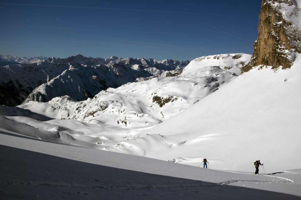
As things stand today (13.2.2015), the areas from the GranParadiso and the MonteRosa to the Dolomites in the east are particularly affected. But the Lake Alps and the areas from the Hautes Alpes in the southwest of France are also likely to receive supplies.

Now the great thing about this dump: In the south, the whole thing falls with relatively little wind on a fairly stable old snow cover, but unfortunately not everywhere, because in France the old snow is problematic, but here Ullr doesn't dump that much either. And the best thing is that it comes down as snow a long way. In the west and the Maritime Alps as well as some of the southern foothills of the Alps, it can sometimes rain up to 1000-1200 m, but in the main precipitation areas it snows up to 600-700 m or even down into the valleys.

The total amounts are difficult to predict: but overall, there should be more than a meter of fresh snow from the eastern Aosta Valley to the Adamello in the Dolomites by Tuesday. In the core zone around the MonteRosa even up to 150 cm of fresh snow. However, this is only a total amount estimate and the snow depth increases are more likely to be around 70 to 100 cm due to the distribution over four days, as the fresh snow can constantly settle. Here are the amounts up to Sunday, which can be given with greater accuracy: Southwest France 20 to 40 cm. From the Aosta Valley via Monte Rosa and the Adamello area to the Dolomites 40 to 70 cm. There may be 80 to 90 cm in one or two of the reservoirs, but the meter will certainly not be full by Sunday.

What should we do? Put on our Viking costumes and head into the trees to pay homage to Ullr. Four times Treesking-Powder-Alaaf, because it probably won't open up in the south before Tuesday. Whether it might do so will be revealed in the new alarm. On Sunday. From Wednesday onwards, there will be the finest bluebird weather and you can let off steam in the new powder in the south on a lush base, if the avalanche situation plays along. The weather will then remain very skiable until the weekend and there will probably be no wind, so you can still find powder on the north side.

So get in the car and ski some really jolly südstau powder. Until the next alarm on Sunday.

Powder to the people!

Your oracle

Photo gallery

This article has been automatically translated by DeepL with subsequent editing. If you notice any spelling or grammatical errors or if the translation has lost its meaning, please write an e-mail to the editors.

Show original (German)

Related articles

Comments