Skip to content

Cookies 🍪

This site uses cookies that need consent.

Learn more

Zur Powderguide-Startseite Zur Powderguide-Startseite

Language selection

Search PowderGuide

WeatherBlogs

WeatherBlog 8 2022/23 | Winter is back!

Still changeable, snow again and again

by Lea Hartl 01/11/2023
After a long break, the PowderOracle has brought us good news. Maybe there will even be another alarm at the weekend? Thanks to a strong north-westerly current, the next few days will be pretty wintry and at least the north will gradually get a base layer in mid-altitudes too! Also: New glacier study with predictably bad news for the ice in the Alps.

Current situation and outlook

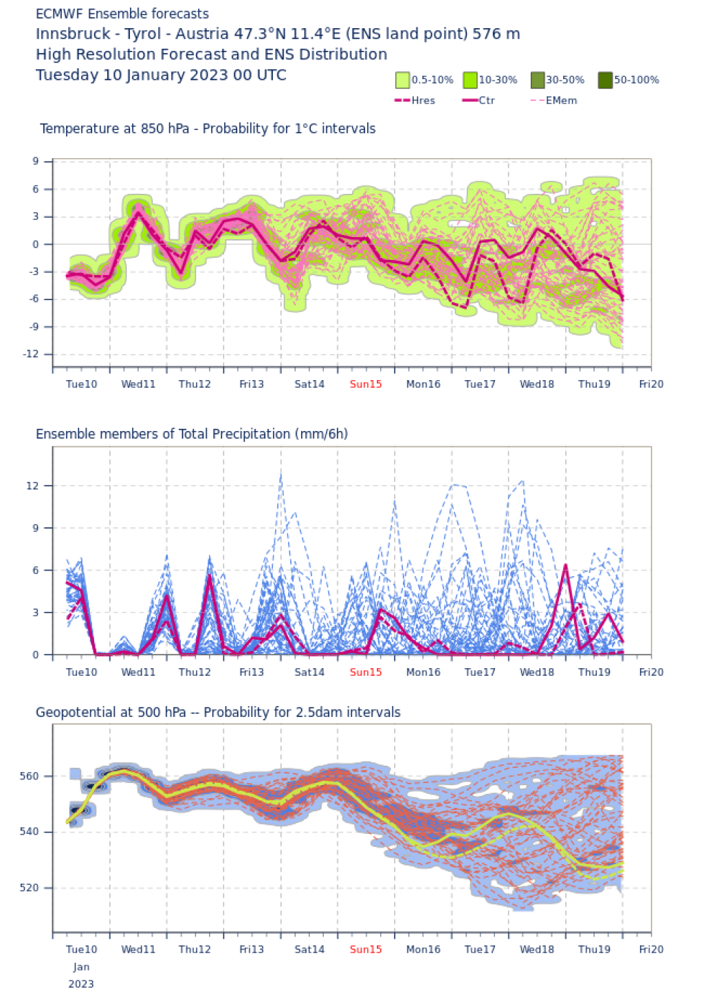
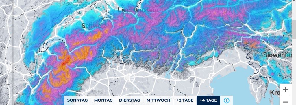
All good and all good! Low pressure over the Atlantic is spilling over to us again and again these days. The fontal zone is far enough south. The Atlantic disturbances are hitting the Alps with a series of fronts and temperatures are finally back to a reasonably wintry level. At least at high and medium altitudes, precipitation will fall as snow. Away from the artificial snow, there is often still no base to really make use of the fresh snow, but what is not, can still be!

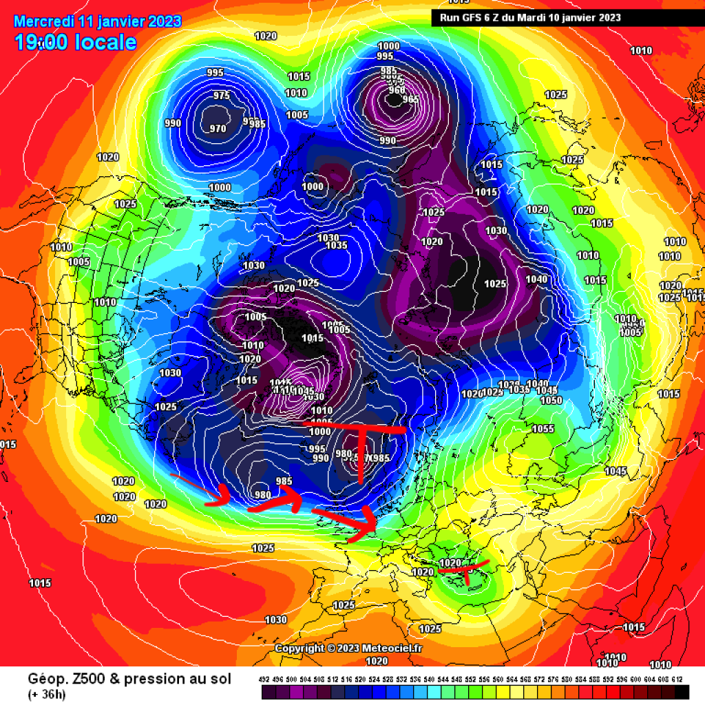
Today's Wednesday (11.1.23) will start warm and mostly sunny with a brief intermittent high influence, but the next cold front is already on its way. In the afternoon, it will move in from the northwest (earlier in the western Alps than in the east) and it will start to snow with relatively stormy winds. The temperatures, which are still quite high at first, will drop quickly and snow is likely to fall up to around 1000m. In the north there will be a lot of snow, in the south it will only be cosmetic. Thursday will be similar. We'll probably just miss alarm levels here

.
WeatherBlogs
presented by

Friday is expected to remain rather cloudy. It will continue to snow a little in the (north-west) traffic jam before the weather briefly calms down a little on Saturday. On Sunday, the next front with snowfall will arrive - according to the current plan. With any luck, there will also be another PowderAlert! The forecast for next week also looks pleasantly wintry. The uncertainties are increasing as usual, but the signs are pointing to low pressure with interesting precipitation options and cool temperatures.

Study: Depending on emissions trends, up to >80% of all glaciers will disappear by 2100

A recent study published in Science (an important scientific journal) presents a new modeling of global mountain glaciers by 2100 under different temperature scenarios. If global temperatures rise by +1.5°C by 2100, around half of today's glaciers will disappear by the end of the century. With an extreme increase of +4°C, a good 80% of glaciers will be lost. If everyone sticks to their emissions reductions promised at COP26, we will be at +2.7°C by 2100.

This would result in the melting of almost all glaciers in mid-latitudes. As ice loss is more or less linearly related to the rise in temperature, any increase in temperature, however small, makes a noticeable difference to the future of glaciers. Here is a striking animation that uses the example of the Aletsch Glacier to show how a temperature rise of 1.5°C, as opposed to an extreme scenario, affects the ice. The key message in all of this: It's worth fighting for every tenth of a degree, and not just because of the glaciers.

A highly digestible video summary is available here:

Photo gallery

This article has been automatically translated by DeepL with subsequent editing. If you notice any spelling or grammatical errors or if the translation has lost its meaning, please write an e-mail to the editors.

Show original (German)

Related articles

Comments

WeatherBlogs
presented by