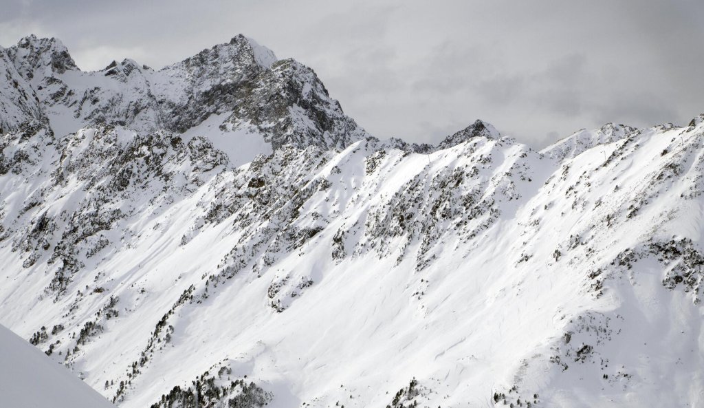
Both sides will have to continue to cope with the current situation. Central Europe lies in a slight SW flow between a low to the west of the British Isles and a high over North Africa. Anyone who thinks that the next dump is due in the south will be disappointed. Compared to the PowderAlert south, the current flow is much weaker and has a clear westerly component. In addition, the core of the low is positioned "wrong", i.e. too far to the north and west. This means there is no chance of tapping into warm, humid Mediterranean air. Minor disturbances here and there will bring high clouds, but no significant precipitation. On the mountains, the Föhn will make itself known with strong gusts, but even this will be far less extreme than last time. The wind may penetrate the valleys in places, but it is likely that the cold air lakes will not be cleared out everywhere and the high fog cover may persist in places.
WeatherBlog 5 2020/21 | Mild, windy, future uncertain
No snow in sight for the time being
Snow cannons on the Patscherkofel on Tuesday, 15.12.

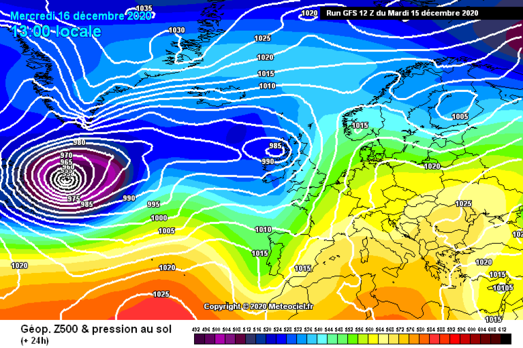
500hPa geopotential and surface pressure, Wednesday 16.12., GFS. Weak SW flow in the Alpine region, high pressure
.500hPa geopotential and surface pressure, Wednesday 16.12., GFS. Weak SW flow in the Alpine region, high pressure
.Ensemble forecasts
No exciting changes are expected until the weekend. After that, the predictions of the crystal ball are difficult to interpret. As the current situation doesn't offer that much, today we'll take a closer look at the nature of the much-cited crystal ball: Strictly speaking, it's - surprise! - It's not a crystal ball like the fortune teller around the corner, but an ensemble forecast. As the name suggests, there is not just one model run that shows us the most likely development, but many different ones. In other words, an ensemble. The model is run with many, slightly different variants and just as many, slightly different results are obtained, which together cover the potential expected development. The better the results match, the fewer uncertainties there are. If the results are widely scattered, the future is unclear or the picture in the crystal ball is blurred.
Ensemble forecasts reveal the two main sources of uncertainty in weather models: 1) We do not know 100% of the initial conditions with which we start the model, as we do not have accurate, up-to-date weather data for every point on earth and in the atmosphere. However, small differences in the initial conditions can sometimes have a big impact, especially for longer forecast periods. If you vary the initial conditions within the range of assumed values and feed several model runs with them, you can see how these deviations affect the forecast. 2) The model cannot represent reality perfectly. Some model parameters are too complicated to be calculated exactly in every model run. They are parameterized or otherwise estimated. This effect can also be taken into account in ensemble forecasts by slightly changing the relevant parameters in each run.
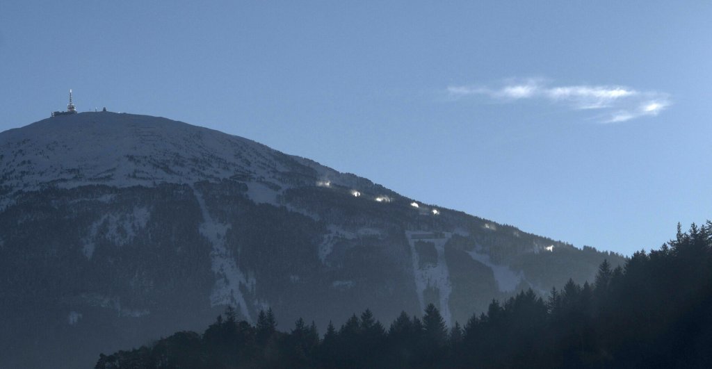
Snow cannons on the Patscherkofel on Tuesday, 15.12.
Snow cannons on the Patscherkofel on Tuesday, 15.12.
The image on the left shows an ECMWF ensemble forecast for Innsbruck from December 15 to 24. The top panel shows the temperature in 850 hPa, in the middle is the precipitation (6-hour total), at the bottom is the geopotential. The thick lines are the main run and the control run. The main run is a high-resolution run without changes to the initial conditions, as used for the normal weather forecast. The control run starts with the same initial conditions, but has a lower resolution, as do the ensemble runs. This saves computing time.
You can clearly see in all three plots that the uncertainties increase from Sunday/Monday: At the beginning, the thin dashed lines are quite close to each other. There is little change in our boring SW current. From about Sunday night, the lines diverge. There are warmer and cooler options, some with precipitation and some without. It does happen that the ensembles for forecasts agree much better in a week. The fact that they don't here shows how uncertain the development is.
The graphic comes directly from the ECMWF website. You can enter city names or coordinates to view your own location, set the start time and the display format. These images, as well as many others, have only been freely available for a few weeks. The ECMWF has taken a big, very valuable step towards open data and made many forecast products freely available that were previously reserved for weather services and other professional, paying users. Thank you for this, please keep it up and make the rest accessible too!
And to Ms. Holle, Ullr and anyone else who might be responsible: Please keep the snow coming!
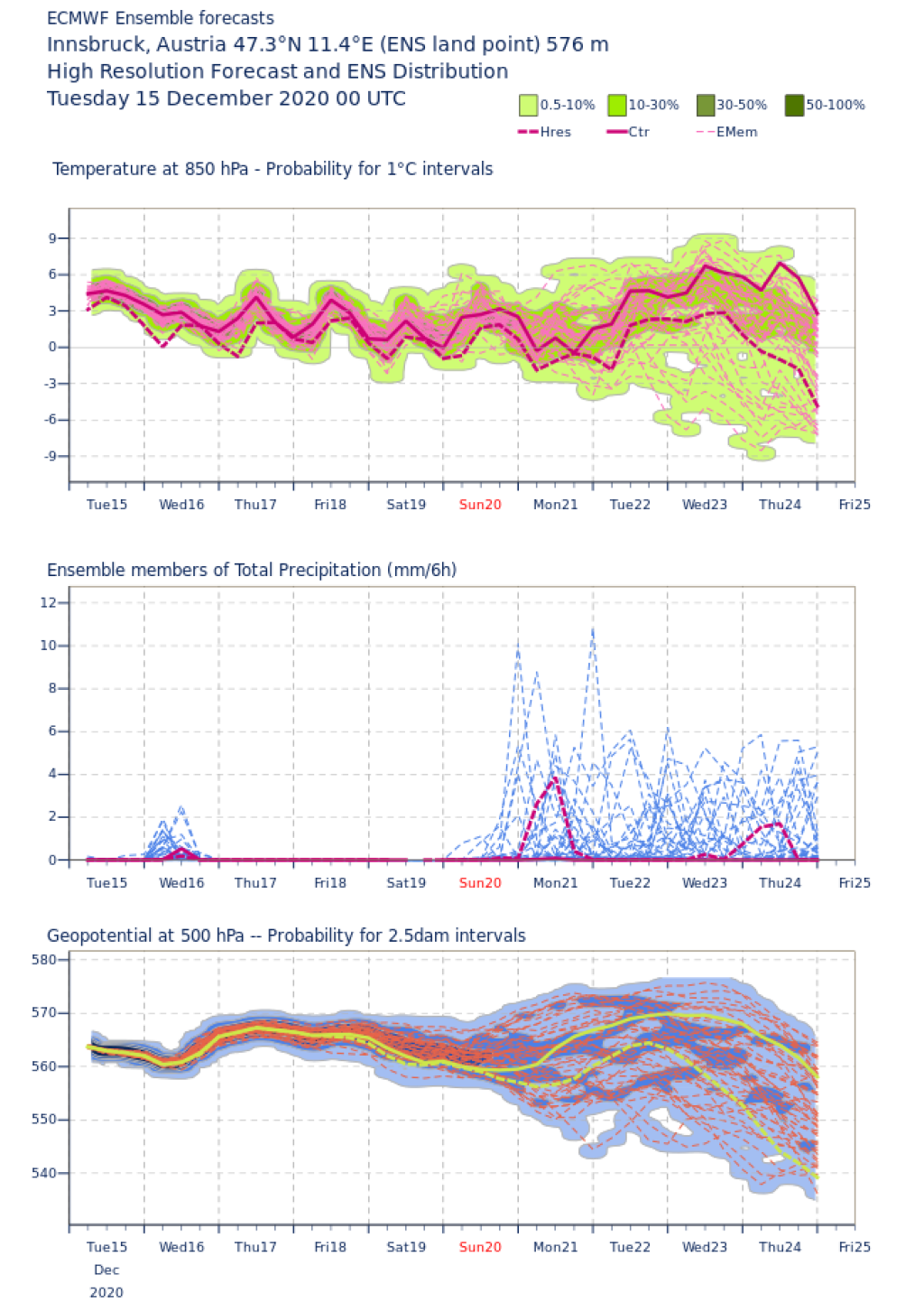
Ensemble forecast ECMWF for Innsbruck, Plume representation.
Ensemble forecast ECMWF for Innsbruck, Plume representation.
This article has been automatically translated by DeepL with subsequent editing. If you notice any spelling or grammatical errors or if the translation has lost its meaning, please write an e-mail to the editors.
Show original (German)Related articles
-
SnowFlurry 4 2020/21 | Low probability - High consequence
Lukas Ruetz • 12/12/2020Roughly speaking, there is now an accident-prone old snow problem in Tyrol, especially north of the Inn, as the weaker snowfall means that there is now a perfect slab above the weak layers. Further south, however, the weak layers have not disappeared, but there are far fewer places where slab avalanches can be triggered due to the thicker layers. -
WeatherBlog 4 2020/21 | südstau! Review & outlook
Lea Hartl • 12/09/2020The influence of low pressure will remain until the weekend. It will continue to flake here and there, but the extreme snowfall - more on this in the current alert - will come to an end. This is a good thing for the core areas of the southern congestion. -
SnowFlurry 3 2020/21 | Snow profile review
Lukas Ruetz • 12/05/2020Avalanche warning services, PowderAlert and WeatherBlog have intensively discussed the current situation regarding the intensive new snowfall in the south and the build-up of old snow cover. That's why we're devoting ourselves here to an exemplary snow profile from mid-November. How do you read it and how do you interpret it?
Comments
-
hTranslated from German.