Skip to content

Cookies 🍪

This site uses cookies that need consent.

Learn more

Zur Powderguide-Startseite Zur Powderguide-Startseite

Language selection

Search PowderGuide

WeatherBlogs

WeatherBlog 22 2018/19 | Unsettled and cool

Air mass boundary in the west, cool air from the northeast

by Lea Hartl 04/10/2019
Spring is progressing rapidly, but has to pause for breath: Cool air of polar origin is reaching the Alps from the north-east and it is getting fresh again with snowfall limits in some of the higher valleys. Maybe it's better to wait a few more days with the summer tires!

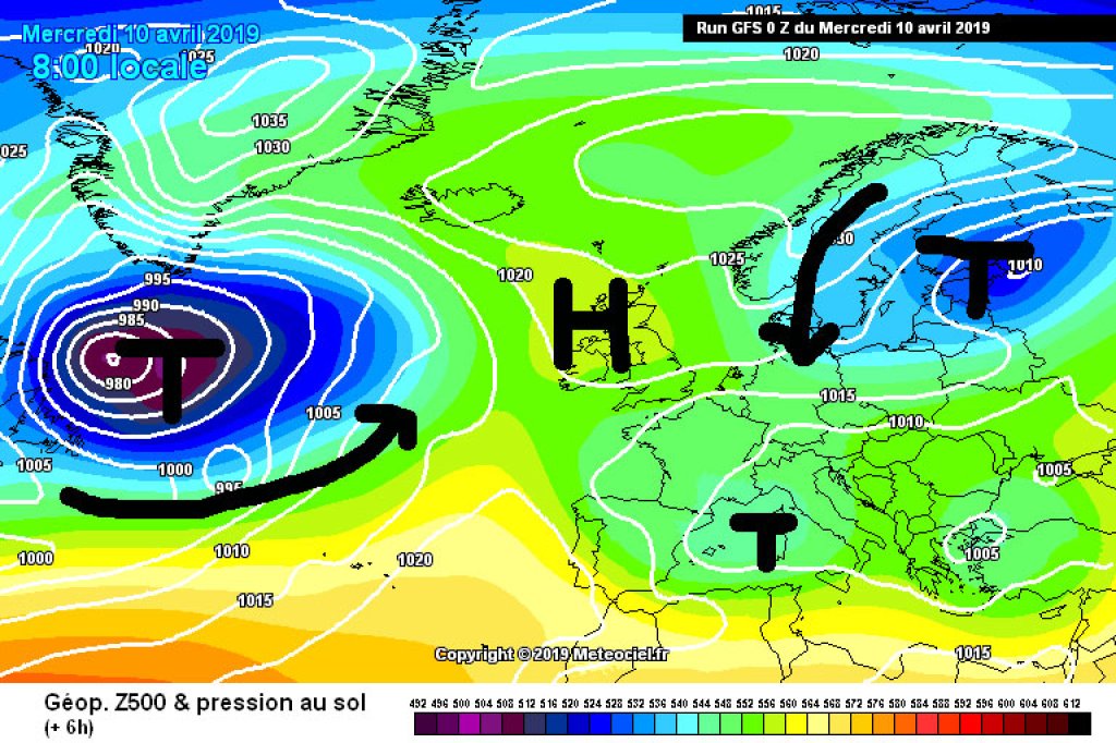
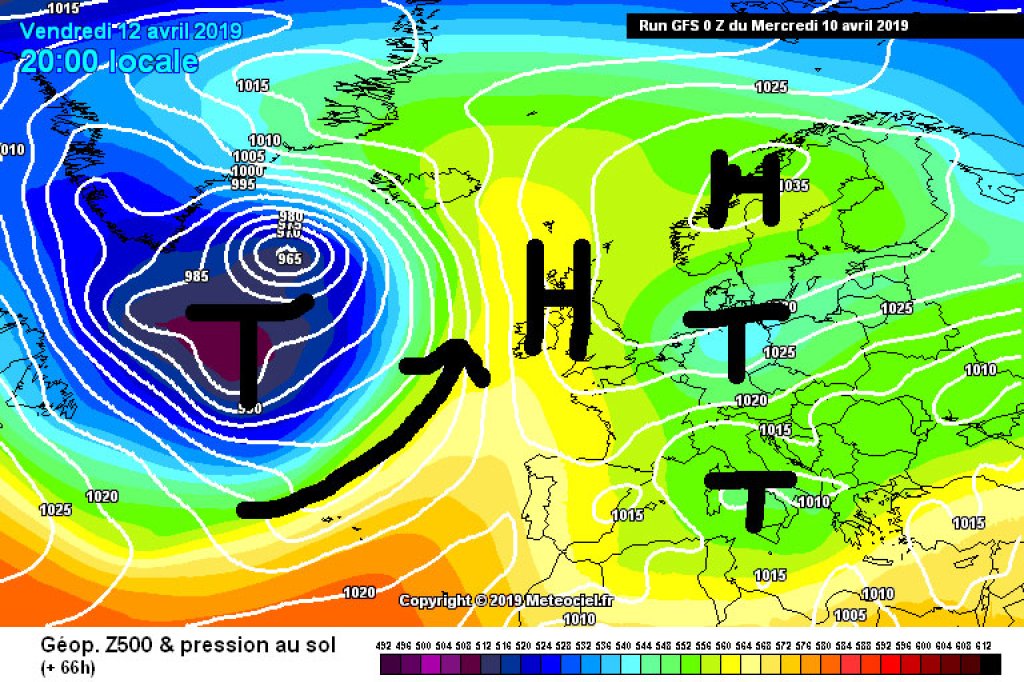
Current situation and outlook

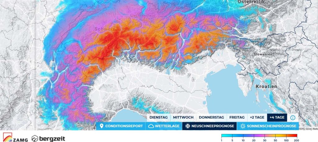
Temperatures will drop to a refreshingly late-winter level by the weekend, especially in the eastern Alps. This is due to the general weather situation, which, for a change, is not providing a large-scale southerly flow by means of low pressure in the west and high pressure in the east, but is blowing cold air from the far north to us in a moderately pronounced NE flow by means of high pressure in the northwest (High Katharina over the British Isles) and low pressure with a core east of Finland (Low Quirinus).

Meanwhile, a fairly substantial area of low pressure is brewing over the western Atlantic, which will cause warm air to advect in the opposite direction - from south to north - over western Europe over the next few days. A high-pressure bridge from Spain to Scandinavia is expected to build up between the Atlantic low and the low in the east.

WeatherBlogs
presented by

For the weather in the Alps, this basically just means: April-typical unsettled weather. Today, Wednesday, there will be widespread rain and snow showers, especially in the afternoon, with only a few drops in the western Alps and heavier rain/snow, especially in the south-east. On Thursday it will get a little colder again, the precipitation will continue in the east and the snow line will drop towards 1000m. There won't be too much, but some of the already snowed-out slopes in the valleys will probably be covered in snow again. Friday will continue to be cloudy and wet in the south, generally drier in the north, more so in the northwest than in the northeast. For the weekend, it currently looks like low pressure, especially in the southern western Alps, otherwise relatively dry, but not bright blue and generally uncertain. Professional meteorologist's advice: it's best to look out of the window in the morning!

Fruit trees already in spring mood

Phenology, according to wikipedia, "deals with the periodically recurring developmental phenomena in nature during the course of the year", which usually means it deals with the question "when does which plant flower?" and related topics ("when does which plant get leaves?"). Most plants get leaves and/or flowers in April, so it is an important month for phenological observations. These have been carried out for a long time because in the past - as well as today - it was important for agriculture to know when which plant was doing what. What arose out of practical necessity now provides valuable time series that allow conclusions to be drawn about the local climatic development at the respective hazel bush or cherry tree location.

MeteoSwiss dedicates a blog entry to phenology (vegetation explodes!!!) and notes that the cherry blossom has bloomed 12 days earlier below 600m since 1958, the dandelion blossom has bloomed 10 days earlier, but the beech leaves have only bloomed 3.7 days earlier. While cherry and dandelion flowering is primarily determined by the temperature of the preceding months, the length of the day is also important for beech. The timing of beech leaf development is therefore much more stable than that of the fickle cherry blossom. In spring 2019, the plants are generally early, as you can see in this continuously updated graphic from ZAMG, at least if you study the legend for a while. Or you can simply go out into the garden and enjoy the early apple blossom, which will hopefully not be too badly affected by the brief cooling of the next few days.

Photo gallery

This article has been automatically translated by DeepL with subsequent editing. If you notice any spelling or grammatical errors or if the translation has lost its meaning, please write an e-mail to the editors.

Show original (German)

Related articles

Comments

WeatherBlogs
presented by