Skip to content

Cookies 🍪

This site uses cookies that need consent.

Learn more

Zur Powderguide-Startseite Zur Powderguide-Startseite

Language selection

Search PowderGuide

WeatherBlogs

WeatherBlog 20 2018/19 | Sun ahead!

Good mountain weather in prospect

by Lea Hartl 03/27/2019
A large-scale weather situation of the "anticyclonic north" type brings sunshine (therefore anticyclonic) with relatively cool temperatures (because of the northerly flow). Good conditions to make the most of the little fresh snow of the last few days with the best touring weather!

Current situation and outlook

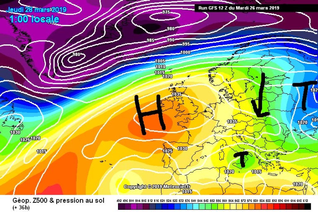
The Alps are on the eastern edge of a high pressure system with a core over the British Isles. The resulting northerly flow is bringing cooler air masses and, at least in the eastern half of the country, clouds and even the odd snowflake, but the high is increasingly gaining ground from the west.

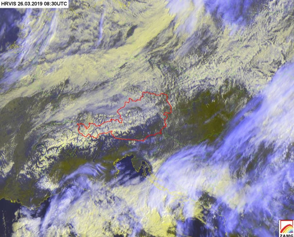
This can already be seen in the satellite image from Tuesday (right): From the main ridge to the north, the Alps are freshly snow-covered, in the east, the wools are still accumulating. Towards the west, the clouds on the northern slopes of the Alps are becoming less and less. And in the south, it's virtually cloudless with north föhn winds.

WeatherBlogs
presented by

Tomorrow, Thursday will be relatively cloudy in the east, but probably dry. This will be followed by a few very sunny days for the entire Alpine region. According to the current model opinion, a small trough with an associated frontal system will move through towards Sunday evening and it will become more unsettled.

A look into the crystal ball shows a very speculative option for a more snowy, lasting disturbance in the middle of next week, but as usual this is still subject to great uncertainty.

Cold high-altitude air and warmth on the ground

In contrast to the very warm high-pressure phase last week, temperatures will remain relatively low this time because the air masses coming in from the north are colder. This also results in a different atmospheric stratification: last week's warm high-altitude air in combination with inversion cold on the ground was very stable - this means that there is hardly any vertical exchange because the cold "heavier" air is already below the warm, "lighter" air anyway and does not rise.

This time, however, the air at altitude is quite cool and the ground warms up quite a bit during the day as the sun gets stronger, which leads to more instability: the warm, "light" air on the ground wants to go up. This creates clouds and increases the susceptibility to showers. We are not yet at the instability level of summer heat thunderstorms, but at least spring clouds are slowly becoming the order of the day again. The more spring progresses, the more April approaches and the proverbial April weather - in April, the temperatures at high altitudes are usually still cold enough for snow if the flow direction is right, but the ground is often already warm enough to produce convective (snow) showers. The result is the typical seasonal alternation of sun, clouds, showers, sun, showers, Easter bunny.

Photo gallery

This article has been automatically translated by DeepL with subsequent editing. If you notice any spelling or grammatical errors or if the translation has lost its meaning, please write an e-mail to the editors.

Show original (German)

Related articles

Comments

WeatherBlogs
presented by