Skip to content

Cookies 🍪

This site uses cookies that need consent.

Learn more

Zur Powderguide-Startseite Zur Powderguide-Startseite

Language selection

Search PowderGuide

WeatherBlogs

WeatherBlog 19 2019/20 | Fair to cloudy

How are you doing?

by Lea Hartl 03/25/2020
The Alpine region lies between a low in the south and a wide-ranging bridge of high pressure that spans us in the north. We are on the borderline between "cool and mostly sunny" and "cloudy and often wet". The cold easterly flow will remain with us.

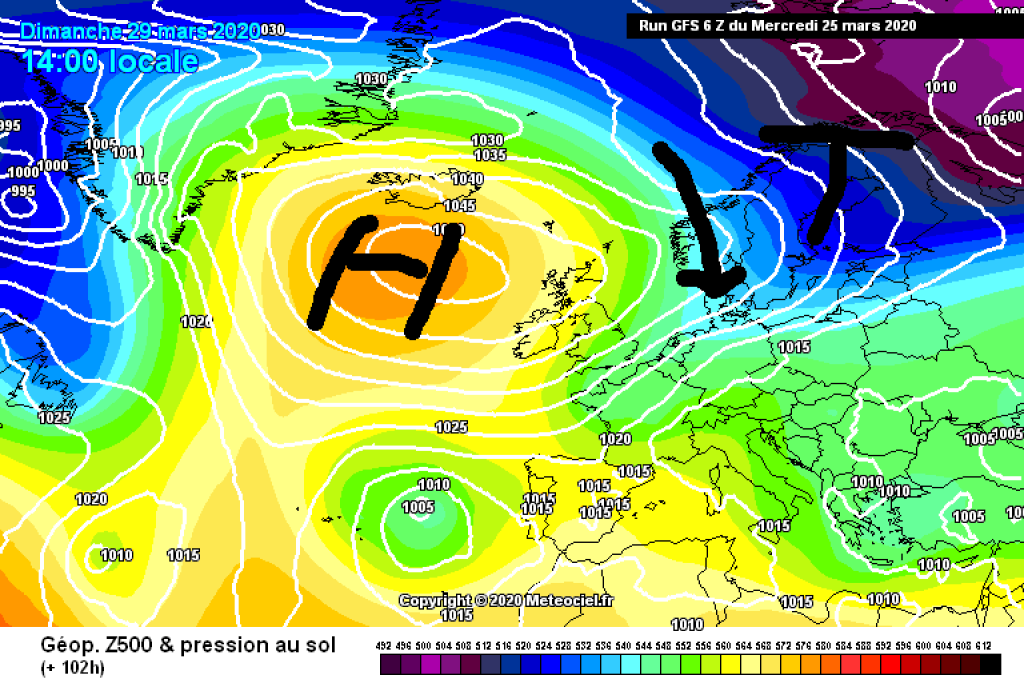
The current weather situation is an interesting change after months of westerly weather in winter 2019/20. For once, we are not being hit by one Atlantic front after another, but the continental high is stretching out its fingers towards Central Europe. The cold that has slowed down spring gardening is also coming from the east. The corresponding air mass is not only cold but also very dry, which means that the sky has often been deep blue and cloudless in recent days. As the WeatherBlog has heard the opposite here and there, we would like to point out that the sky would also have been blue if there were currently so many planes flying around, as is usual without a pandemic. When the weather is right, there are simply no, or only very small, short-lived contrails, regardless of the number of planes.

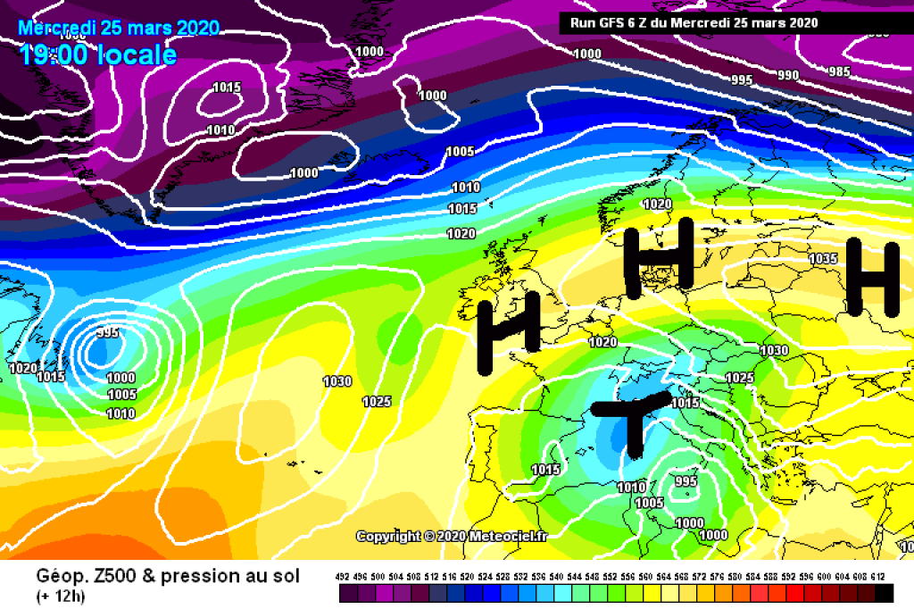
But back to the weather - I'm really struggling to concentrate at the moment and keep getting distracted, do you feel the same? - Anyway, the weather today is not as sunny as yesterday. Stratus clouds are moving from the low over Italy across the main Alpine ridge and into the northern foothills of the Alps, where it's too cold and windy on the balcony today for longer home office activities. On the southern side of the Alps, the clouds will be thicker and a little snow will fall here and there. As the day progresses, clouds and possibly precipitation will spread westwards. In the western Alps, the northern side of the Alps will also remain rather clear despite increasing cloud cover, while balcony conditions in the south will be much less favorable.

WeatherBlogs
presented by

In principle, this will continue until Friday: low pressure in the south-east, low pressure influence strongest in the south-east, but also spreading to the north-east, south-west also cloudy with some snow from time to time, but less than in the east, the north-west will get the most sun. The cold easterly wind will gradually weaken over the next few days. On Saturday it should be quite friendly everywhere before a cold front arrives from the northwest on Sunday and puts a temporary end to the unusual spook from the east (only temporarily, because a growing area of high pressure off the British Isles will probably soon open a gateway to the east again). The front is expected to bring fairly widespread precipitation in the north, which is likely to continue on Monday. It will probably also be wet at times in the south, but in terms of balancing weather justice, it will then be comparatively friendlier there again as the current turns to the north.

Other

There are increasing reports, at least in the WeatherBlog social media bubble, of decreasing air pollution and even CO2 concentrations due to the anti-virus measures. There are also more and more ideas, some of them drifting into cynicism, about breathing space for Mother Nature and dolphins in the suddenly crystal-clear canals of Venice. Clear water in Venice is the result of fewer propellers churning up the bottom, not suddenly somehow fundamentally better water quality, and the dolphin photos are from Sardinia.

It's not quite so simple with air pollution either. If traffic is largely stopped in large cities, this does of course have an impact, for example on nitrogen dioxide (NO2) levels at the relevant measuring points. However, this also depends very much on the weather conditions and not all of the fluctuations currently observed can be easily attributed to the lockdown. Urban air pollution can fluctuate from day to day, for example when the wind shifts, but there are also seasonal patterns, for example when the inversions typical in winter increasingly dissipate in spring or are no longer formed, meaning that less pollution remains trapped under the inversion. If you compare snapshots, whether in satellite images or in station graphics, important background information on controlling processes may be missing.

The atmospheric CO2 concentration is also subject to significant seasonal fluctuations, regardless of the global upward trend: it decreases with the increase in plant growth in spring and increases again in fall for the opposite reason. The fact that the decrease in carbon dioxide in spring - as can currently be seen at the Sonnblick measuring station - coincides with the shutdown measures does not mean that it is caused by the shutdown measures (recommendable article by ZAMG on this). Correlation is still not a particularly good indicator of causal relationships.

Interesting reading on global CO2 emissions and concentrations in times of crisis can be found here, with details on the effects of the 2008 financial crisis and the subsequent rebound (summary: slight decrease recognizable, but not permanent). It is still too early to be able to make meaningful, reliable statements about the effects of the current crisis on global CO2 concentrations.

The WeatherBlog is also currently seeking distraction and cheering up with nice animal photos (and its own pets) and of course has nothing against the search for good news among all the bad news. Nevertheless, he thinks it is important not to throw basic media literacy and paying attention to the reliability of sources completely out of the window.

Of course, this also applies to general news consumption.

Photo gallery

This article has been automatically translated by DeepL with subsequent editing. If you notice any spelling or grammatical errors or if the translation has lost its meaning, please write an e-mail to the editors.

Show original (German)

Related articles

Comments

WeatherBlogs
presented by