Skip to content

Cookies 🍪

This site uses cookies that need consent.

Learn more

Zur Powderguide-Startseite Zur Powderguide-Startseite

Language selection

Search PowderGuide

WeatherBlogs

WeatherBlog 14 2023/24 | Between southern storms

Turbulent days ahead!

by Lea Hartl 02/28/2024
Last week's pattern is set to repeat itself: After a brief interlude of high pressure on Thursday, the southern flow will return with föhn in the north and wet weather in the south. Winter at altitude will continue and the mild, slushy spring at lower elevations will too.

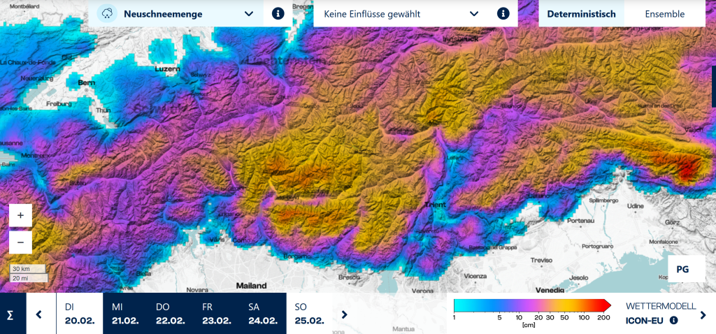
Current situation and outlook

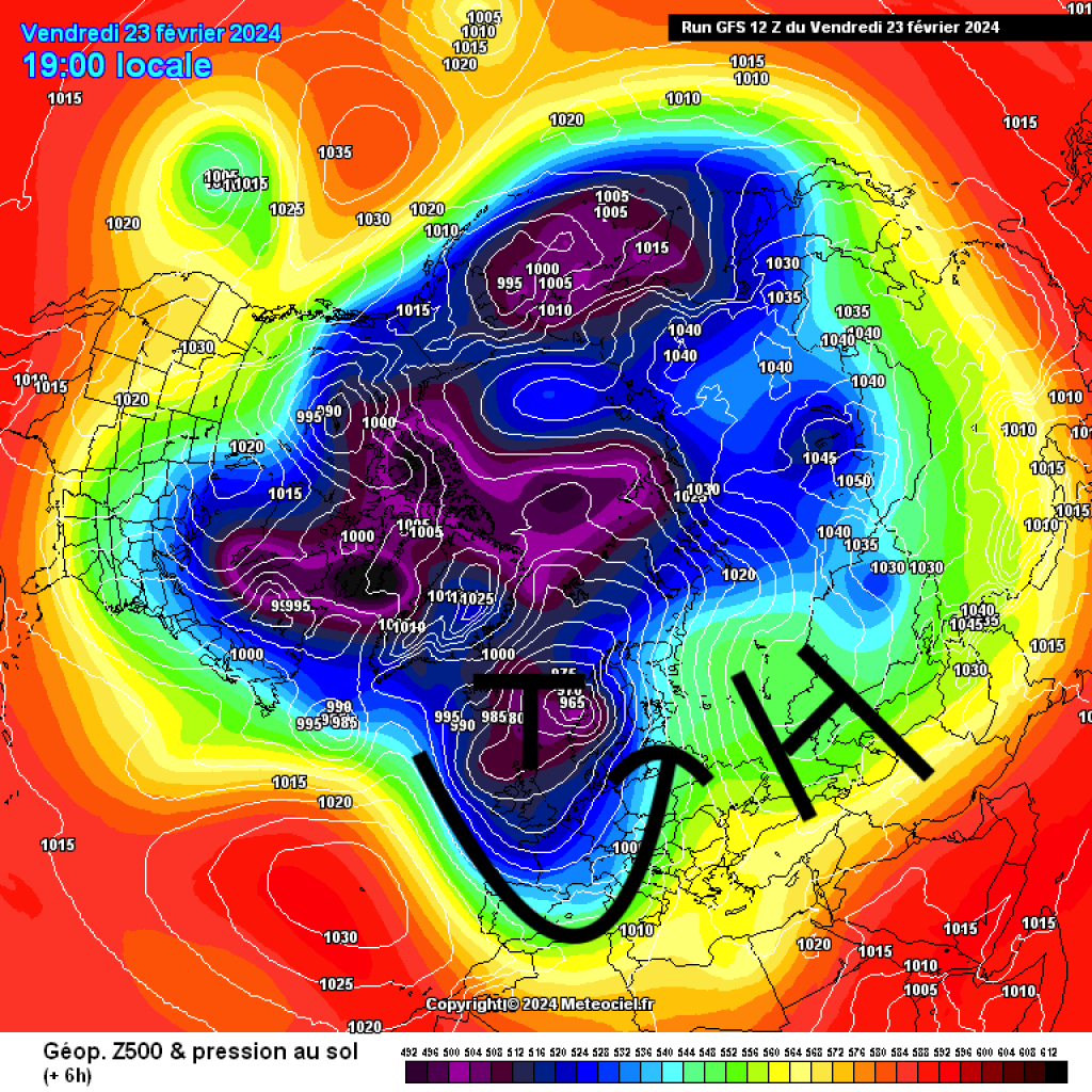
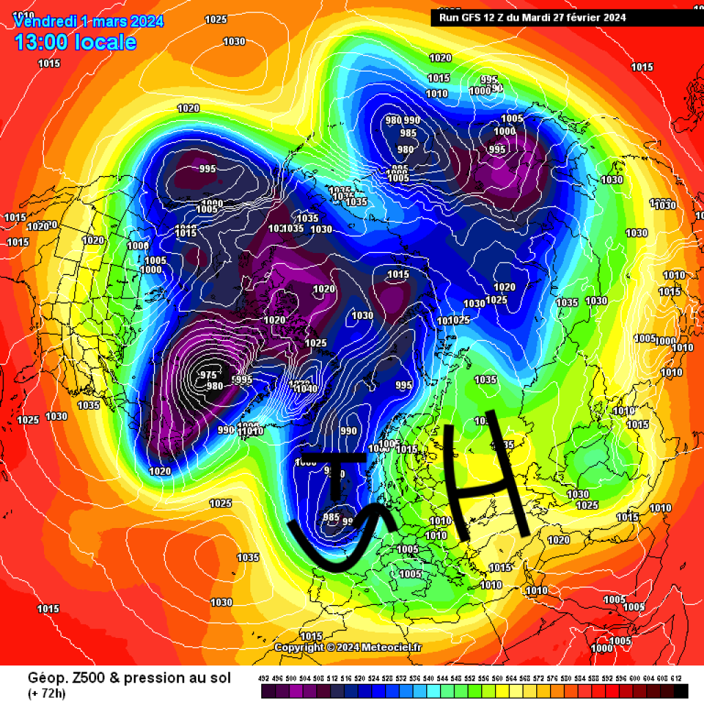
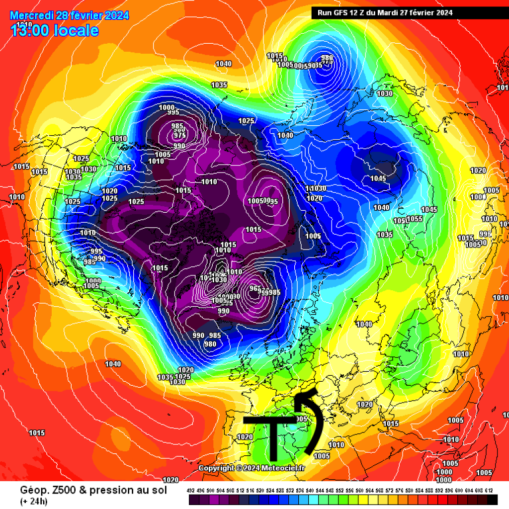
A quick look back at the snowfall of the last PowderAlert: A large-scale high over Eastern Europe and Russia was in the way of the westerly drift and the flow had to move around. A trough with a core over the British Isles was unable to make any progress due to the blocking continental high and the "south to north" flow downstream fo the trough lay across the Alps. This brought a lot of precipitation in the south at the end of last week and first foehn and then some precipitation in the north. The trough then drifted into the Mediterranean as a cut-off low. This means that a smaller low pressure system left the large-scale current and continued independently in the Mediterranean.

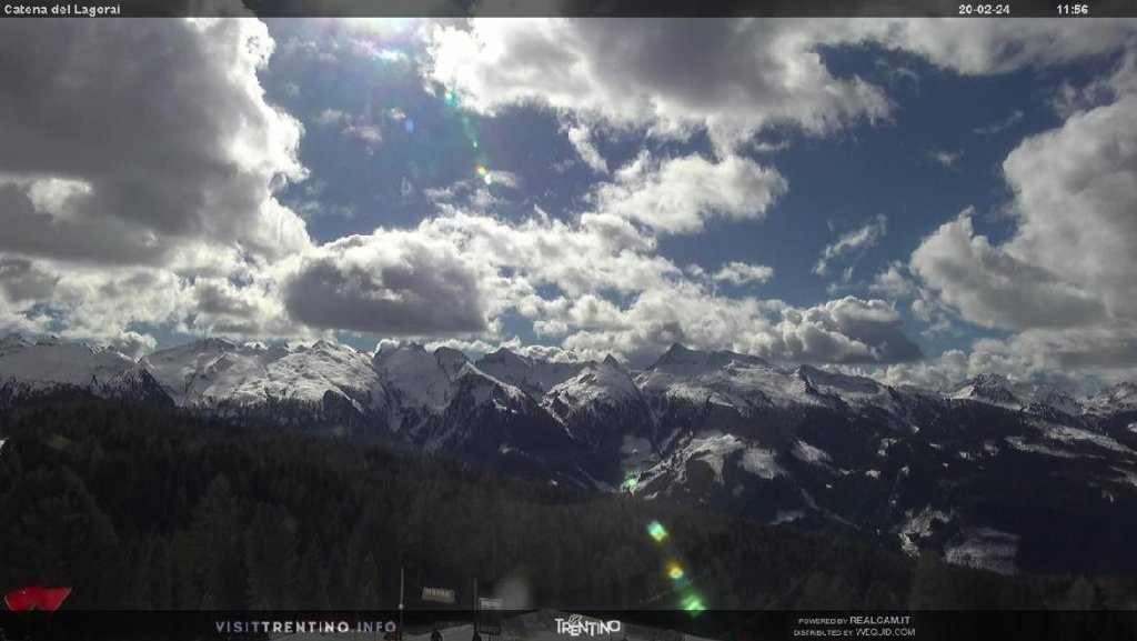
This Mediterranean low is currently still pushing warm, humid air masses towards the Alpine arc. In the north, this is bringing foehn-like, very mild weather, while in the south there has been a steady stream of precipitation since the beginning of the week. Today, Wednesday, the precipitation in the south will ease and the weather will calm down briefly. Thursday will be quite friendly with the influence of intermediate highs. 

WeatherBlogs
presented by

At the meteorological start of spring (1 March), the next strong southerly storm will arrive. Similar to last week, the continental high will block the advance of Atlantic low-pressure areas. Another trough will form over England and the Alps will once again come to rest in the southerly flow downstream of the trough. This is likely to keep be the defining pattern for our weather from Friday through the weekend, although the details are still somewhat blurred. It is likely to start snowing again in the south on Friday at moderate intensity. A cold front will then also bring a few centimetres to the north before the Föhn makes itself felt again at the weekend. In the south,snow looks to continue till Monday, so that there will be some decent accumulation despite the moderate intensity. 

Do the snowdrops always bloom so early?

The WeatherBlog inhaled the first insects during a recent walk - a process that everyone involved is usually spared in winter. The subsequent coughing fit only briefly drowned out the already very distinctive spring birdsong. The walk could continue and the snowdrops, violets and hazel bushes blooming along the way did nothing to make things feel like winter. A favourite topic of conversation on such occasions is: "Isn't it actually far too early for all that?" 

The short answer is "Yes, much too early." The longer answer can be found in phenological data, i.e. records of "when do the first snowdrops bloom", which have been kept long enough to determine on a climate-relevant time scale when the normal time would be and how much a given year deviates from this. The snowdrops in Austria usually start in the last third of February, as do the hazel bushes. This year, both were already there at the beginning of February. According to the Geosphere phenology chart, there is even an apricot tree blooming somewhere, which should actually take until the end of March. 

The graphic from 2023 shows the course of the spring ski season: mild weather and early blossoms in February and March, then cool and, at high altitude, a lot of fresh snow until June, or late leaf shoots in copper beech and sycamore. If you like observing plants, you can join in here (for Austria) and contribute to the time series with your own observations. For Germany, you can even view the snowdrops and many other species in map form and, as usual, there is also a comprehensive measurement network in Switzerland.

Unfortunately, the weather services do not yet cover a phenology table for parameters such as "last ski tour with starting point below 1000m" or "first firn tour of the year".

Photo gallery

This article has been automatically translated by DeepL with subsequent editing. If you notice any spelling or grammatical errors or if the translation has lost its meaning, please write an e-mail to the editors.

Show original (German)

Related articles

Comments

WeatherBlogs
presented by