Skip to content

Cookies 🍪

This site uses cookies that need consent.

Learn more

Zur Powderguide-Startseite Zur Powderguide-Startseite

Language selection

Search PowderGuide

WeatherBlogs

WeatherBlog 13 2020/21 | Winter is returning

Cold, sunny days after some fresh snow

by Lea Hartl 02/10/2021
After the interesting contrast of Sahara feeling in the Alps and snow chaos in the northern German lowlands, the cold is now making its way south. The coming weekend will be very cold with lots of sunshine. There will still be a little snow here and there today and tomorrow, but the coming cold phase will be mostly dry.

Current situation and outlook

The very warm, very Sahara-dusty weather section is over, but the Alps are still in a southerly flow. Today, Wednesday, it will snow in the südstau up to about the main ridge. In the north it will still be dry at first with some foehn, but by the evening it will start to snow moderately heavily here too. Thursday will start cloudy in the north, but it will probably be sunny in the south from early in the morning. The northern Alps will then gradually clear up. Increasingly colder air masses will reach us from the north, which will accompany us over the next few days with plenty of sunshine. From today's perspective, there will be a few more clouds on Friday, especially in the western Alps, before the weekend turns out to be bright and sunny everywhere.

WeatherBlogs
presented by

Sunshine is nice, but not too exciting meteorologically. The interesting thing about the upcoming weather situation is the low temperatures: let's start in the Atlantic, where the weather usually comes from. A large area of low pressure is establishing itself south of Iceland and pumping warm air northwards. Over the British Isles and Scandinavia, this "drive" will help to build up a high reaching far to the north over the next few days, which will then be flanked on both sides by areas of low pressure and block the westerly drift (Omega). On the eastern side of the high, increasingly cold air from polar latitudes flows southwards in the familiar wave motion. The Alps will initially be caught in a northerly flow and by the weekend the high will "tilt" slightly to the east and very frosty, continental air masses from the NE will reach us. The further east we go, the colder it gets - depending on the region, the coming weekend could be the coldest of the winter so far. It will remain milder in the western Alps.

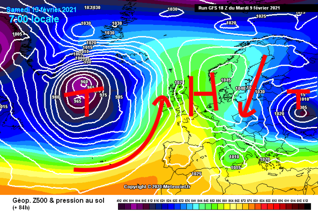
The upcoming general weather situation (mostly sunny, cold, no fresh snow) is likely to stay with us for a while, thanks to Omega. The lowland regions, which have suffered from the unusual onset of winter in recent days, can now look forward to beautiful winter weather. And even in the Alps, the brownish Sahara dust will be covered with at least a little fresh snow before the longer sunny phase.

Cold spell: Building transformation

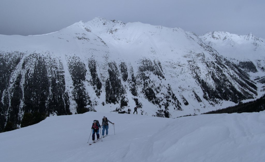
The angular layers in the middle area of the snowpack, which are currently causing us problems in many regions and which have been discussed several times in SnowFlurry, formed during a cold, dry period in mid-January. We can assume that the snow surface will continue to build up this time and if Ullr and Mrs. Holle bring us more snow at some point, things will become critical again. Unfortunately, the weak layers that already exist will not simply disappear into thin air either.

The WeatherBlog has recently been discussing the following topic with ski touring partners: What would have to happen for us to get out of the old snow problem? There are no particularly promising answers. Raining it down might work quite well at low altitudes, but not so much further up, and it wouldn't just be selectively destroying a weak layer if it poured down in sufficient quantities right up to the summit. Waiting for spring and a really solid firn cover is the classic, quite reliable test of patience. In view of the approaching cold, we throw the following, in this case completely unrealistic option into the room: building up the entire snow cover. This is also possible and where there is no board, there is no avalanche, even if the snowpack consists of a single weak layer. In dry, very cold regions, this type of snow cover is quite common. In the changeable Alps only very rarely, mostly in early winter when there is little snow after a long cold spell. It's not particularly good for skiing and there's usually hardly any snow, so perhaps we'd better wait for spring after all...

This article has been automatically translated by DeepL with subsequent editing. If you notice any spelling or grammatical errors or if the translation has lost its meaning, please write an e-mail to the editors.

Show original (German)

Related articles

Comments

WeatherBlogs
presented by