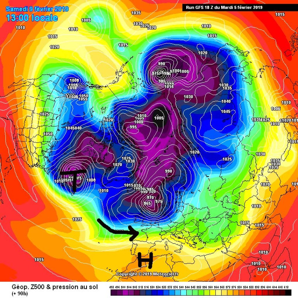
Friday looks pretty sunny again and the "clear to cloudy with a tendency to clear" pattern will continue more or less unchanged over the weekend. On Monday, there is a chance of snow in the south, but that is still uncertain. From a large-scale perspective, the cold air masses between NE Canada and Greenland will remain decisive for our weather. As we discussed last week, the constant influx of cold polar air into the western Atlantic stimulates low pressure activity there and creates a strong, zonal flow that brings us sometimes sunnier, sometimes wetter westerly weather variations.
WeatherBlogs
WeatherBlog 13 2018/19 | Weekly greetings from the west
Groundhog day, January review, clear to cloudy
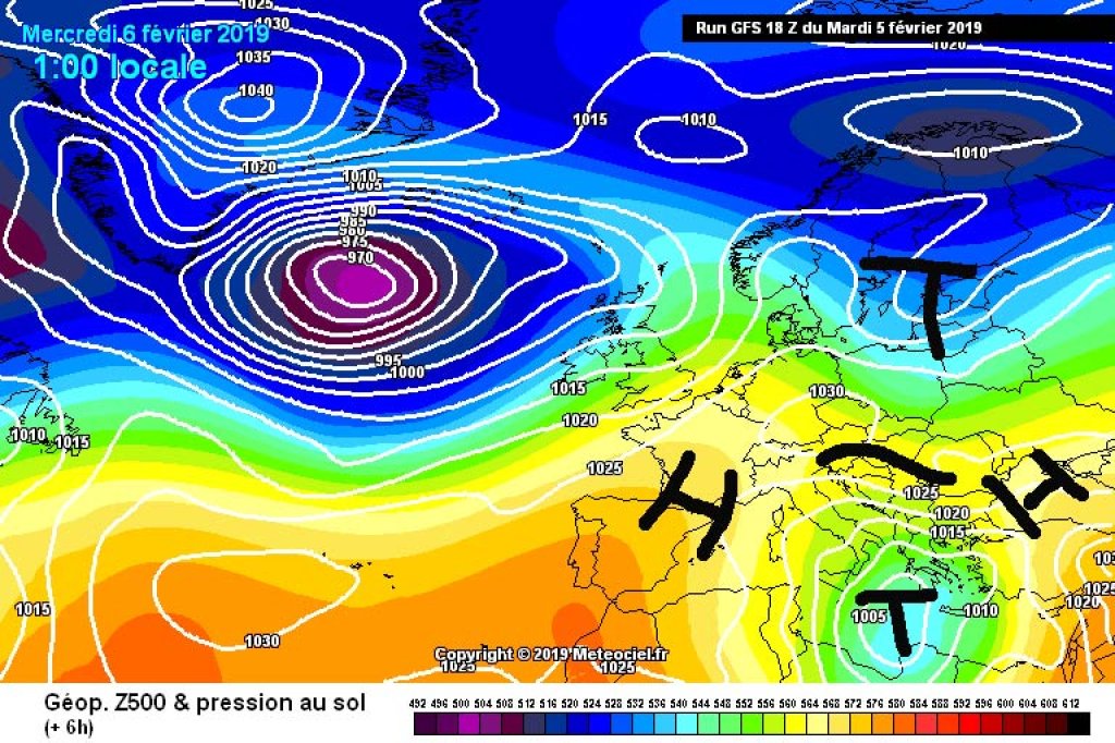
500hPa geopotential and ground pressure, Wednesday 6.2.2019. High pressure bridge over the Alpine region.
meteociel.fr
A small high-pressure bridge has moved between a low over Scandinavia and one in the Aegean and is currently providing sunny, high-pressure weather in the Alps. Tomorrow, Thursday, a small disturbance will move through, bringing snow showers to the western Alps and some clouds to the east.
WeatherBlogs
presented by

500hPa geopotential and ground pressure, Wednesday 6.2.2019. High pressure bridge over the Alpine region.
meteociel.fr
500hPa geopotential and ground pressure, Wednesday 6.2.2019. High pressure bridge over the Alpine region.
meteociel.fr
January in review
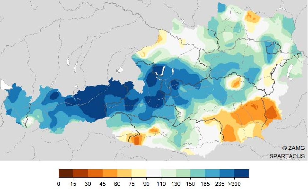
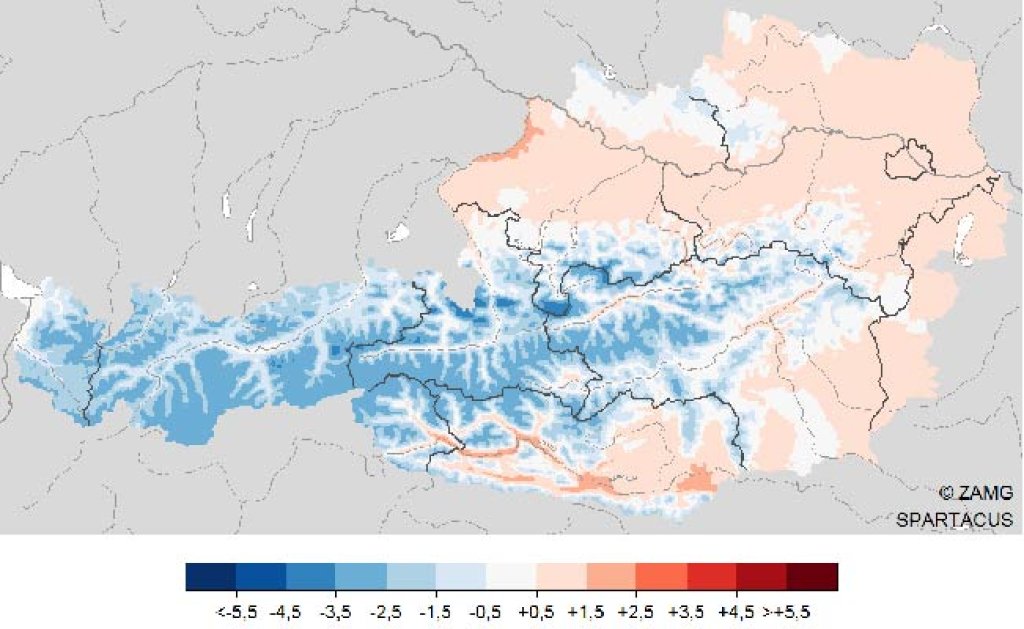
January 2019 was the coldest January in the mountains for a long time. The ZAMG states: in the "high alpine summit areas" of Austria, it was 3.6 °C colder than the average. The last time January was colder was in 1987. It was warmer in the lowlands, especially in the east of the country. The greatest positive temperature deviations in January were measured in the valleys of Carinthia (between 1 and 3 °C warmer than the long-term average). The numerous northerly and north-westerly weather conditions brought a lot of precipitation, but mainly north of the main ridge. Bavaria and Baden-Württemberg were also colder than average and, as we know, it also snowed there.
The pattern of "cold mountains, mild valleys, snow in the north, dry in the south" is, unsurprisingly, also found in Switzerland. MeteoSwiss reports: "January 2019 was the coldest for more than 30 years in mountainous areas on the northern side of the Alps. The southern side of the Alps, on the other hand, recorded one of the mildest January months since measurements began." In Switzerland, the precipitation gradient between congested areas in the north and the southern parts of the country was particularly pronounced. Regionally, only 10 to 15% of normal precipitation was measured in the south, while in the north it was up to 230%.
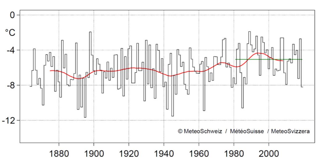
The January temperature in mountain locations on the north side of the Alps above 1000 m since measurements began in 1864. The red line shows the 30-year moving average, the green line the 1981-2010 January norm of -5.1 degrees.
MeteoSchweiz
The January temperature in mountain locations on the north side of the Alps above 1000 m since measurements began in 1864. The red line shows the 30-year moving average, the green line the 1981-2010 January norm of -5.1 degrees.
MeteoSchweiz
Groundhog Day
Last Saturday it was finally time again: on the world's highest meteorological holiday and WeatherBlog's personal favorite day, woodchuck Punxsutawney Phil and his colleagues crawled out of their holes in the ground to predict the further course of winter. Evil tongues would say that they were dragged out of the same holes by old men in silly hats, or rather bribed with cheese and yellow turnips. Be that as it may, the question of all questions is: have they seen their shadows? (Yes = 6 more weeks of winter, no = spring is coming). Winter-friendly predictions this year came from Milltown Mell II, Shubenacadie Sam and General Beauregard Lee, among others. Punxsutawney Phil, Staten Island Chuck, Buckeye Chuck, Wiarton Willie, Balzac Billy and Pierre C. Shadeaux (nutria/beaver rat), on the other hand, favor the imminent arrival of spring.
Punxsutawney Phil, still the most famous long-term prognosticator among rodents, lives the rest of the year with his wife Phyllis in a zoo in Punxsutawney. He has been practicing his profession since 1886 and is 132 years old. He is usually off the mark with his predictions.
Here is this year's forecast in moving pictures:
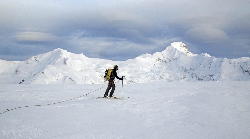
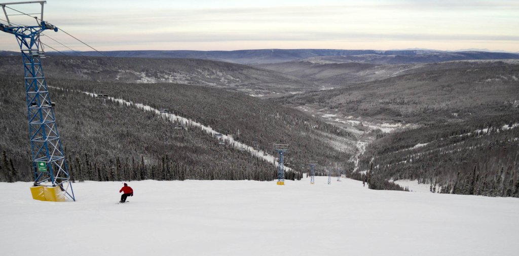
Photo gallery
-
The January temperature in mountain locations on the north side of the Alps above 1000 m since measurements began in 1864. The red line shows the 30-year moving average, the green line the 1981-2010 January norm of -5.1 degrees.
MeteoSchweiz -
January precipitation Austria
ZAMG Spartacus -
Ad
-
January temperature Austria
ZAMG Spartacus -
500hPa geopotential and ground pressure, Wednesday 6.2.2019. High pressure bridge over the Alpine region.
meteociel.fr -
500hPa geopotential and ground pressure, Saturday 9.2.2019. The westerly weather will stay with us for the time being.
meteociel.fr
This article has been automatically translated by DeepL with subsequent editing. If you notice any spelling or grammatical errors or if the translation has lost its meaning, please write an e-mail to the editors.
Show original (German)Related articles
-
WeatherBlog 12 2018/19 | Polar vortex brings südstau in a roundabout way
Lea Hartl • 01/30/2019This time we start with a look at the big picture, or at least the northern half of the big picture. The polar vortex has not been swirling nicely around the pole for a while now, but is wobbling around irregularly with several low-pressure centers. -
WeatherBlog 11 2018/2019 | Genoa low and greetings from the polar vortex
Lea Hartl • 01/23/2019The Alpine region is still under the influence of a high-altitude trough filled with cold, polar air masses, while the Azores High is trying to build up off the European Atlantic coast. Today, Wednesday, a low pressure system will slip from the British Isles towards the Mediterranean and "drip", i.e. leave the main current to remain in the Mediterranean for a while as a genoa low.
Comments
Lade...
No comments yet.
-
hTranslated from German.
WeatherBlogs
presented by