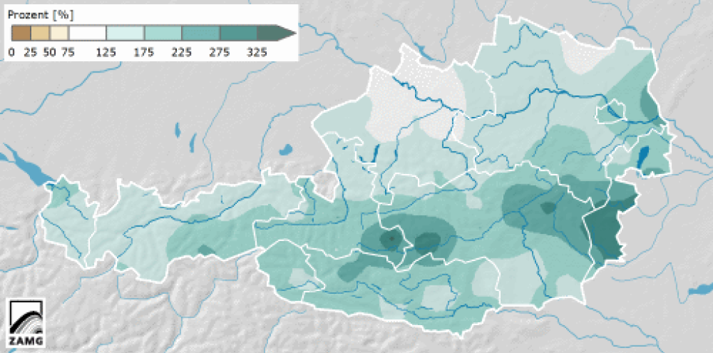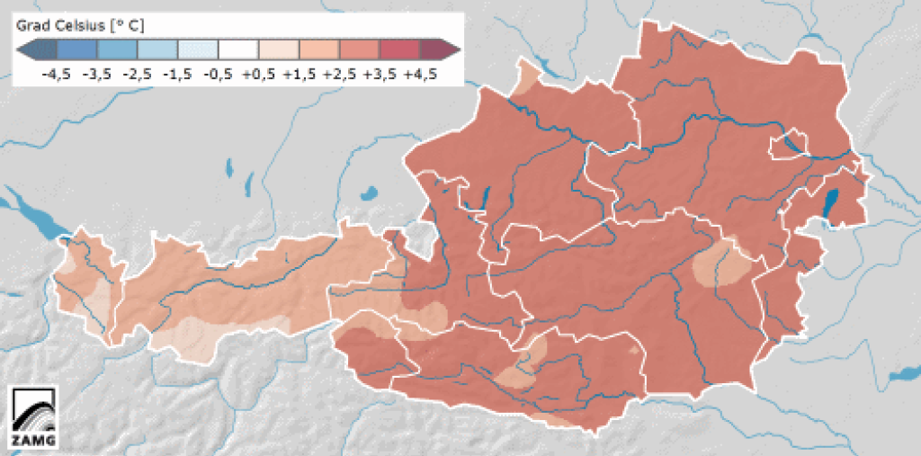
January review - warm and wet
In its preliminary monthly review, ZAMG states that January was 2.7°C warmer than the long-term average across Austria, with the high value mainly due to the very warm phase around January 10. The highest temperature of the month was measured in Graz and Obervellach on January 10 at 21.7°C. Precipitation was also above average in Austria in January, although there was not only snow but also some rain, so the snow depths are not exactly exhilarating.
The current situation
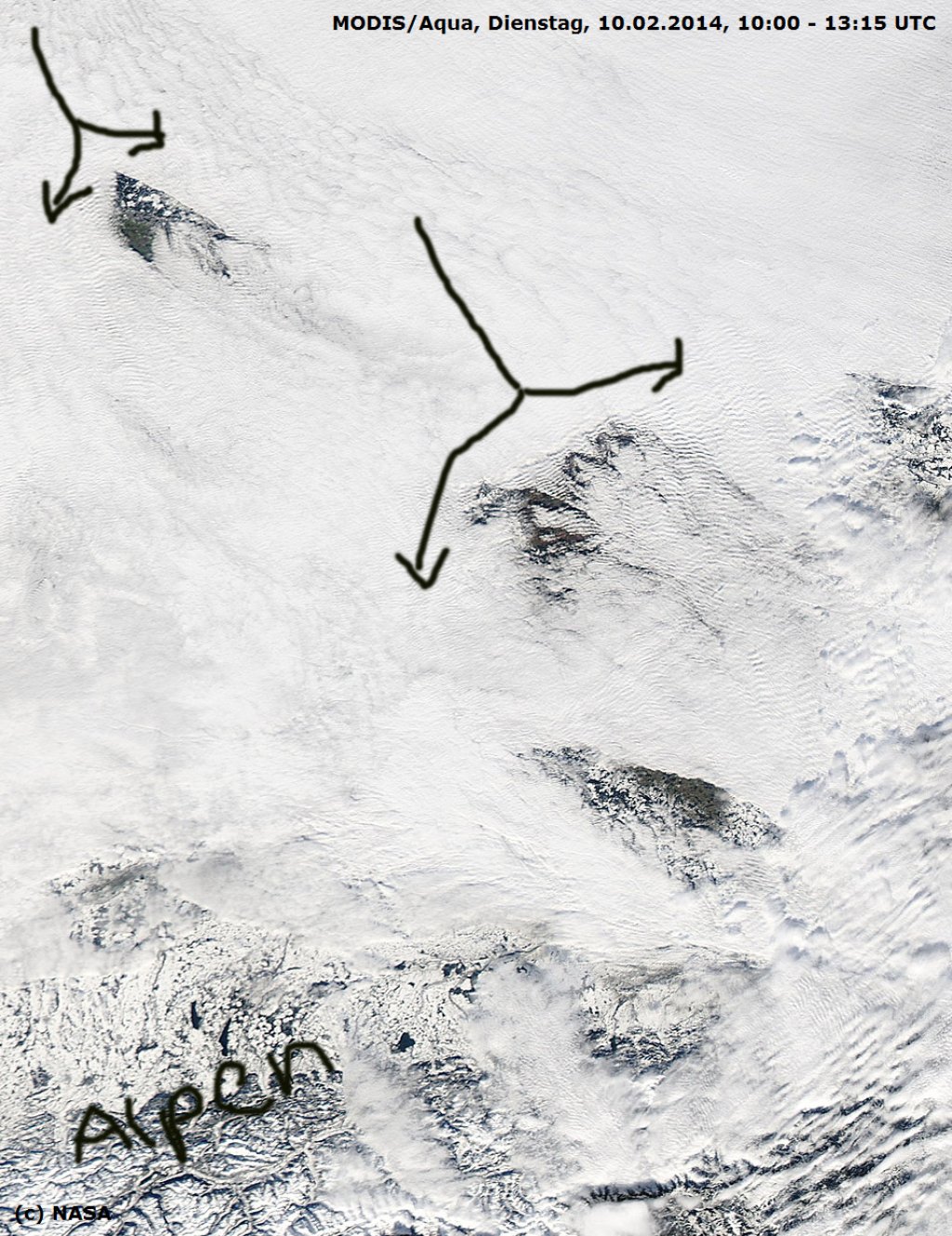
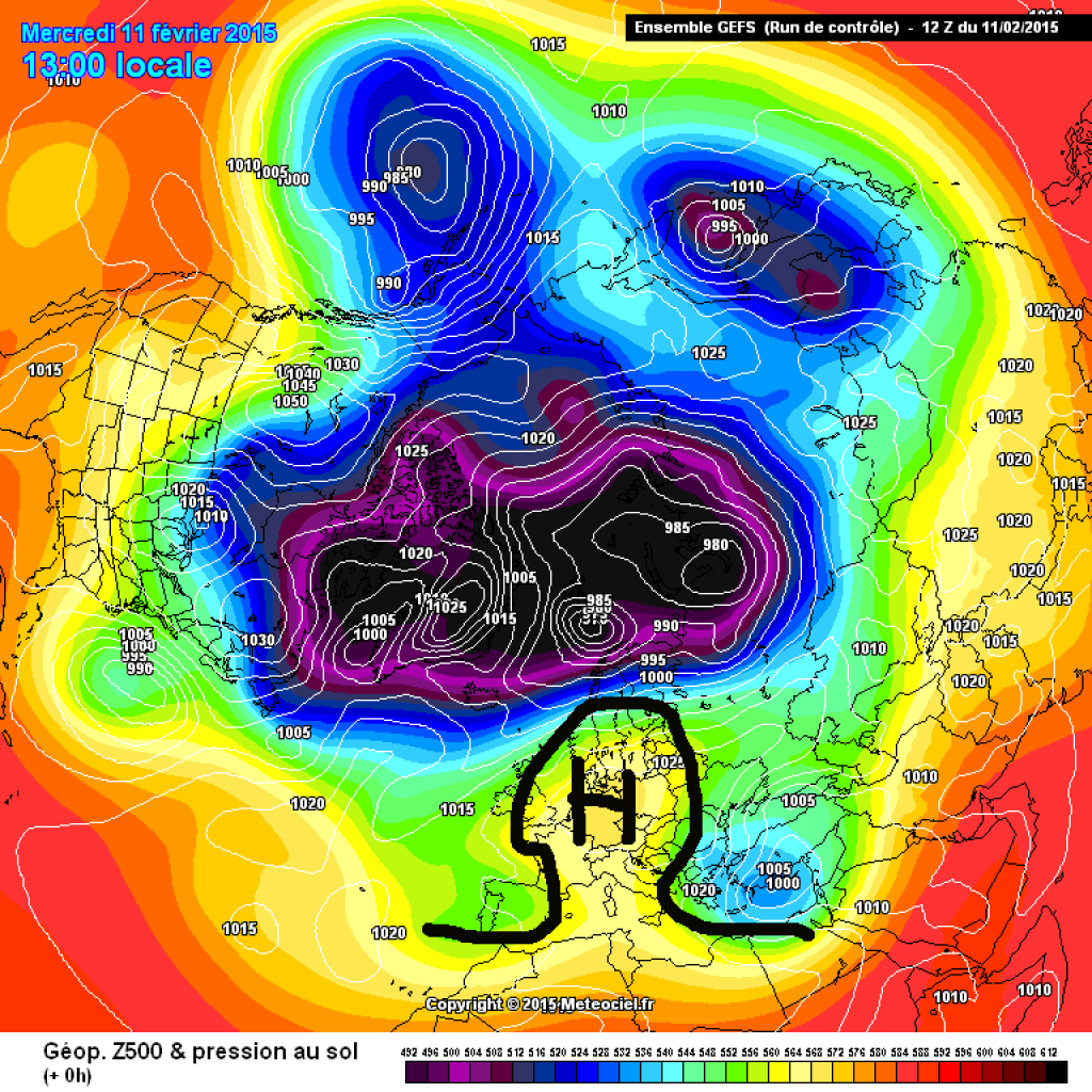
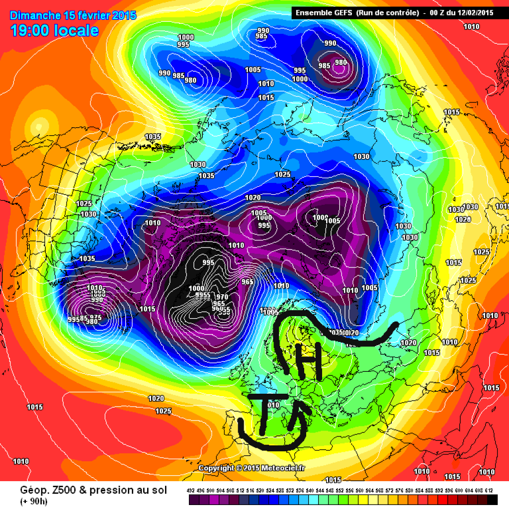
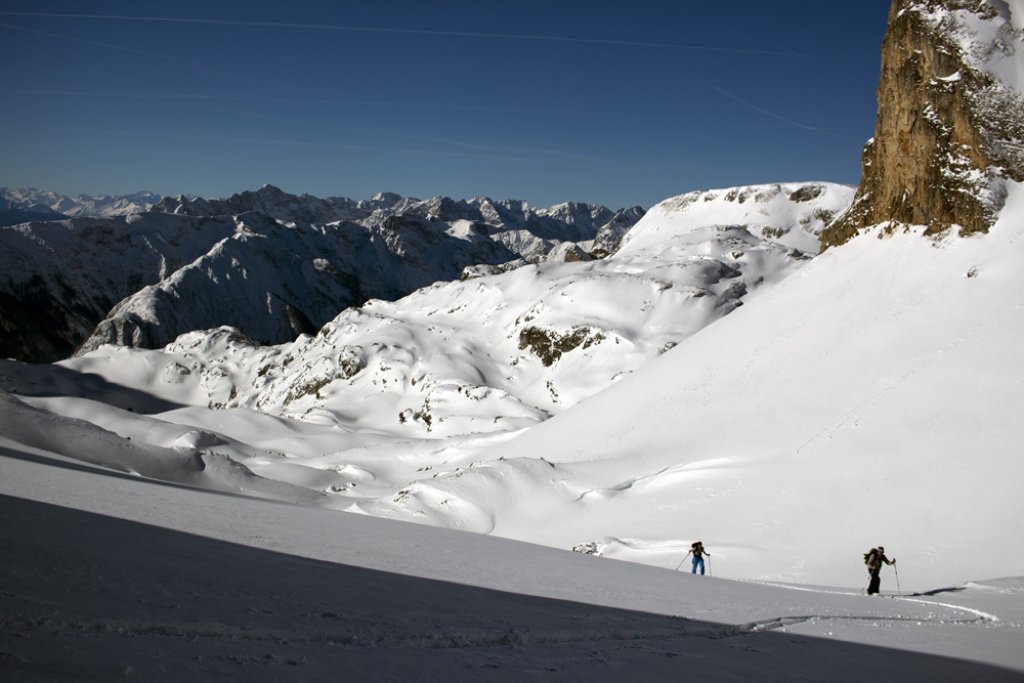
The Alps have been in a low-gradient, omega-like situation for two days now, which can be recognized by the calm, sunny weather without wind or other inconveniences. As there is hardly any breeze, cold air close to the ground remains undisturbed and high fog forms on the inversion boundary, which often does not want to dissipate during the course of the day due to the still low level of the sun. Above this, it is brightly sunny and spring-like warm.
In this image from the polar orbiting satellite Aqua, you can see the German low mountain ranges, as well as parts of the Alps at the bottom of the image, protruding from the high fog. The inflow comes from the NW. The displacement of the air at the mountains causes gravity waves to form around them, which can be seen as small ripples in the image. In the direct lee of the mountains, the warming of the air as it descends leads to brightening.
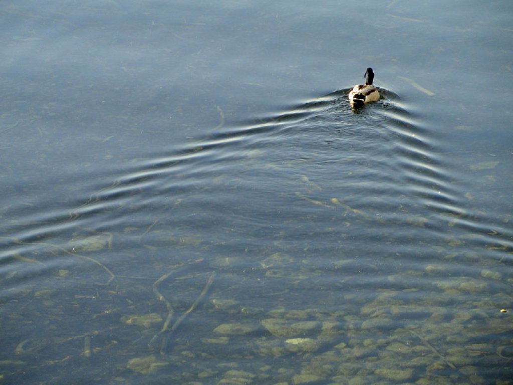
Compare this to this duck in Lake Constance: as it displaces water while swimming, waves form behind it in a staggered pattern.