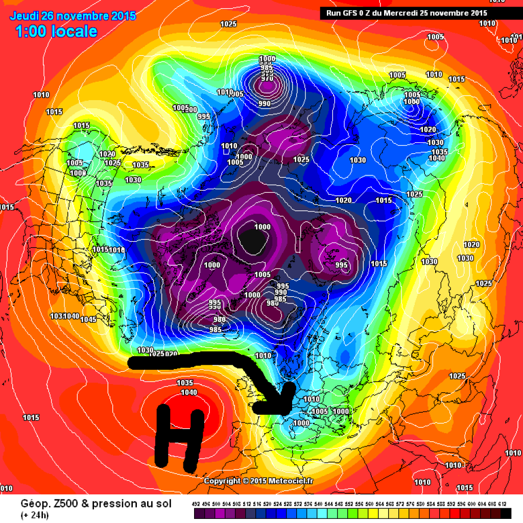
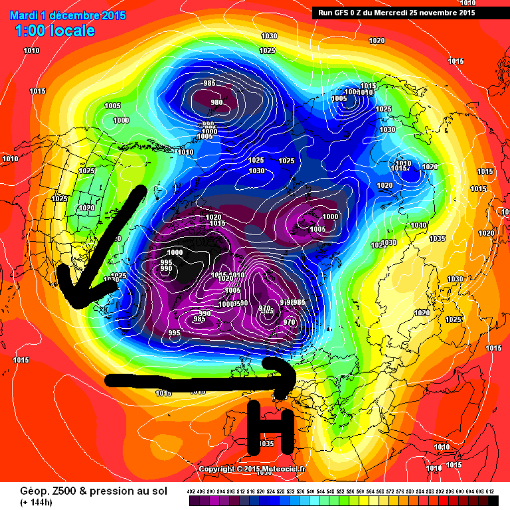
As explained by our colleague Orakel, a north-westerly current will bring snow to the already better-off NW congested areas. In the south, winter is still a long time coming and there is a threat of spring on the horizon at the meteorological start of winter.The decisive factor for our weather at the moment is the activity of the Azores High, which is currently quite strong in the Atlantic and stretches far to the north. As a result, we are caught in a fairly northerly north-westerly flow on the eastern side of the wedge. This will continue until tomorrow before the snow-bringing depression drips off and moves into the Mediterranean region. On Friday, a short-lived bridge of high pressure will form and make for friendlier weather. The Azores high now no longer wants to head north, but rather east.
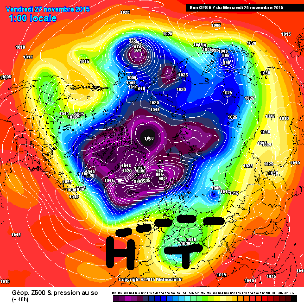
By the weekend, the north-westerly current will rebound again and potentially bring more snow, but the Azores High will not give up so easily.
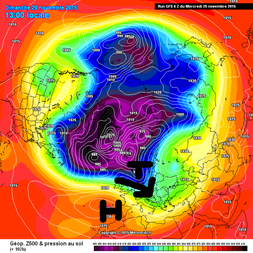
At the turn of the month (meteorological start of winter), it will probably leave its usual home and head towards the mainland (so it will no longer be the Azores High, but just any high). The frontal zone is moving away to the north in an irritated manner and there is a consensus that a phase of high pressure is imminent in the Alpine region, which will also be accompanied by a rise in temperature. How long and how pronounced this mild weather will be is still quite speculative. Usually at this time of year, such weather conditions cause persistent inversions, potentially with thick high fog in the lowlands, while it is sunny and milder at higher altitudes. As the air is relatively dry, a few mild days shouldn't have much effect on the snow depth, if there is any snow at all.
Snow situation
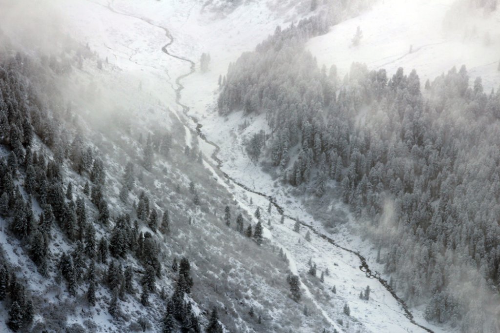
After the recent snowfall, there is between nothing and a good meter of snow at high altitudes in the Swiss Alps, and the situation is similar in Tyrol. South of the main ridge, the situation is poor everywhere.
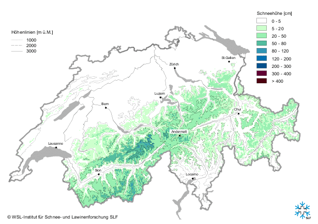
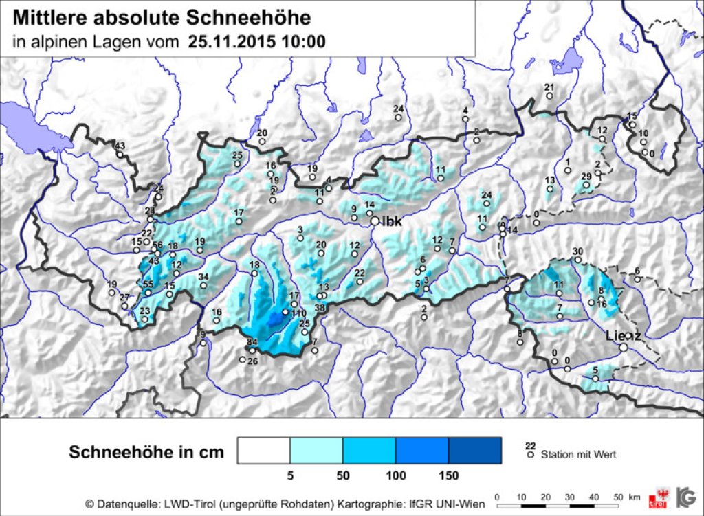
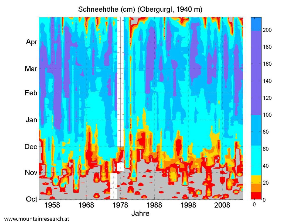
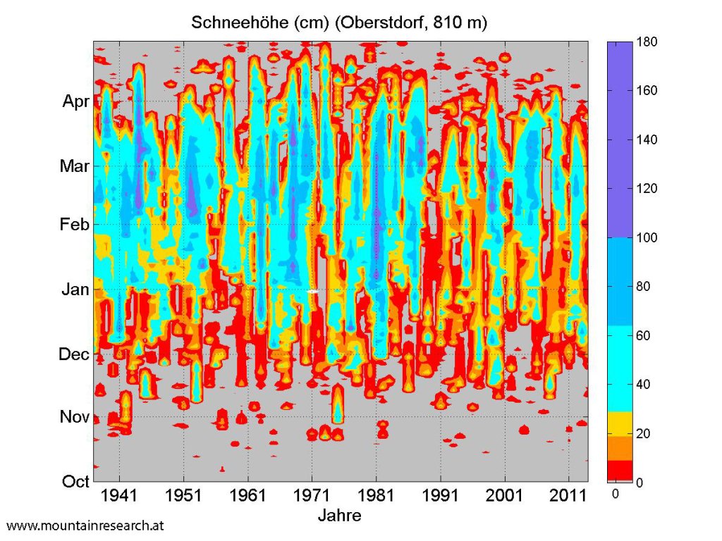
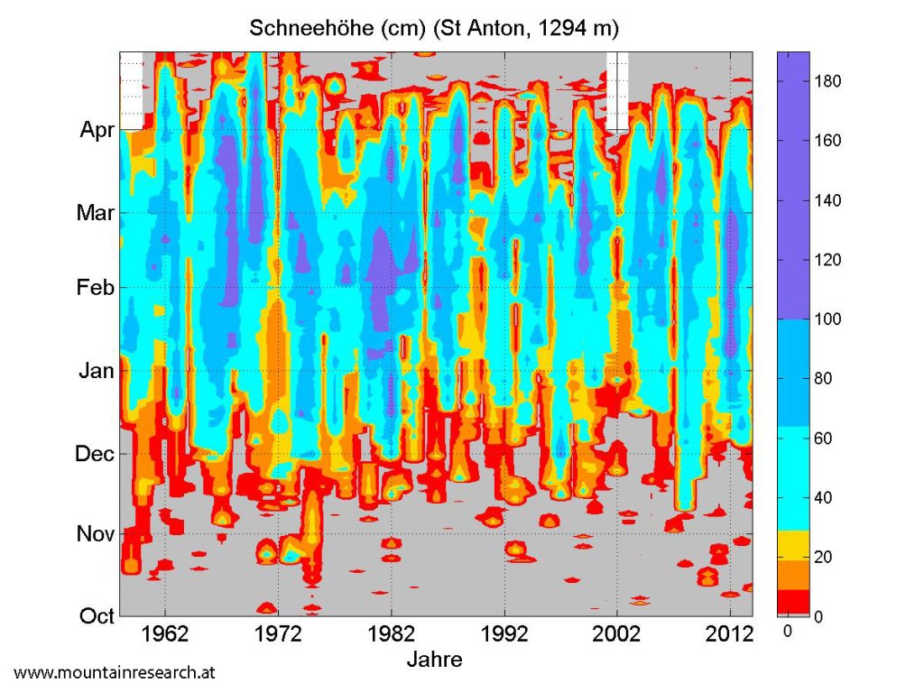
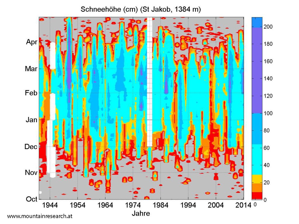
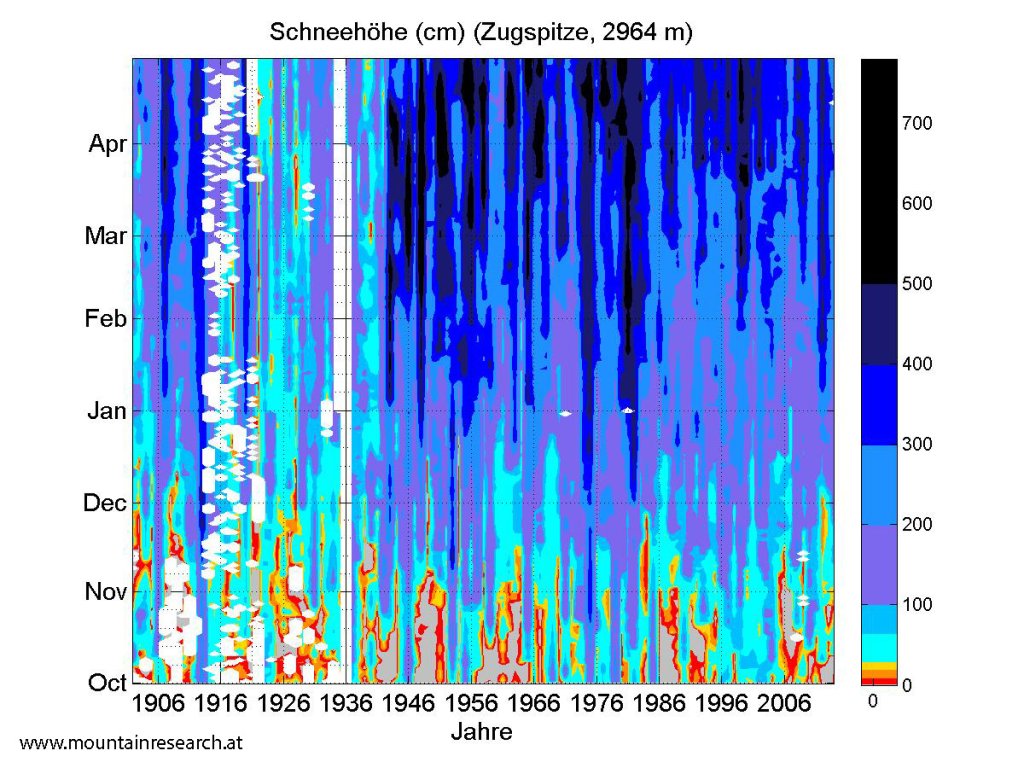
As we hear every year that it's never been as bad as this year at this time of year - that is, when our colleague Orakel isn't announcing a northern thaw and the relevant online media (including PG) are overflowing with reports of face shots with bent over and without a base - here are a few graphics of long-term snow depths at various spots. Of course, everyone has to decide for themselves what is "normal", but the WeatherBlog always finds this interesting for the purpose of classifying subjective perceptions in the measurement data.