The WeatherBlog also appreciates cloud scenery and supports enjoyment of all types of snow and appreciation for smaller snowfalls. Nevertheless, we would like to have a bit more of a winter feeling in mid-February. For Austria, the seasonal temperature graph shows that the last 31 days are roughly in line with what we could expect in mid-March. This expectation is based on the average temperatures of the last 60 years or so. January was also very warm, worldwide according to Copernicus even the warmest in recorded history. Records were broken at various stations in the Alpine region (overview of January in Ö and in CH).
WeatherBlogs
WeatherBlog 12 2023/24 | Still much too warm
No winter cold in sight
LH
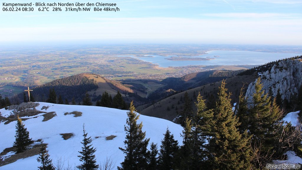
Winter made a brief appearance in the south last week, as the latest ConditionReports show. CRs from the north, on the other hand, indicate that the snow is becoming less, at least regionally. According to Salta's CR from 10 February, "Great cloud scenery and very pleasant slush snow" are highlights of recent touring days in the northern Alps. Jacobanselm even found a small layer of powder on 13 February and "only" south-facing sharks.
WeatherBlogs
presented by


https://labo.obs-mip.fr/multitemp/apps/alps-snow-monitor/
https://labo.obs-mip.fr/multitemp/apps/alps-snow-monitor/
The snow conditions not only felt better, but were better statistically. As usual, there are big differences between different regions and altitudes. In the Northern Alps, there has not been so little precipitation in recent weeks, but it has often been more liquid than we would like. The SLF snow depth map clearly shows the altitude gradient: There are slightly above-average amounts of snow in the high mountains, but significantly less than usual further down and often nothing at all in the valleys. Satellite data show us that the snow cover in the Alpine region reached a new (=in the satellite time series) minimum record at the beginning of February. Please note: This refers to the snow-covered area, not the total amount of snow. The snow-covered area can be determined relatively well automatically in satellite data by having the computer count white pixels in the image, to put it simple. In reality, of course, it's a little more complicated than that (even clouds are usually white...). Here you can take a closer look at various regions and read more if you are interested.
A look at the snow depths at the stations confirms the picture from the SLF map: in the high mountains, depending on the location, snow depths are normal to sometimes even well above average, while in the valleys they are mostly bare. The ConditionReports then show that caution is also required in the higher regions because the wind has exposed ridges and ridges and therefore sharks are lurking despite the amount of snow appearing statistically okay.

https://whiterisk.ch/de/conditions/snow-maps/comparative_snow_depth
https://whiterisk.ch/de/conditions/snow-maps/comparative_snow_depth
Current situation and outlook
It will continue mostly as before. A weak warm front will pass through today (Wednesday), bringing clouds and even warmer air masses. There will be little precipitation, if any. It will remain sunny in the south anyway. The zero degree line will briefly rise to 3000 metres and above before it gets a little cooler again on Friday. A cold front, which is also not very productive, will then bring a few drops or cosmetic snowfall, especially in the west. Slightly cooler in this context means that the snow line will be between around 1500 and 2000 metres. We note: "cooler" is relative. Saturday is likely to be overcast with some rain or snow in the east. Sunday will be widely sunny, more so in the west than in the east.
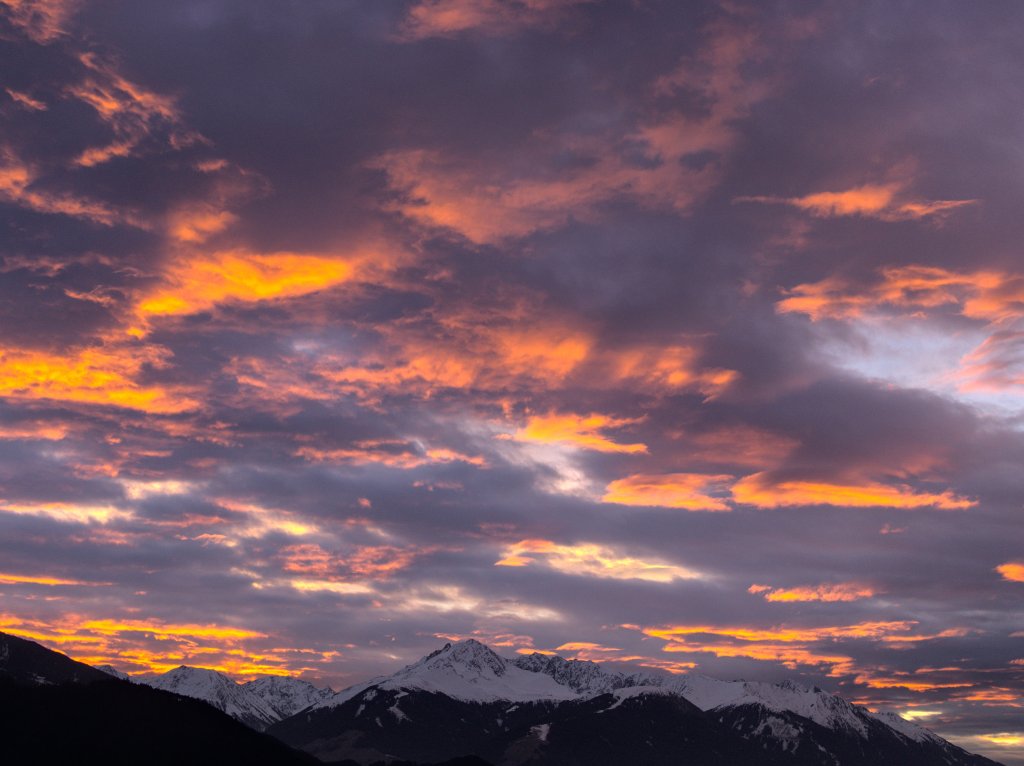
For next week, the crystal ball continues to see comparatively cool temperatures, whereby "cool" means the level from the weekend and, as usual, warmer than the long-term climate average. There are also precipitation options from the west, but these are very speculative. Meanwhile, a return of winter to the valleys is not in sight. Let's take a leaf out of the book of Salta's CR mentioned at the beginning and reflect on the beauty of diverse cloud and snow types!

meteociel.fr
meteociel.fr
Photo gallery


This article has been automatically translated by DeepL with subsequent editing. If you notice any spelling or grammatical errors or if the translation has lost its meaning, please write an e-mail to the editors.
Show original (German)Related articles
-
PowderAlert 8 2023/24 | Light at the end of the tunnel
Lars Oelmann • 02/08/2024It's been a long, long time since the last alert. Unfortunately, the oracle in the last issue of PowderAlert was right: nothing happened before the beginning of February. And now it's almost the middle of February! -
WeatherBlog 11 2023/24 | suedstau, north foehn & a look into the crystal ball
Lea Hartl • 02/07/2024The westerly weather that seems to have lasted forever will come to an end over the next few days. At the weekend, we can expect accumulating precipitation in the south and foehn in the north. The outlook after that is still hazy, but at least more interesting than recently. -
WeatherBlog 10 2023/14 | Continued sunny weather in the west
Lea Hartl • 01/31/2024Among meteorologists, subjective judgements such as "good" or "bad" weather are frowned upon. It's not appropriate to make such judgements; you should remain professional and neutral in any weather situation. Nevertheless, there are of course personal preferences that we can't always hide. Professionally, we tend to be enthusiastic about unusual, extreme or otherwise exciting situations that are often anything but "beautiful". Conversely, classically "nice" weather tends to be boring, especially if it lasts for weeks on end.

Comments
Lade...
No comments yet.
-
hTranslated from German.
WeatherBlogs
presented by