Skip to content

Cookies 🍪

This site uses cookies that need consent.

Learn more

Zur Powderguide-Startseite Zur Powderguide-Startseite

Language selection

Search PowderGuide

WeatherBlogs

WeatherBlog 17 2023/24 | Fresh precipitation and a hot Atlantic

Hooray, it's coming down from the sky!

by Sebastian Müller 03/20/2024
My last weather blog had the honour of announcing a winter comeback, and this time at least I don't have to proclaim the end of winter. A lot is falling from the sky across the Alps again, and at least in high Alpine locations you can expect an improvement in the snow conditions and some powder. For lovers of apocalyptic news, we also have the finest entertainment: the Atlantic is boiling!

Weather situation and weekend outlook

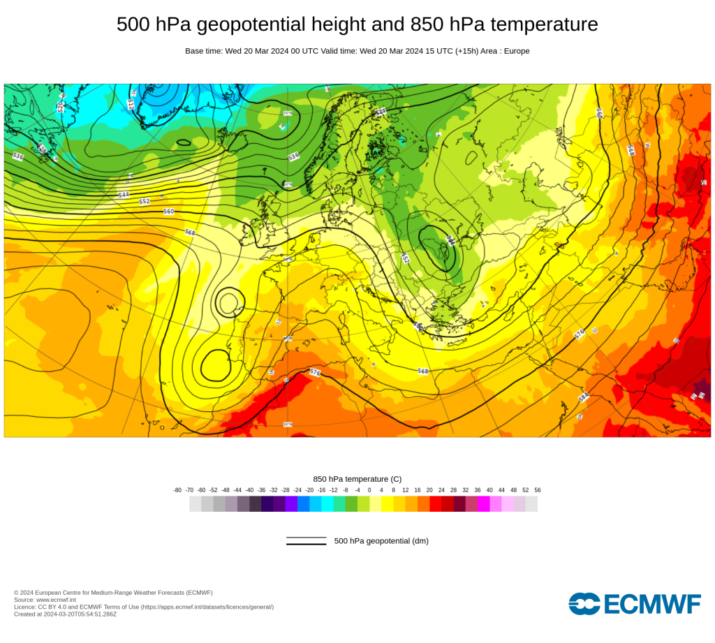
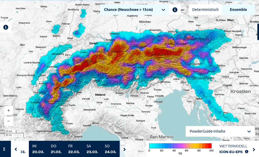
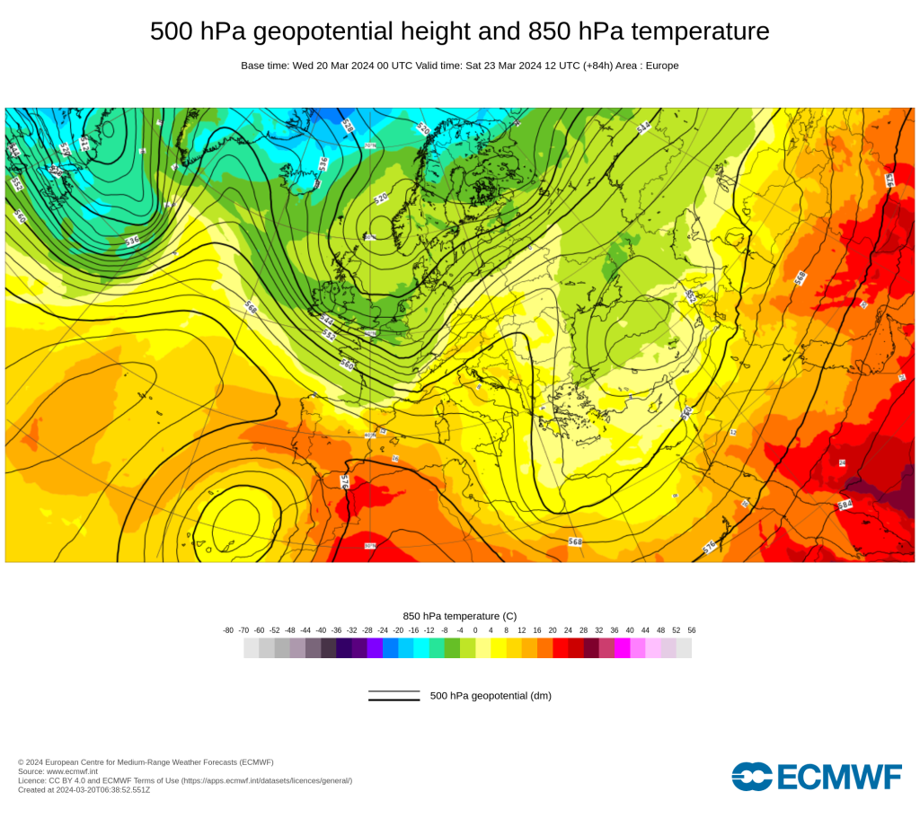
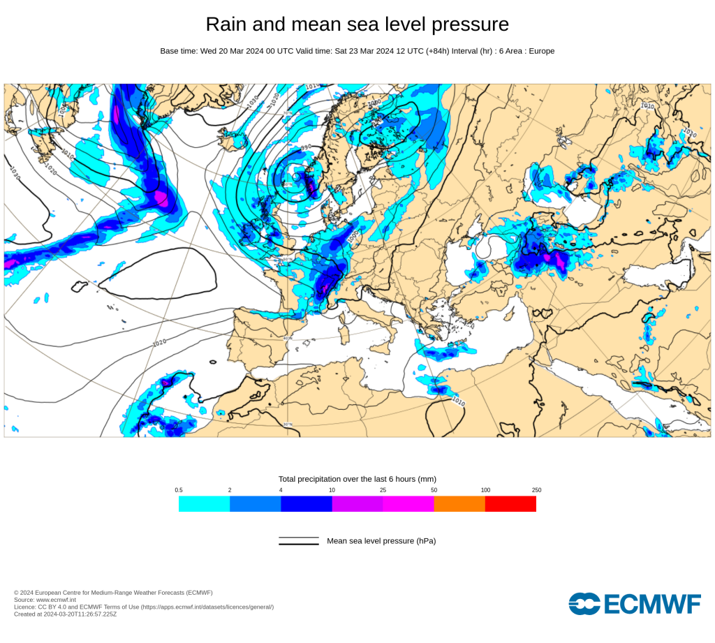
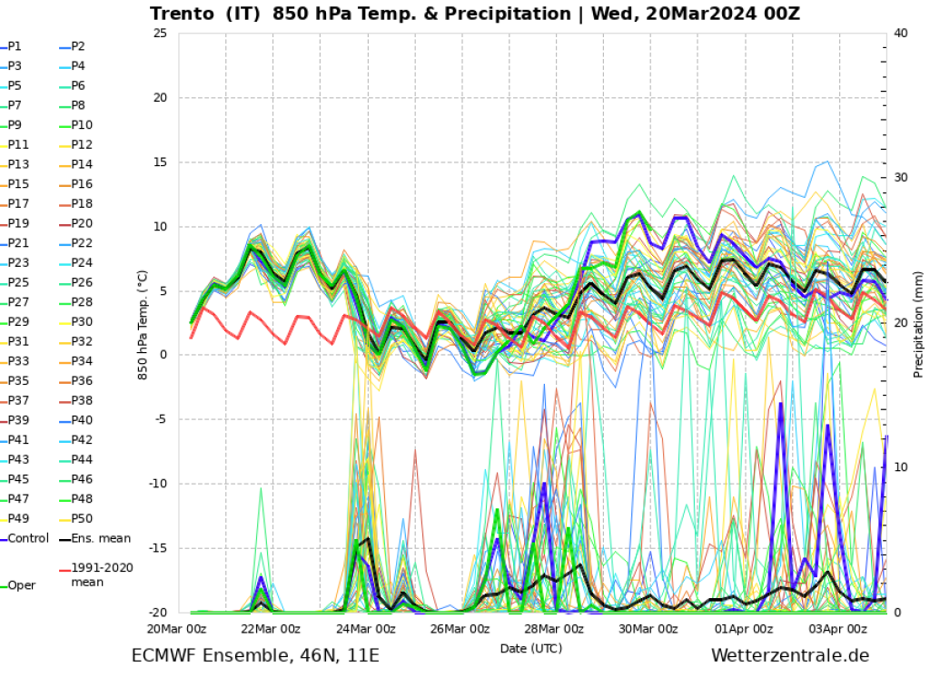
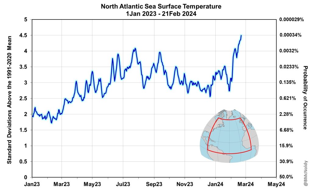
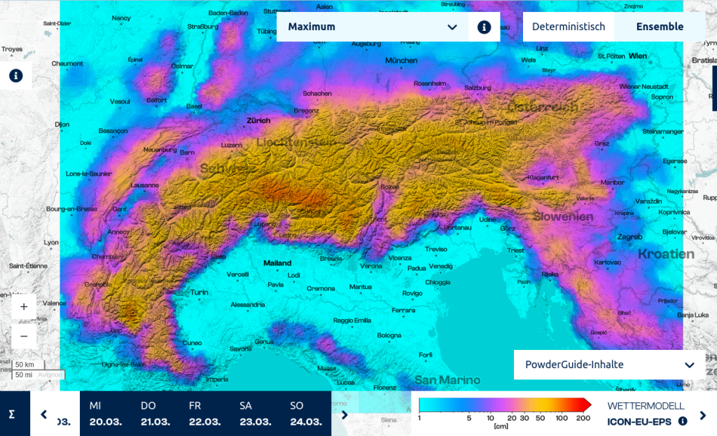
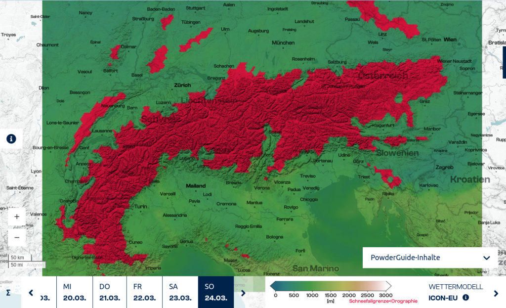
An intermediate high is dominating the weather in Central Europe at the astronomical start of spring, it is sunny and pleasantly warm. The Freeride World Tour has scheduled the Verbier Xtreme for Friday, one day before the official weather window, because something is brewing. There is a lively cyclogenesis over the North Atlantic, and the British Isles, northern France and Germany, and Scandinavia are in for stormy times. The cold front will also reach the northern side of the Alps by midday on Saturday, spilling over the entire Alpine region and hitting the entire Alpine region, flooding us with cool temperatures. On Sunday, the snow line will drop below 1000 metres almost everywhere. This could be seen as another winter comeback, and although the precipitation amounts aren't that high, I'm expecting a PowderAlarm!

WeatherBlogs
presented by

Medium-term prospects

But things will also remain exciting in the medium term. There are signs of a deep trough forming in the middle of next week, which should transfrom into a low pressure area in the Mediterranean and bring further precipitation to the Mediterranean region and the southern side of the Alps. It is, of course, uncertain how their aggregate state will turn out - but it is likely to be much more liquid. So, winter is far from over and I'm looking forward to my colleague Orakel's further assessment.

The hot Atlantic

Record mean sea surface temperatures were already recorded in the North Atlantic in 2023 - the waters were warmer than ever before. The same was true for the Mediterranean Sea, and as a result of increased heat and moisture fluxes from sea to atmosphere, the Mediterranean region was hit by a large number of heavy rainfall events and catastrophic floods (May: Italy/Balkans, August: Slovenia, August: Cyclone Daniel Greece/Bulgaria and Lybia). However, with regard to the Atlantic, the current situation is difficult to comprehend, as the warming relative to the seasonal mean has continued. Finally, for 22 February 2024, mean sea surface temperatures in the North Atlantic were reported to be four and a half (4.5) standard deviations above the climatological mean. Since trends in the oceans do not change as quickly as in the atmosphere, we can expect the following effects over the next six months: increased coral bleaching, intensified tropical and extratropical cyclogenesis. In other words, the Gulf Stream is too warm. The Atlantic Meridional Overturning Circulation (AMOC), whose possible collapse has already been discussed recently, is a thermohaline circulation and is driven by the sinking of water masses in the North Atlantic. This works according to Archimede's principle: due to heat and moisture fluxes from the ocean to the atmosphere, the density of the seawater decreases due to cooling and increasing salinity, and "convection" of the dense water masses down to the sea floor occurs. It is to be expected that the current warm water temperatures represent a reduction in this forcing and cause a deceleration of the AMOC, and this process has actually been observed for some time (decades) [see also here at severe-weather.eu]. Nevertheless, a day-after-tomorrow scenario is not to be feared, also because the super cyclones shown there are totally insane, but the situation is worrying or romantic-apocalyptic.

Photo gallery

This article has been automatically translated by DeepL with subsequent editing. If you notice any spelling or grammatical errors or if the translation has lost its meaning, please write an e-mail to the editors.

Show original (German)

Related articles

Comments

WeatherBlogs
presented by