Skip to content

Cookies 🍪

This site uses cookies that need consent.

Learn more

Zur Powderguide-Startseite Zur Powderguide-Startseite

Language selection

Search PowderGuide

TouringTips

TouringTip | Five days in the Silvretta

Sun, fog, powder and rösti

by Benjamin Kraft 04/18/2024
After our annual ski crossing was cancelled last year due to the lack of snow in the Alps, we really wanted to discover new places again this winter and spend several days in mountain huts. Our main criteria for this were to find an area that was previously unknown to all of us, that could be reached from Innsbruck within two hours and where there were many different options for experiencing nature.

In view of the heavy snowfall at the beginning of the winter, we quickly decided on the Silvretta when planning our trip at the end of December - a good choice, as it turned out almost three months later.

So after booking our huts early and planning our potential tours in the Silvretta region, we're delighted to finally get going. Two nights at the Wiesbadener Hütte (2,443 m) and two nights at the Tuoi Hütte (2,250 m) are on the agenda to explore the Silvretta. We chose these two huts because we wanted to spend several days in a similar area in order to really explore a lot, and also to be flexible in view of the uncertain weather forecasts and not have to change huts every day. Of course, the other huts in the area (e.g. Heidelberger Hütte and Jamtalhütte) are also very interesting and their surrounding mountains are worth skiing, but getting a place there proved to be impossible this year.

Day 1: Ascent to the Wiesbadener Hütte - but how?

Our destination on the first day is the Wiesbadener Hütte. Getting there in summer is easy thanks to the pass road to the Bielerhöhe, but in winter the logistics are much more complicated. There are three sensible routes to get to the Wiesbadener Hütte in winter.

  1. By car (journey time from Innsbruck: 2h 15min) or by public transport to Partenen in Montafon, then take the Vermuntbahn cable car and the tunnel bus to Bielerhöhe (costs €41.50). From there, skin up through the Ochsental valley to the hut (approx. 2 h and 400 m ascent).

  2. From the Tyrolean side to Galtür by car (journey time from Innsbruck: 1h 30min - permanent car park available in Galtür) or by public transport and continue by bus to Wirl. From here, the pass road to Bielerhöhe is groomed as a cross-country ski trail. There are then two options for the rest of the ascent: either as in 1. through the Ochsental valley, or 2. through the Bieltal valley with a detour to one of the peaks (e.g. Bieltalkopf, Tiroler Kopf or Rauer Kopf) and then downhill to the hut.

As the journey to Montafon is too long and the route from Wirl too far (at least 14 km and 1,200 metres in altitude without summit and descent), we opt for the third option:

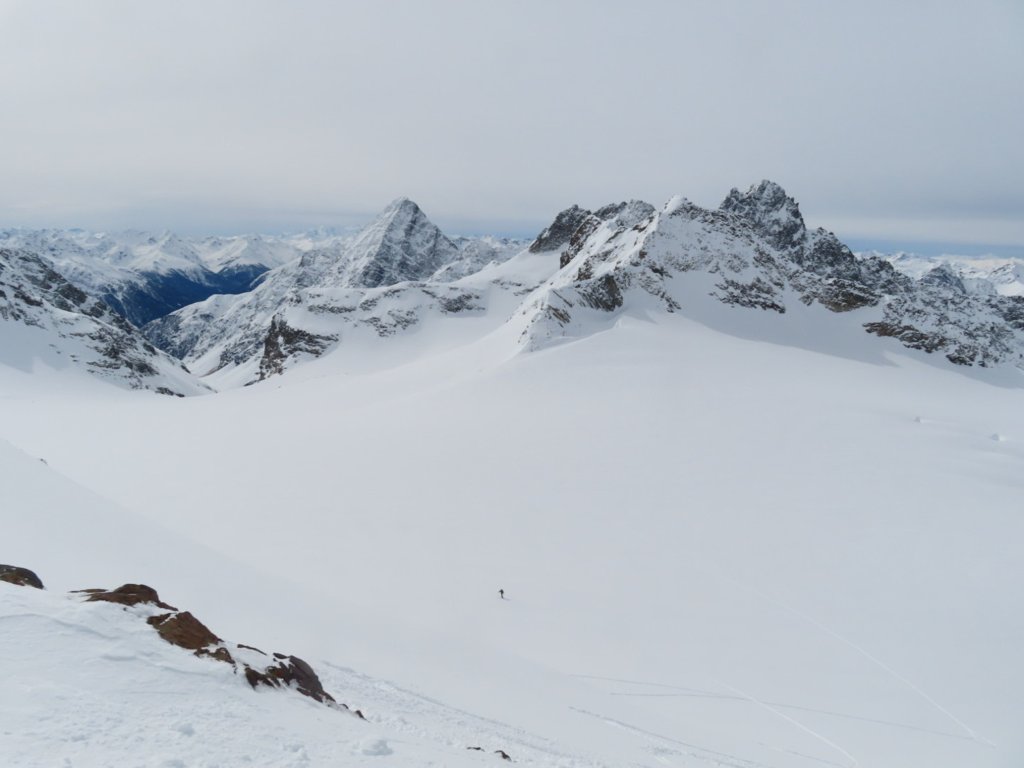
  1. From Guarda in Graubünden (journey time from Innsbruck: 1h 50min), ascent past the Tuoi Hut to the Vermunt Pass at 2,798 m and then descent to the Wiesbadener Hut. This results in an ascent of 8 km and 1,200 metres of ascent, followed by a 350-metre descent to the hut.

TouringTips
presented by
Ad

We set off from Guarda at around 10 a.m. and are very surprised by the good weather, as various forecasts had predicted diffuse radiation and little sun for the day. The car park is located right at the entrance to Guarda (driving is prohibited in the rest of the village except for residents) and offers a good starting point with reasonable prices (CHF 8 for the first day, CHF 2 for each additional day - the machine only takes coins, but also €). We only have to carry our skis through the village for about 50 metres, but can then strap on our skis directly on the prepared forest path and set off.

The rest of the route follows the forest road to Alp Suot, always with the Piz Buin, the Vermunt Pass and, in places, the Tuoi Hut in view. You can already prepare yourself for the fact that the path from the Tuoi hut up to the pass will be quite long due to the warm temperatures and the heavy backack.

We walk step by step in the sun and get closer and closer to our destination. The ascent to the Tuoi hut was very easy, as the forest path is quite flat and pleasant to walk on. Even though the sun was blazing, it was still fun and the anticipation of the next few days spurred us on. After 2.5 hours and 650 metres of ascent, we arrive at the Tuoi hut and briefly take in the upcoming ascent. Now we have to tackle a 350-metre slope littered with hairpin bends, which, given the temperature, is going to be torture. After 45 sweat-inducing minutes, we arrive in a hollow at 2,600 metres, where there is a small lake in summer. We take a break in the sun in our T-shirts and wonder whether it really is still winter.

The last 200 metres up to the pass are then entertaining and the descent to the Wiesbadener Hütte is quickly completed, as we are really looking forward to something cold to drink and a small snack.

It's a little difficult to write much about the descent to the Wiesbadener Hütte from the Vermuntpass, as it's quite flat and actually a long traverse of the slope.

When we arrive at the hut, we are somewhat overwhelmed by its size. With 200 beds, the Wiesbadener Hütte is the sixth largest DAV hut in the Alps. No wonder it's quite a struggle to get the waiter to our table to finally order our well-earned cold drinks.

Summary day 1:

  • Trail: Guarda (CH) - Tuoi Hütte - Vermuntpass - Wiesbadener Hütte

  • Altitude metres: 1,250 m uphill and 350 m downhill

  • Trail distance on the ascent: approx. 8 km

  • Planned time to the pass: approx. 4.5 hours

Day 2: Good weather? Three-country peak!

The weather forecast for the next day is again changeable, but a look out of the parlour at breakfast suggests a cloudless day. So we decide to attempt the Dreiländerspitze and set off from the hut at around 7.45 a.m. with skins towards the Vermunt Glacier. We are almost alone on the way, as most of the guided groups are heading towards Piz Buin to climb the highest mountain in Vorarlberg. We make good progress in a fine 15 cm of powder snow and reach the upper Ochsenscharte at 2,955 m after about 1 hour 15 minutes, which is a transition to the Jamtalferner and the Jamtalhütte.

From here, we continue in hairpin bends over the north-west flank of the Dreiländerspitze to the ski depot at approx. 3,100 m (1h 45min). After switching to crampons and ice axes, the summit ridge is well snow-covered and easy. If the snow conditions are poor, the ridge can be secured with the help of bolts. We make rapid progress and after around 2.5 hours from the Wiesbadener Hütte, we are the first to reach the Dreiländerspitze (3,197 m) today. Incidentally, this is so named because the borders of Tyrol, Vorarlberg and Graubünden meet here.

On the descent from the Dreiländerspitze, we are met by several rope teams and are pleased to be the first to enjoy the good, untracked descent. As it is still very early in the day and the weather is stable, we decide to ski down the Vermunt Glacier on the orographic left edge and tackle the ascent to Piz Mon (2,982 m). The descent from the Dreiländerspitze awaits us with soft, dry powder and rounds off the experience perfectly.

From a dip at 2,700 metres above sea level, we then set off on the ascent towards Piz Mon, which is described in the Panico Silvretta ski touring guide as not very difficult. We can easily reach the ski depot at 2,900 metres, but the subsequent ridge is an insurmountable obstacle due to the waist-deep powder snow on slabby rocks. So we decide to simply brush up on our climbing skills and rescue techniques at the top of the ridge and spend almost the whole afternoon scrambling around on the ridge and enjoying the sun.

The subsequent descent back to the Wiesbadener Hütte is still very powdery on the north side, but everything that was exposed to the sun has quite a cover and is difficult to ride. Arriving at the hut, clouds slowly gather and the onset of snowfall causes us both joy and concern. Joy, because we know that the unpleasant lid will then be covered in snow, worry, because tomorrow we have to change our hut to the Tuoi Hut and we actually have two interesting options in mind, but they require stable weather.

After dinner, we check the weather outside again and are surprised at how much snow has accumulated in view of the fresh 10 cm of powder with further snowfall. So we decide that we won't decide anything today, but will make our plan spontaneously tomorrow. While we are discussing this, we are suddenly visited by an unexpected guest: a fox who, as we learn on enquiry, lives behind the hut by the waste. We will see him outside our room window when we go to bed - a very open-minded fellow who clearly has a good time up here.

Summary day 2:

  • Trail: Wiesbadener Hütte - Obere Ochsenscharte - Dreiländerspitze - Piz Mon - Wiesbadener Hütte

  • Altitude metres: 1,100 m uphill and downhill, up to the Dreiländerspitze 750 m

  • Trail distance on the ascent: approx. 4 km

  • Planned time to the summit: approx. 2.5 hours

Day 3: Poor visibility, renunciation?!

The snowfall that started yesterday evening continued through the night and brought almost 20 cm of fresh snow, which of course makes us happy from a skiing point of view, but probably puts a spanner on the works for today. We had considered two options for the change to the Tuoi Hut, with the safe option via the Vermunt Pass in the back of our minds:

  1. Descent via the Obere Ochsenscharte to the Jamtalferner up to approx. 2,500 m, ascent from there and descent via the Piz Urezzas (3,065 m) to the Tuoi hut.

  2. Descent via the Ochsentalergletscher towards Piz Buin, then via the Fuorcla dal Cunfin and Plan Rai to the Tuoi hut.

As the weather improves slightly during breakfast and we know parts of the route from yesterday, we decide to try the first route. However, with the option in mind of possibly riding from the Obere Ochsenscharte to the Vermunt Pass and choosing the safer option to the Tuoi Hut.

Just as we leave the hut, the snowfall gets heavier again and fog rolls in. We are glad that a group ahead of us has already made tracks, as contrasts are currently in short supply and we are not sure whether we are ascending or descending.

Nevertheless, we tell ourselves that we will at least go to the Obere Ochsenscharte. The sun, which keeps coming out, also encourages us in our plan to at least see what the day brings. Once we reach the top of the Ochsenscharte, however, we realise that there is fog on the Jamtalferner and the cold wind is not exactly motivating us to attempt the tour. So we decide to climb up a little more and ski down the same way as yesterday. The powder is even better today, so it's no problem for us that this option doesn't work. After a short break, we climb out of the valley up to the Vermunt Pass, where the wind is icy at what feels like 100 km/h, so we quickly transition and set off on the descent to the Tuoi Hut. On this side of the Silvretta, the visibility is a little better, but it has also snowed heavily here. We are rewarded for our decision with 500 metres of fine powder with reasonably good visibility and arrive at the Tuoi hut satisfied.

It's just before midday and we decide to take a short break at the Tuoi Hut and get rid of some of our luggage. On entering the hut, we are presented with a complete contrast to the Wiesbadener Hütte. The Tuoi Hütte impresses with its rustic parlour and fine, cosy rooms. But this hut also knows how to score points in culinary terms: After an Ovomaltine and some very tasty rösti, we are full of energy and decide to set off on a short tour with light luggage from the Tuoi Hütte.

As we actually wanted to descend from Piz Urezzas, we decide to head in this direction and choose Furcletta (2,734 m) as our destination. This is a nice transition towards Ardez and offers views of completely different parts of the Silvretta. Thanks to the more stable weather on the Swiss side, we can enjoy another ascent and a few downhill turns in the sun and arrive back at the Tuoi hut after about 3 hours, satisfied and hungry.

Summary day 3:

  • Trail: Wiesbadener Hütte - Obere Ochsenscharte - Vermuntpass - Tuoi Hütte - Furcletta - Tuoi Hütte

  • Altitude metres: 1,100 m uphill and downhill

  • Trail distance on the ascent: approx. 7 km

  • Planned total time: approx. 5 hours

TouringTips
presented by
Ad

Day 4: Good visibility? Double shift!

Today promises good weather at least until midday, so we set off towards the Silvrettahorn at around 7.30 am, as we haven't yet got to know this part of the Silvretta in the last few days. From the Tuoi hut, the ascent towards Plan Rai starts with a 500-metre hairpin bend party, accompanied by plenty of sun and wind. From around 2,750 metres, the terrain slowly begins to recede and we discover the last foothills (or dead ice fields?) of the Plan Rai glacier. The rest of the route to the saddle opens up and the good weather, marred only by a few foehn lenses, makes us dream of a good descent.

We descent shortly from the saddle (Plan Mezdi) to La Cudera and continue our rope-free ascent over the glacier towards the Silvretta Pass (2,987 m). Here we decide to climb the Silvretta-Egghorn, as the descent looks more rewarding. A short steep ascent with a few hairpin bends and a short ascent on foot later, we reach the summit of the Silvretta-Egghorn and look out over the vastness of the Silvretta region, see our sleeping place from the previous days (Wiesbadener Hütte), the Piz Buin, the Silvrettahorn, the Piz Linard, the Ortler group and the Bernina. Simply a fantastic view, which is rewarded with a beautiful descent in powder snow.

We now have more than 1,000 metres of climbing in our bones, but somehow not enough. Maybe that's because the weather forecast for tomorrow is bad and we'll probably only be travelling from the Tuoi hut down into the valley on day 5. So we head back to La Cudera and climb again from 2,800 m to the Fuorcla dal Cunfin (3,043 m), the transition to the Ochsental glacier and Piz Buin. The ascent is steep and saps our strength, but the good snow mobilises our energy reserves once again. Once at the top, we are rewarded with an incredible panoramic view and are glad that we put in this double shift after all. 

The descent in the powder is fantastic again and we continue without a break to the last Anfellplatz, as we still have to climb from La Cudera to the saddle (Plan Mezdi) to get back to the Tuoi hut. These last 50 metres of ascent are easy because we know that good snow awaits us on the other side. This 600-metre descent is a pleasure in good powder (but also in firn) and we arrive at the Tuoi hut happy, satisfied but very hungry. How could it be otherwise, we once again choose the delicious rösti for lunch, as you can see, I can only warmly recommend it.

Summary day 4:

  • Trail: Tuoi Hütte - Plan Rai - Plan Mezdi - Silvrettapass - Silvretta Egghorn - La Cudera - Fuorcla dal Cunfin - La Cudera - Plan Mezdi - Tuoi Hütte

  • Metres in altitude: 1.400 metres uphill and downhill

  • Distance on the ascent: approx. 8 km

  • Planned total time: approx. 5 hours

Day 5: Wet pleasure

Unfortunately, the weather forecast for day 5 is miserable, so we decide to practise the crevasse rescue from the hut terrace in the morning, but then head down into the valley. The descent is physically and mentally exhausting in this sticky snow, as almost half the route has to be pushed, as the gradient is unfortunately not sufficient to get over the short counter ascents. With the onset of snowfall and rain from below 2,000 metres, the whole thing also becomes a waterproof test for our hardshell material, so that we arrive back in Guarda about 1 hour later, wet inside and out. A little cold, but very satisfied, we get into the car and are already looking forward to the next ski crossing, hopefully next winter.

Summary day 5:

  • Trail: Tuoi hut - Alp Suot - Guarda

  • Altitude metres: 600 m downhill

  • Trail distance in ascent: 0 km

  • Planned total time: approx. 1 hour

A FEW TIPS FOR THE TOUR

Taking glacier equipment, crampons and ice axe with you is obligatory on the tour and also opens up many other descent and ascent options. Even if the glaciers are sometimes very small and have few crevasses - better safe than sorry!

The Tuoi Hut offers great firn terrain, so if you want to stay here longer, you will easily find tours for several days.

You should expect to pay around €60 per day for a place to sleep and half board, plus drinks and other catering. We would also like to take this opportunity to thank the Alpine Club Youth for supporting us financially! This is a cool initiative for people under 30 who plan and organise their own alpine tours. So definitely check it out.

The times we give are usually very generous, we were usually a little quicker.

The huts should also be booked well in advance. The Austrian huts in the Silvretta (Jamtalhütte and Wiesbadener Hütte) and the Heidelberger Hütte in particular are always busy.

Earplugs ensure a good night's sleep.

Sun cream with SPF 50+ is definitely advisable. We also learnt from the mistakes we made on our Ötztal tour and this time we also applied sun cream to our thighs (at least 2 out of 3).

The Alpine Club map AV 26 Silvretta contains a lot of information that you need for planning. I also recommend the Panico Silvretta ski touring guide. There are also GPS tracks for the Alpenvereinaktiv app, which is very useful in uncertain weather conditions. We also used Google Earth and Fatmap for planning.

Note: The PG touring tips are general descriptions of tours that we like subjectively. Our touring tips do NOT refer to CURRENT CONDITIONS. Read the situation report and the weather forecast and plan your tour accordingly.

This article has been automatically translated by DeepL with subsequent editing. If you notice any spelling or grammatical errors or if the translation has lost its meaning, please write an e-mail to the editors.

Show original (German)

Comments

TouringTips
presented by