Skip to content

Cookies 🍪

This site uses cookies that need consent.

Learn more

Zur Powderguide-Startseite Zur Powderguide-Startseite

Language selection

Search PowderGuide

TouringTips

TouringTip | Eastern Puez Peak Canale Nord

Feinste Dolomite gullies in a quiet touring area

by Tobias Hipp 03/09/2018
At 2,913 m, the Östl. Puezspitze is one of the highest peaks in the Puez-Geisler group in the Dolomites. In combination with the northern descent, this tour is certainly one of the most beautiful, but also most challenging undertakings in the mountain group.

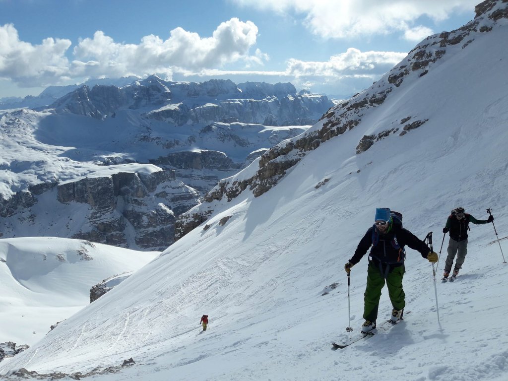
An absolute tip for ski tourers. Because: in the nature park of the same name, there are no lifts far and wide to make the ascent easier (as is usual in many other places in the Dolomites). The clear advantage: less crowds and a better chance of untracked descents.

HOW TO GET STARTED

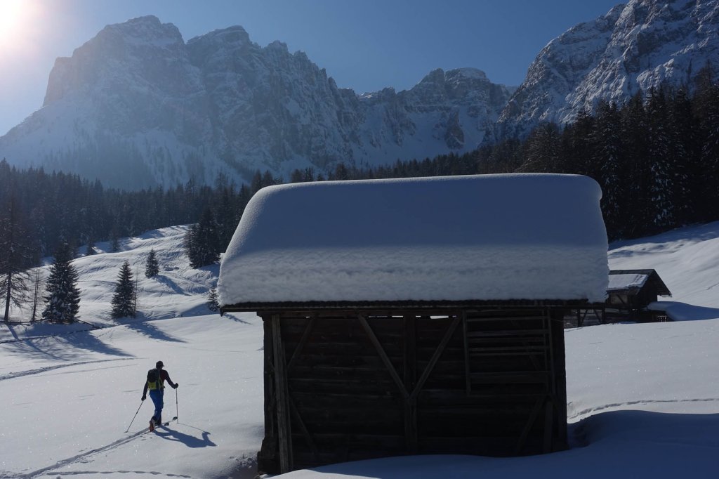
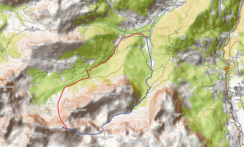
The starting point of the tour is the small village of Campill or Lungiarü, as it is called in Ladin here in the region. From the tour parking lot at the end of the valley ("at the back left), cross the still flat alpine meadows in a southerly direction. You soon overcome a steep step on a forest road and find yourself in the middle between the Dolomite peaks of the Ciampani to the left (south) and Zwischenkofel/Antersasc to the right (north).

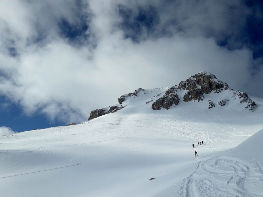
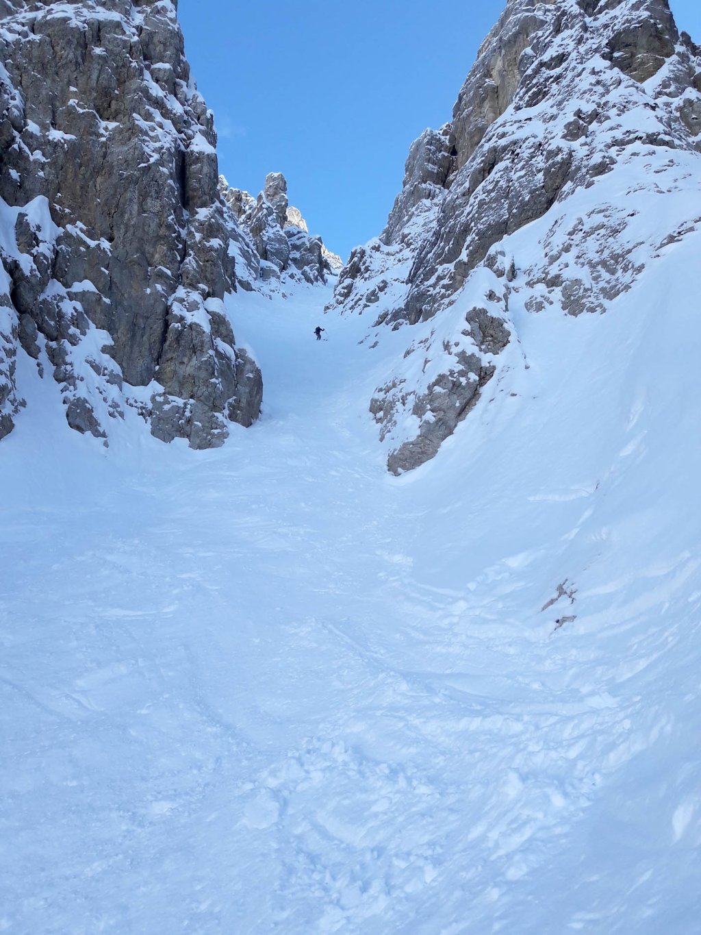
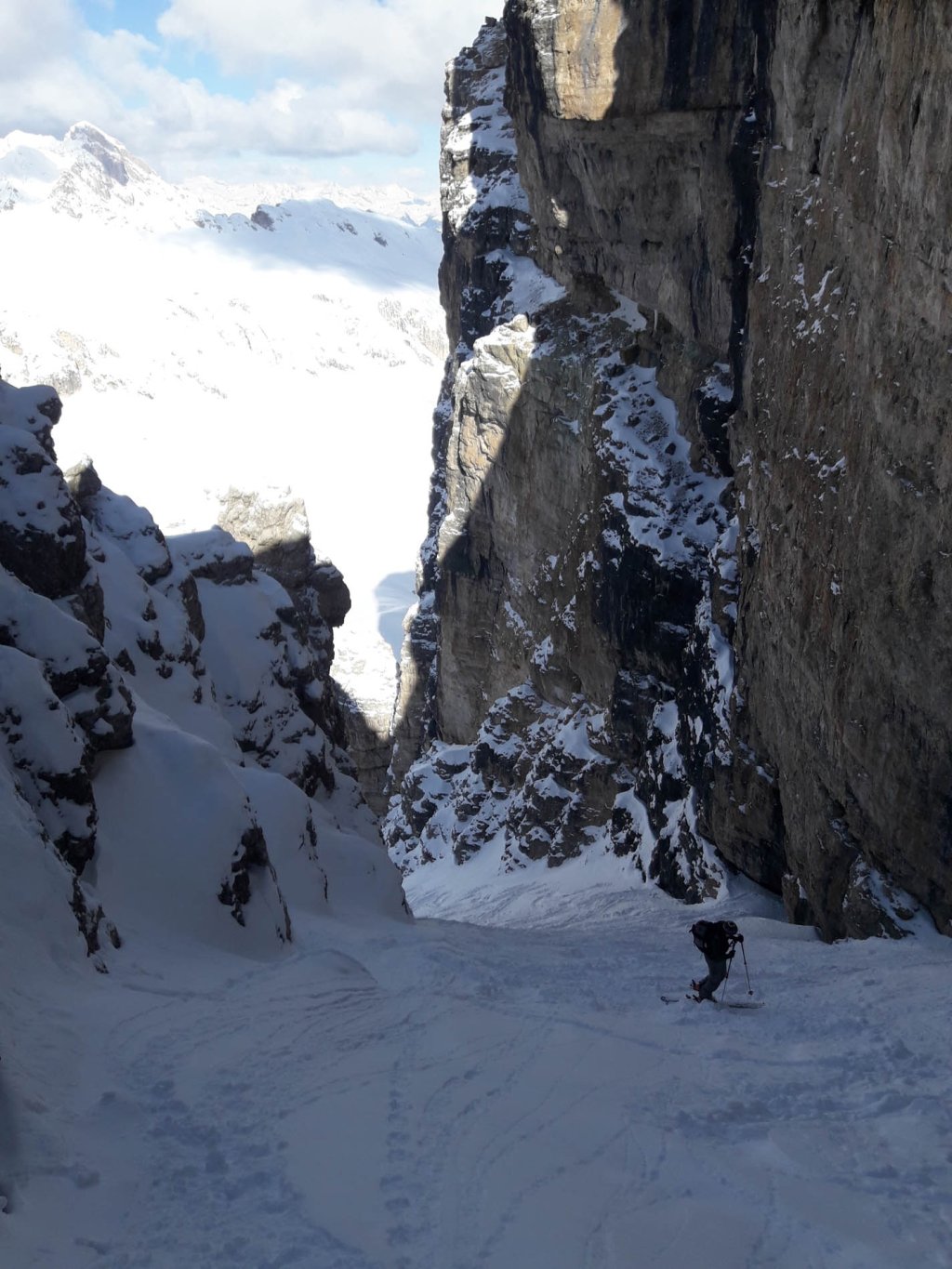
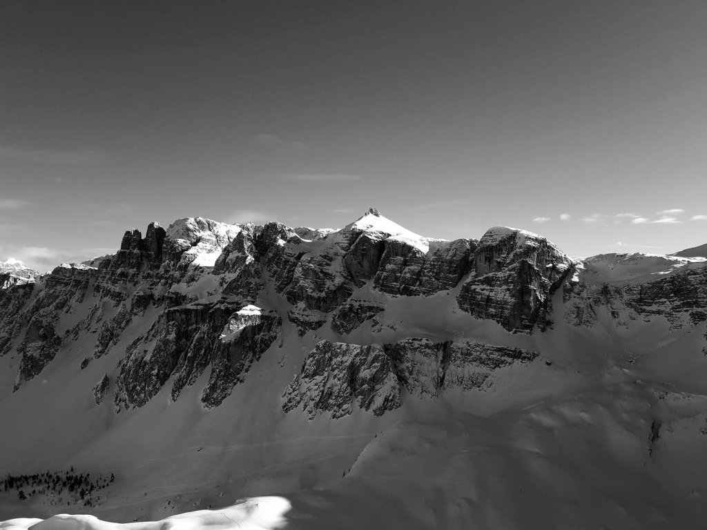
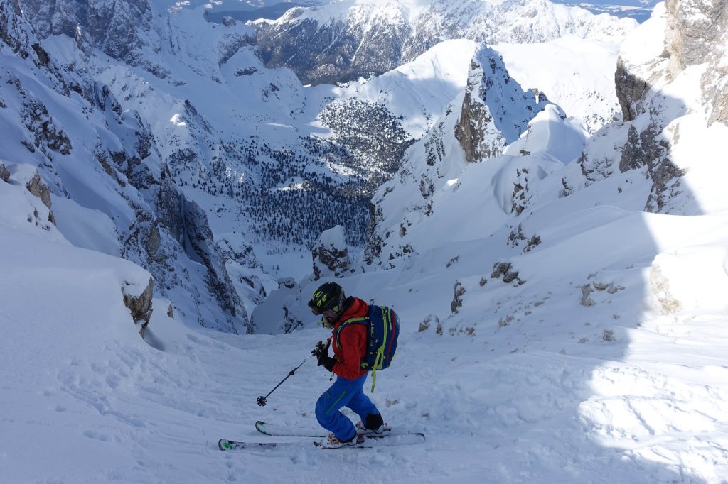
Continue in the direction of Zwischenkofelalm over domed terrain on the valley floor. The key section is very well hidden between the rocks and is usually not visible from the ascent route. Above the Zwischenkofelalm, a wide gully leads southwest up to a plateau between the Puezkofel and Puez peaks. Here you need a few hairpin bends and a good assessment of the avalanche danger: the 35° mark is reached here. Once you have overcome this hurdle, the evenly steep summit slope (30°) to the Puez peaks follows.

TouringTips
presented by

From here, you can already see the striking saddle on the ridge where the north gully begins.

The ascent inevitably ends in this saddle and the entrance to the north gully, our descent option, which cannot be overlooked. The summit is around 50 m higher.

DESCENT "CANALE NORD"

The descent leads through the gully without any obstacles down into the Sopedaces valley to the north. The entrance is also the steepest part of the gully at just over 40°. Even in a snowy winter, there are many stones lurking here, so the first few meters usually have to be descended without any problems or carefully slid down.

After that, the track is clear and the gully runs straight down at 35° to max. 40° to over 600m. At the end of the gully, another 400 vertical meters of the finest north-facing slopes await, at the end in sparse mountain forest. The skis then quickly run out on the forest road back to the starting point.

If the conditions in the gully are not good or the avalanche situation does not allow entry, you can easily ski down via the ascent route.

CONCLUSION

Dolomite ski tour in lonely and impressive surroundings with a steep descent through an impressive northern gully.

The gully is homogeneously steep (35-40°), but never particularly difficult. The steepest point is the entrance to the gully, which briefly (30-40m) exceeds 40°.

TIP

Lungiarü is certainly ideal for an extended touring weekend: the accommodation options are excellent and not expensive, the touring area extensive. Both in the massif around the Ciampac and from the Antersasc, there are at least as many interesting north gullies waiting to be climbed. Easier tours are also possible directly from the village, e.g. to the famous Peitlerkofel.

The special feature in Lungiarü: there are no ski areas in the entire mountain range. All peaks and tours are only accessible "by fair means". So if you're looking for peace and quiet, you've come to the right place. In addition, the chances of finding untracked gullies and slopes are much higher than in the neighboring Sella area, for example.

INFORMATION

Difficulty (5-level scale): ****

Duration: 4-5 hours

Altitude difference: 1,500 m

Max. Slope: 45° (short section at the start of the gully)

Exposure ascent: E and S

Exposure ascent: N

Descent option: It is of course also possible to descend via the ascent route.

Photo gallery

This article has been automatically translated by DeepL with subsequent editing. If you notice any spelling or grammatical errors or if the translation has lost its meaning, please write an e-mail to the editors.

Show original (German)

Related articles

Comments

TouringTips
presented by