Schneeberg
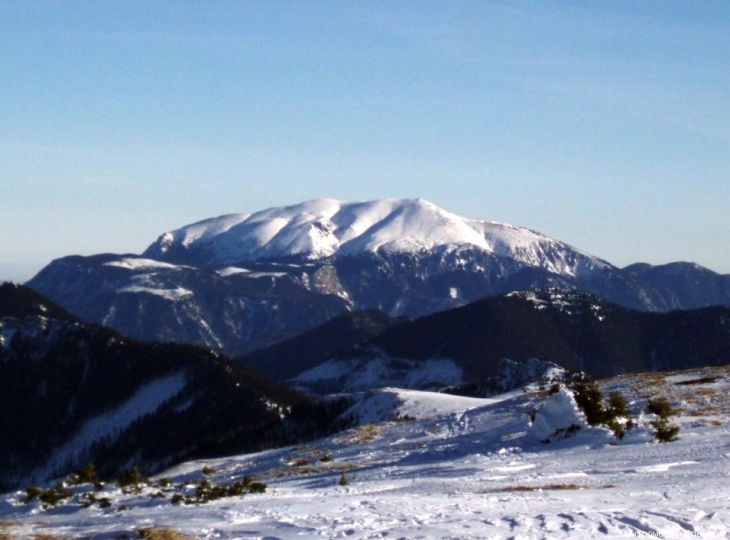
From the summit of the Göller, the parade ski mountain of the eastern edge of the Alps, the Schneeberg (the highest mountain in Lower Austria at 2076 m), shows its gentle side. This mountain offers such diverse terrain that it even has its own up-to-date ski guide with a total of 200 descents and variants on 240 pages. This mountain was first climbed on skis in 1895, again by the well-known Toni Schruf.
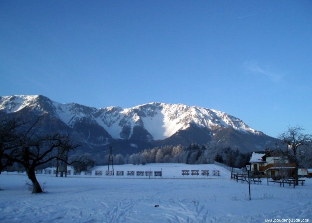
However, the Schneeberg is much more impressive from the north-east, more precisely from the Puchberg basin. The Schneeberg is the easternmost two-thousand-metre peak in the Alps, and thanks to its proximity to the city of Vienna, it is of course very accessible (cog railroad up to almost 1800m). Unfortunately (or fortunately), this cog railroad no longer operates in winter. The track is usually only cleared at the end of April and operations resume. After good winters, however, this allows even the laziest of climbers relatively easy access to the numerous gullies and cirques (although skis then have to be carried further down into the valley ?).
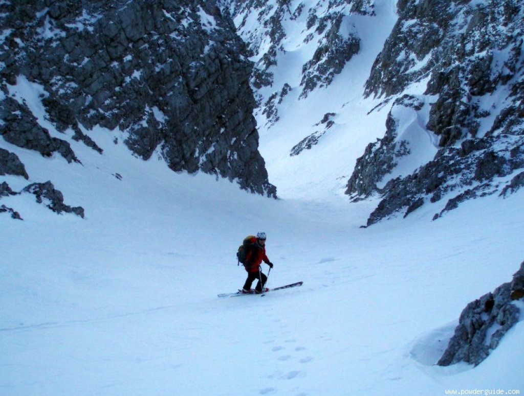
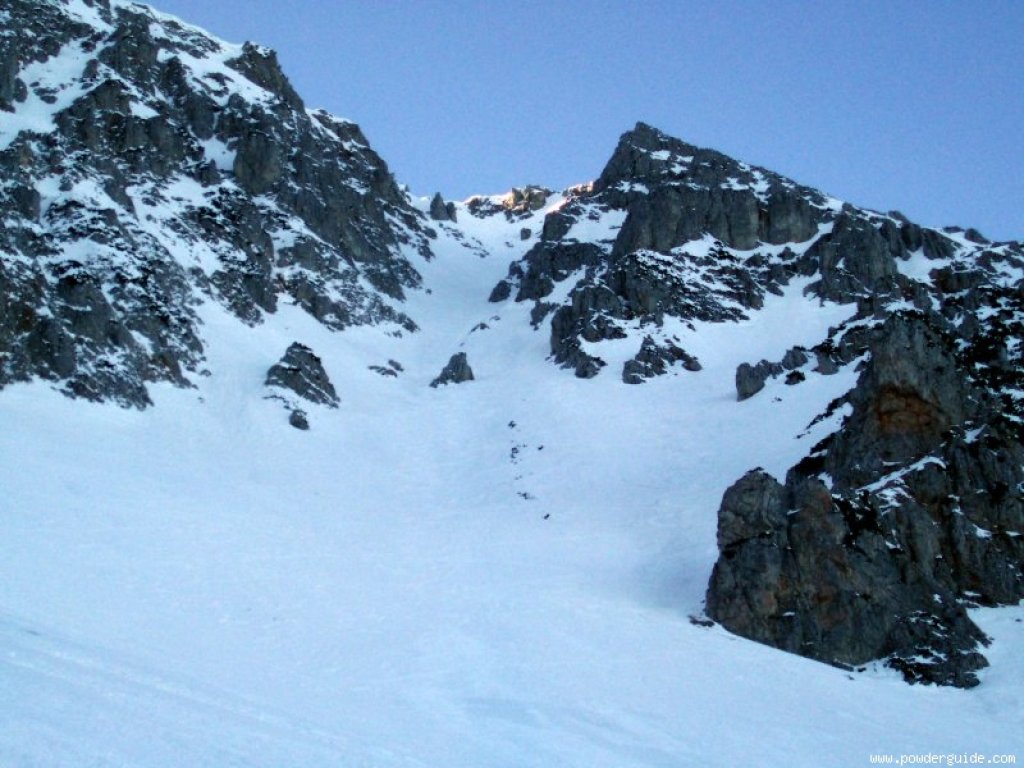
In Losenheim, on the north-eastern edge of the Schneeberg, there is also a small ski area (approx. 850-1250m), whose chairlift significantly shortens the ascent to the summit (namely by 400 vertical meters). The ascent via the Fadenweg trail circles the north-east corner of the Schneeberg and is groomed practically all winter long. The (shorter) ascent via the Fadensteig is more alpine, leading partly through rocky terrain (some insurance) and may also require crampons in poor conditions. Right next to the Kaiserstein (2061m) is the Fischerhütte (2049m), which is open but not open in winter and offers welcome protection from the strong winds that are unfortunately common here. The relatively easy standard descents lead down the north-western slopes: Wurzengraben (flat entrance directly from the Fischerhütte) and Schneegraben (steep entrance directly from the Klosterwappen, the highest elevation of the Schneeberg, adorned with the radar installations of the Austrian Armed Forces). The Salvisgraben (beautiful descent with a very steep and narrow passage) and the Hoyosgraben can be reached via the often windswept slopes north of the Kaiserstein.
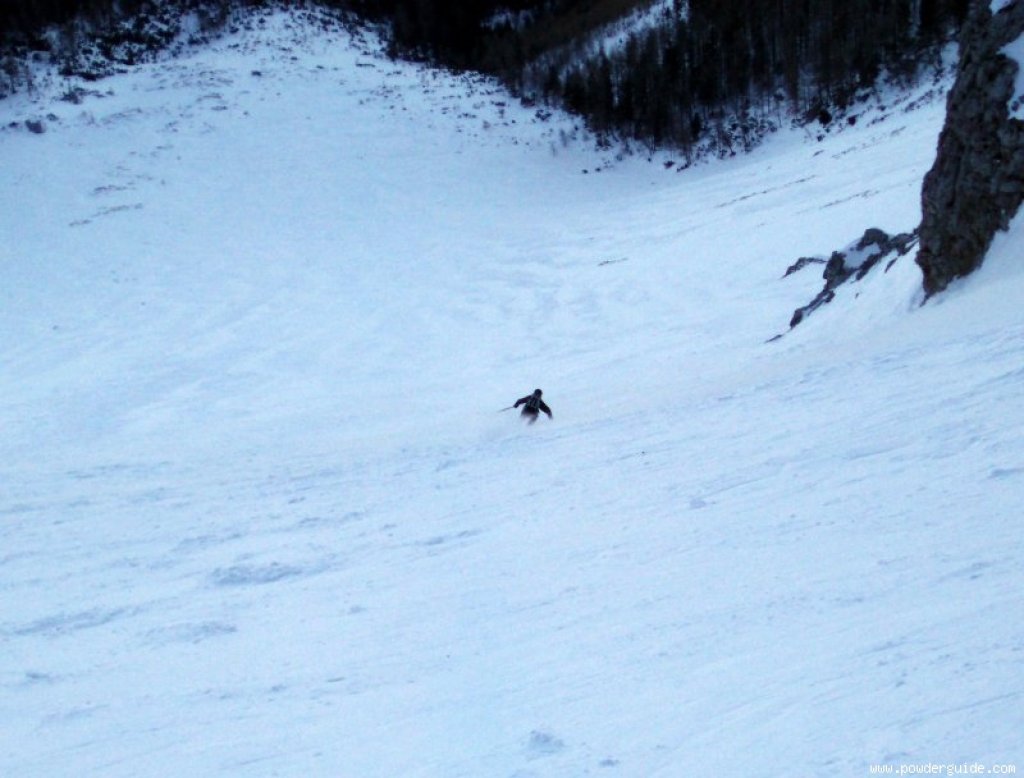
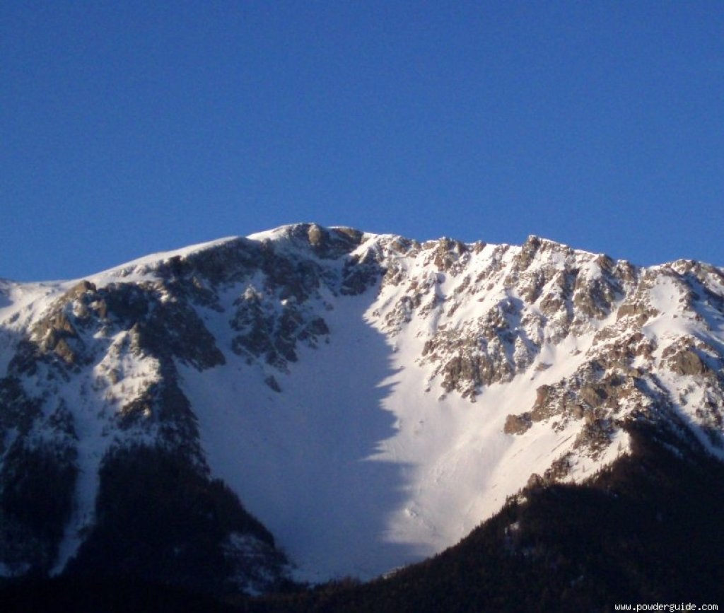
The most famous - and most popular - descent, however, is the one through the Breite Ries (the gullies and cirques here are called "Riesen"). The Breite Ries is historically significant (first ascent around 1900), when skiing pioneer Matthias Zdarsky succeeded here in 1905 in impressively demonstrating the superiority of alpine skiing in the Alps over his Nordic competitor and Hollmenkamm winner Hassa Horn...
Known steep runs that are a little more challenging than the Breite Ries are the Rote Schüttflanke (leads into the Breite Ries cirque) and the Lahning Ries (leads directly into one of the pistes in the Losenheim ski area). In principle, however, practically all gullies and flanks can be skied in suitable conditions. More information can be found in the aforementioned Schneeberg ski guide (by Wolfgang Ladenbauer, published by Schall-Verlag, Vienna, 2007).
Directly in the summit area (south of the Fischerhütte and the monastery emblem) is the Hackermulde - nice enough for a few turns to warm up. This became sadly famous due to a tragic accident on 25 March 1912 when an avalanche triggered by a rockfall fatally buried a certain Dr. Aemilius Hacker and nine of his companions.
Rax - the Lower Austrian La Grave
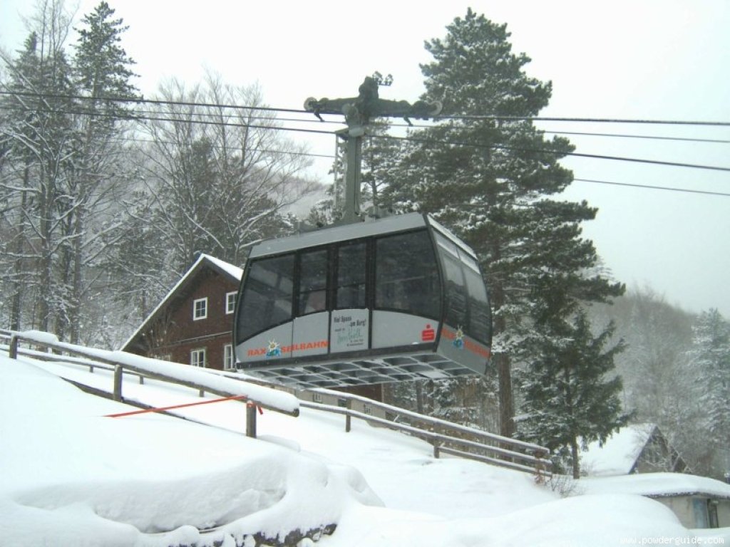
Directly adjacent to the Schneeberg (separated by the deeply incised, wildly romantic Höllental valley) is the Rax, whose highest peak (Heukuppe, 2007) is already back in Styria. In a way, the Rax is the starting point of "modern", i.e. lift-supported freeriding. Because here (starting from Hirschwang) a cable car has been shovelling skiers who are lazy about the ascent up approx. 1000 vertical meters since 1929.
Since there are no official, groomed valley runs, Hirschwang could rightly be described as the Lower Austrian La Grave... In fact, the cable car opens up quite attractive (and in some cases challenging) downhill options through gullies, ditches and high forest. Standard are the Seilbahngraben (directly below the cable car in its forest aisle, interruption point when there is little snow, but which can be skirted sideways in the forest), the Schöllerabfahrt (easiest variant, partly marked via Gsollwiese and Knappenhofen to the meadows near Hirschwang) and the Lahngraben (from the Gsollwiese steeply down through forest gullies and ditches to the cable car aisle). Steeper and trickier is the Maschingraben, a gully that runs steeply down to the south directly from the cable car mountain station. There are also - depending on the snow depth - numerous additional variants in the upper difficulty level. The only downside of the Rax: the low altitude of the valley floor (just under 600 m) in combination with regional climatic conditions (local foehn effects, low precipitation due to shielding) rarely guarantees really good conditions.
With the right conditions, however, the Rax descents leave little to be desired...
Conclusion
The destinations and routes presented here are of course only a small selection of the many possibilities and are limited to the best-known "classics". First of all, I have deliberately concentrated on the "southern route" (southern highway, southern highway, Semmering expressway). Of course, the Westautobahn also offers beautiful destinations, with the most striking ones being the Ötscher (1893 m), the Gemeindealpe (1626 m) and the Hochkar (1808 m).
Text: Helmut Gassler Photos: Helmut Gassler, Gerhard B., Gerrit L., Gernot S.