Skip to content

Cookies 🍪

This site uses cookies that need consent.

Learn more

Zur Powderguide-Startseite Zur Powderguide-Startseite

Language selection

Search PowderGuide

PowderAlerts

PowderAlert 9 2021/22 | Finally in the East!

Felix Austria, you happy land of powder!

by Lars Oelmann 01/20/2022
Court councillors, horse-drawn carriage drivers and Sissi fans finally have reason to cheer, because unlike many, many alarms, today it's not "from France to the Arlberg", but Ullr makes Felix Austria happy.

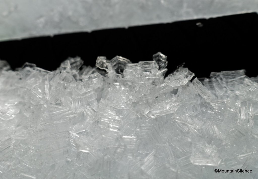
The glorious remnants of the K&K monarchy are finally getting some white foam on their Viennese Melange and the season can be ushered in on the powder. If I could, I'd gather my last shillings and visit Hermann Maier for a Red Bull, because we here in the West are staring sadly into our cheese fondue and don't know what to make of the forecasts. Not to mention the viewers from the Italian internet, who have had to fret all season.

Ok, enough with the clichés.

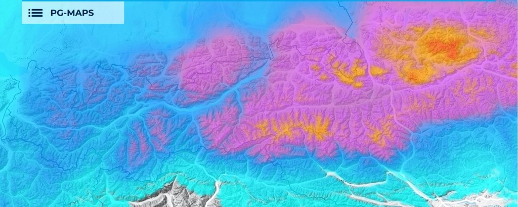
Alert period and areas

The alert goes from eastern North Tyrol to Vienna, with the core going from the Salzkammergut to the Rax. The alert lasts until Sunday evening, although it has already started to snow. Before Saturday, however, this is more just cosmetics or a soft base for the real snowfall.

Wind

The high is near, the isobars are pushing

a storm will squeeze against the Alps.

It will be very windy, but that means snow up to the main Tauern ridge.

Snow line

Almost always almost at the very bottom. At the end possibly around 800-1000m. So it should be enough for POWDER.

The amounts

There will be 30-50cm at the edges and 50-80cm in the core. In the reservoirs of the core, such as in the Salzkammergut or on the Hochschwab, 70-100cm are quite certain and 120cm are also possible in one or two places, as the accumulation is long and the Eastern Alps, like the Austrians in soccer, are notoriously underestimated in the models.

Where should I go?

On Fridays, if you're free anyway, you can slide around on a meadow. But you don't have to.

On Saturday, the meadows should be more fun and the forest, if you know there's a base there, should be fine too.

On Sunday, the forest is open almost everywhere. After that, it's likely to stop for a while, but it will stay cool, so the odd horse-drawn carriage ride to the Zirbnwirt on the Hüttn should be possible.

Mid-term

Ullr has unfortunately set a fairly well-worn pattern until the end of January, so the west and south can't hold out much hope due to the nearby UK or Central European high. In the east, we're so close to possible troughs that something could even happen again in the Land of the Court Councillors by the last weekend of January.

But it's staying cool so far, so at least there won't be much thawing where there's snow on the north side.

Powder to the Non-Piefkes!

Your oracle!

Snow height prediction game

The snow height prediction game will take place at the "Altaussee Loser Schneestation" station from 20.1. to 23.1. 20:00. A reliable candidate for a bag of snow.

Write your tip by Friday, 21.1. 22:00 either here as a comment, or in the Forum

.

This article has been automatically translated by DeepL with subsequent editing. If you notice any spelling or grammatical errors or if the translation has lost its meaning, please write an e-mail to the editors.

Show original (German)

Related articles

Comments