Skip to content

Cookies 🍪

This site uses cookies that need consent.

Learn more

Zur Powderguide-Startseite Zur Powderguide-Startseite

Language selection

Search PowderGuide

PowderAlerts

PowderAlert 5 2019/20 | The wild wild South

We're in for another wild three days with meters of fresh snow.

by Lars Oelmann 11/21/2019
It just doesn't stop. Alarm 5 also brings snow to the south again. Ullr says: To him who has, to him shall be given. And more is more!

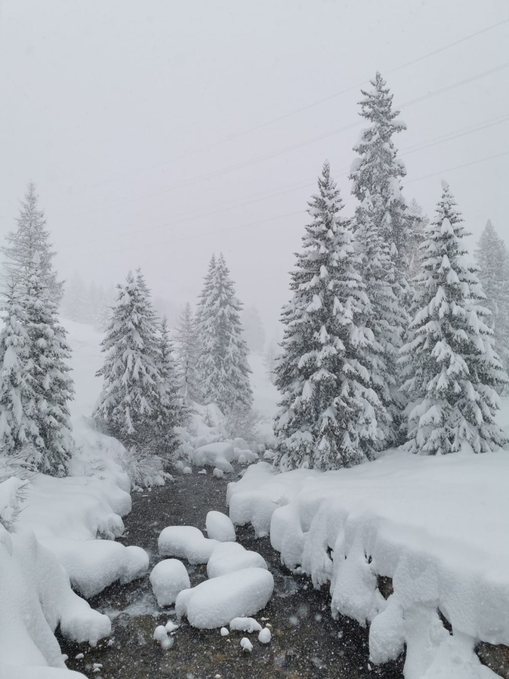
It's getting wild again! If Ullr had a funfair ride, his message for the coming days would be this: Fasten your seatbelts, it's getting wild again! The holes are about to fly out of the cheese!

And my mouth is also opening and closing at the upcoming situation. We're talking about fresh snow in the south, again well into the meter range. Unfortunately, the massive system will also make it massively warmer.

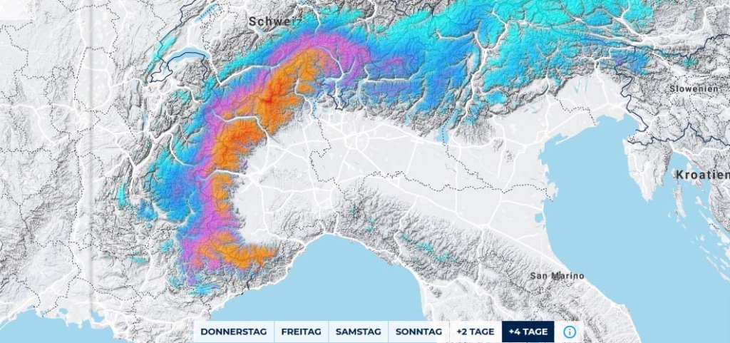
Alert period and areas

The alert goes through the entire Southern Alps, but this time the wild core is clearly in the west from the Maritime Alps to Monte Rosa or Simplon and has a very sharp border where the fresh snow goes from over a meter to 40-50cm within a few kilometers. It's not quite clear exactly where this limit will be, but it will definitely be less from eastern Ticino onwards.

Wind

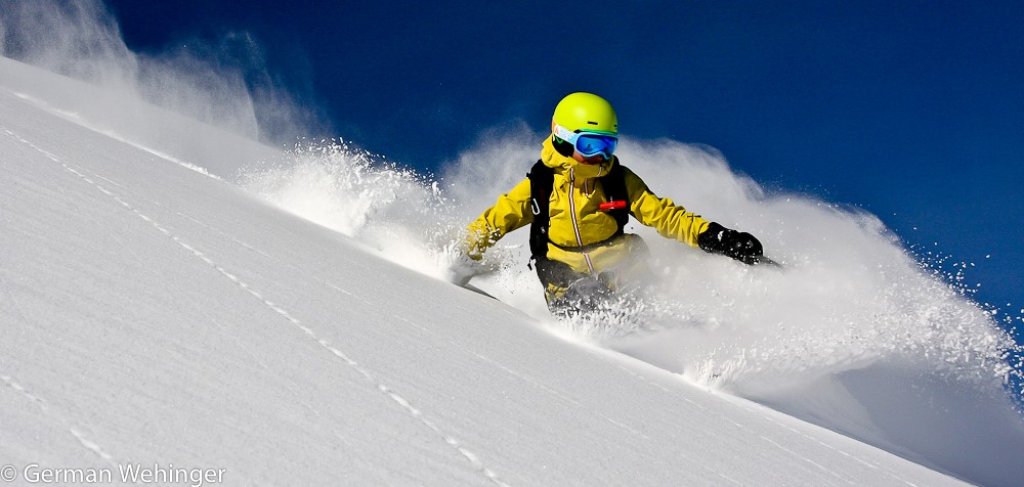
Storm in the traffic jam and gale on the main ridge and in the north. So really really uncomfortable and dangerous. Level 4 will probably be in the LLBs for sure. But it's pushing the full amounts over the main Swiss ridge into Valais and from Italy to France.

Snowfall line

Starts not so bad in the core of the Alps and will be between 1300-1700m during the heavy precipitation. Higher at the end than at the beginning. From 1500-1800m it should stay snowy. At the edge of the mountain ranges and in the east it will probably rain until 1900-2100, so that everything there will only come as snow from 2000-2200m. The rising snow line will make everything even more dangerous than it already is.

The amounts

Outside the core, the alert will be just about full with 30-40cm, if that.

In the core of the Maritime Alps (this time on both sides, also in France) it will be absolutely wild again and there will be 100-130cm, in the accumulation areas 150-170cm and even 2m of fresh snow somewhere from Monte Rosa, over the Graian Alps to Monte Viso in the high altitudes from 2000m.

I would still say that there are no such snowpack increases anywhere, as the snowfall extends over three days. However, the snowpack can increase by around 80-130cm at high altitudes in the core.

Where should I go?

Difficult. It doesn't break up anywhere in the core before Sunday. You should still be able to get into the trees somewhere in the core on Friday and it will be warm on Saturday. In the core with the most intense precipitation, I would look for trees with at least 1500-1600m as the lowest point and hope for the best. From 1800m you're on the safe side in the inner alpine core.

On Sunday there may be slightly better visibility in the east and also in the core in the afternoon on the main ridge, but do you really want to go up there in the core? After that, the situation will calm down and you can theoretically take advantage of a small window of sunshine.

Mid-term

Completely uncertain, but it will remain rather warm until the end of November. Not even the oracle's crystal ball knows what will happen then. So first take what you can get and then hope for the best at the Ullrschrein!

Powder to the People! And take care of yourselves.

Your Oracle

This article has been automatically translated by DeepL with subsequent editing. If you notice any spelling or grammatical errors or if the translation has lost its meaning, please write an e-mail to the editors.

Show original (German)

Related articles

Comments