Skip to content

Cookies 🍪

This site uses cookies that need consent.

Learn more

Zur Powderguide-Startseite Zur Powderguide-Startseite

Language selection

Search PowderGuide

PowderAlerts

PowderAlert 16 2016/17 | North jam with errors

More snow, but a little warm.

by Lars Oelmann 03/07/2017
March is shaping up to be a veritable winter month and there's plenty more to come on top of the existing base as Ullr is working overtime on the atmospheric machine. The only fly in the ointment is the significantly higher snow line than recently.

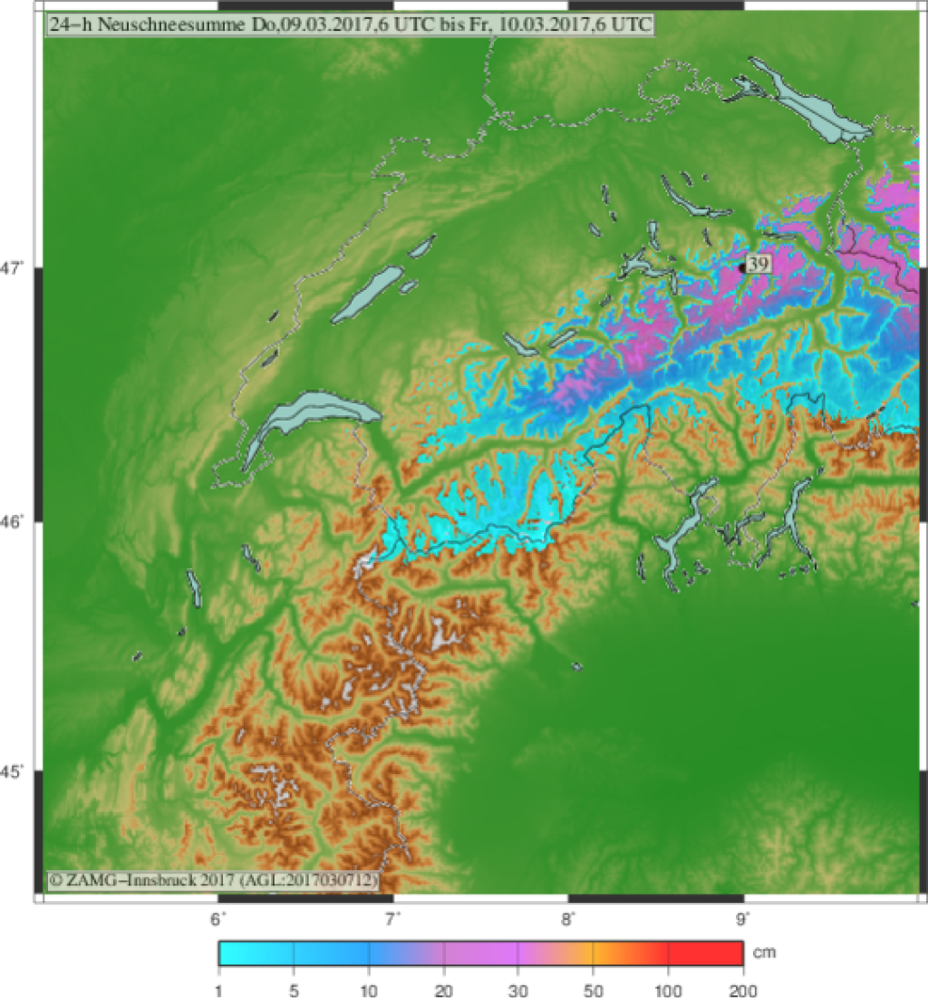
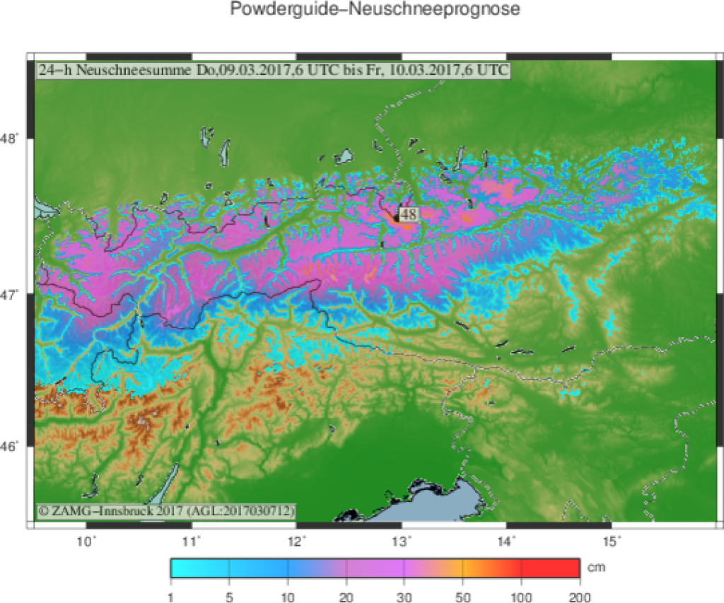
Alert areas and period:

Alert volumes are in place from the Bernese Oberland/central Switzerland to Lower Austria, i.e. almost the entire northern Alps. The core is probably between Glarner Land and Styria with the highest amounts on the Arlberg or in North Tyrol and towards the Salzkammergut.

The alert is valid until Friday morning or in the east until Friday afternoon, then everything is through.

The snow line:

This is where we have our problem. The snowfall that is already starting will only fall as snow above about 1200-1800m. The 1200m is for the deep east of Austria and the 1800m for western Switzerland. In between, it's more difficult, because in the Arlberg, for example, it can snow up to 1200m (or even lower?) in narrow valleys with heavy congestion, just like in northern Grisons in Switzerland. However, it can also rain higher in the east with less heavy snowfall on the main ridge.

In general: If you want to powder on Friday, you should try your luck in the east above 1500m and in the far west above 2000m, because it should stay with good powder there. In the main precipitation areas, 1500-1700m should be enough for good powder.

As the icing on the cake, the snow line will drop below 1000m again on Friday and provide a fluffy topping everywhere with the last few centimetres at the end of the snowfall. Just as it should be.

Wind:

The wind will remain quite suitable for powder with this warm front snowfall and will blow moderately to strongly further up, in the foothills of the Alps much stronger than in the inner Alps. Of course, it's still dangerous after all the fresh snow, because there's now a good amount of freight available.

Amounts:

In the Bernese Oberland/central Switzerland and in the far east, 30-50 cm will fall with a higher distribution towards the core area. Depending on the exact location of the core, this may shift by a few kilometers, which means that the core amounts may also apply at the edge, especially in central Switzerland.

From the Glarus region to Styria, I can imagine 60-90cm and in the reservoirs the meter will certainly be full somewhere. Some models also see a little more on the Arlberg or North Tyrol, so I could imagine up to 120cm on the Alrberg or in North Tyrol in perfect dust conditions. Not so much in the east.

Where should I go?

This will be difficult on Thursday, because depending on how much the precipitation cools down, you can actually go into the trees or not because it rains too high. I would tend to look for high trees in the core if you don't want to check webcams in the morning.

Friday it will break up from west to east, with snow likely in the far east until the afternoon. However, due to the cooler temperatures, you'll probably be able to get out into the trees or higher in the sun.

Mid-term:

Stays skiable, but will probably be a bit drier again. There should be good touring weather on Saturday, while it will probably snow a little (but not alarmingly) on Sunday.

Powder to the people!

Your oracle.

Here's the prediction game.

This article has been automatically translated by DeepL with subsequent editing. If you notice any spelling or grammatical errors or if the translation has lost its meaning, please write an e-mail to the editors.

Show original (German)

Related articles

Comments