Skip to content

Cookies 🍪

This site uses cookies that need consent.

Learn more

Zur Powderguide-Startseite Zur Powderguide-Startseite

Language selection

Search PowderGuide

PowderAlerts

PowderAlert 14 2020/21 | Ullr against the trend

An April as it used to be

by Lars Oelmann 04/05/2021
In contrast to the last few years and the fears after the summery episode in March, there is now another nice alarm in April! With a northerly thaw and heavy showers and possibly record high altitude cold! (MeteoSwiss says: If minus 40 really does reach the Alps at an altitude of 5000m, you have to go back to 1973 to find anything comparable).

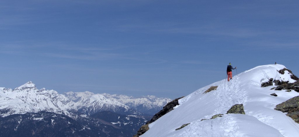
The base is still available quite far down on the north side, but of course you have to know where you still have something before you start in the forest at medium altitudes.

Alert period and areas

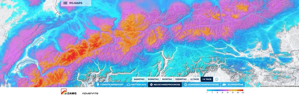
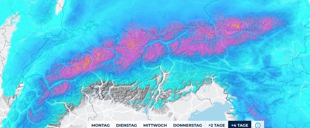
The alert goes along the entire Alpine arc from the northern Valais to the east of the Dachstein and there is no defined core, but there can be significantly more in congested areas. Important here: Even if a persistent shower track forms that hits a corner, there can be significantly more. Or less if you are 10km further away. In general, the strongest high-altitude cold will come down towards Switzerland, but it will build up everywhere.

The alert will last until the night from Wednesday to Thursday.

Wind

With the arrival of the cold front today on Monday, it may whistle, but the high-altitude wind will no longer be so strong that there won't be powder further up. Most of it will be in the foothills of the Alps and in the backcountry. Much less on the main ridge.

Snow line

Starts at around 1000m, but then drops rapidly, thanks to the arctic air. Full amounts from 1200m or so. Without wind and, we are in spring, with holes in the sun in the showery weather, that means POW.

Quantities

Wide-spread 30-50cm of snow, but in a traffic jam or with several showers in a row, it can also be 60-70cm in the cold air. Or just 20cm if the showers don't hit or local lee effects take effect

.

Where should I go?

On Tuesday, you should only go out if it already looks great at the window or at the measuring station, because theoretically that's not enough on the hard-frozen harsch with 10-20cm of new snow to get you excited.

Wednesday in the trees or alpine meadows, because then you should feel the harsch less.

Thursday it opens up and you can do a bit of north-facing blower turns at the top, because it's still quite cold.

Mid-term

Unclear. It will probably get a little warmer first, which is no mean feat with the maximum cold air mass that is flooding us. It is not yet certain whether a new air mass boundary or a südstau will form at the weekend. But it's unlikely to be Saharan air. Incidentally, the signals look more interesting for Baden-Columbia than for the Alps. Maybe we can expect some more snow on top of the 15-30cm from Wednesday. A powder tour on April 10 in the Black Forest would also be something.

Powder to the people!

Your oracle, who can only congratulate Ullr on his timing during the vacations.

Snowy heights tip game

The snowy heights tip game is of course also included, especially for the 5 best tips, the remaining tips will decide who wins... The betting takes place in central Switzerland at the Rupperslaui station: please post your tips in the Forum by Tuesday, 10 pm!

!

This article has been automatically translated by DeepL with subsequent editing. If you notice any spelling or grammatical errors or if the translation has lost its meaning, please write an e-mail to the editors.

Show original (German)

Related articles

Comments